THE ADVENTURE COLLECTIVE® · Independent discovery and booking for outdoor travel

Five days of forest, heather and high alpine ridgelines lead to Point Lenana on Mount Kenya. This Chogoria Route itinerary mixes long approaches, huts and camping with a midnight summit push—plan for altitude and variable trail conditions.
Five days of forest, heather and high alpine ridgelines lead to Point Lenana on Mount Kenya. This Chogoria Route itinerary mixes long approaches, huts and camping with a midnight summit push—plan for altitude and variable trail conditions.
Dawn finds you on a dirt track east of Chogoria, the forest breathing cool mist as a 4x4 drops you at the trailhead. You shoulder a pack and move into giant heather and moss-draped forest; clouds climb with you, and the gorges valley pulls the air into its throat as if daring you onward.
Verified experiences and guided adventures in the surrounding area.
Operated by Gracepatt Safaris · Chogoria, Meru County
Dawn finds you on a dirt track east of Chogoria, the forest breathing cool mist as a 4x4 drops you at the trailhead. You shoulder a pack and move into giant heather and moss-draped forest; clouds climb with you, and the gorges valley pulls the air into its throat as if daring you onward.
The Chogoria Route follows one of Mount Kenya’s most dramatic approaches — carved by ancient glaciation into steep gorges and cirques. Geology here reads like a vertical history: volcanic cores, glacially polished cliffs and the last remnant ice fields near the peaks. For the Kikuyu people, the mountain is sacred; villages on the lower slopes still tend terraced farms and tell stories about the peaks.
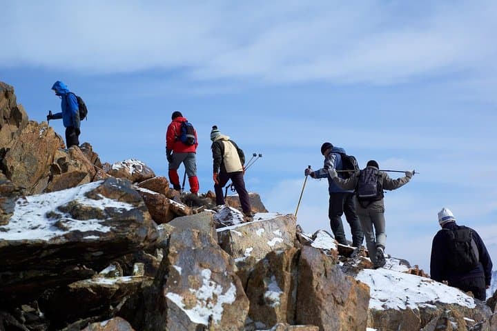
Over five days you move from 2,950m at Mt. Meru Bandas through Road Head and Mintos Hut, then a pre-dawn push to Point Lenana (4,985m) before descending to Met Station and down through rainforest to Naromoru. Expect long days (16–29 km on some stages), sharp elevation changes and a trail that alternates mud, rocky switchbacks and open ridgelines.
Practical edge: start early, pace conservatively for altitude, and use layered insulation for the cold summit hours. Hydrate often—the trek’s dryness and altitude combine to dehydrate quickly—and carry a reliable headlamp for the midnight summit push. Camps and huts on route supply cooked meals and treated water as noted, but bring personal water treatment and warm sleeping gear. With attention to acclimatization and a steady pace, the Chogoria Route delivers raw mountain terrain, high alpine views and a genuine summit sense of arrival.
challenging.
5 days.
Recommended for fit hikers comfortable with long daily distances, multi-day carrying or porters, and sustained ascent to ~5,000m.
No — Point Lenana is a non-technical trekking summit; crampons are not required on standard routes, though conditions may vary after heavy snow.
Climbs on Mount Kenya require National Park entry fees and camping/hut fees; organizers typically handle permits—confirm before travel.
You should be comfortable hiking 6–10+ hours on successive days and able to handle high-altitude breathing; regular aerobic training beforehand helps.
Acute mountain sickness is possible above 3,000m; follow acclimatization rules, stay hydrated, and descend immediately if severe symptoms occur.
Mount Kenya holds cultural significance for the Kikuyu people and was an early landmark for colonial surveyors; it became Kenya’s first national reserve in 1949.
Mount Kenya National Park and surrounding forest are UNESCO-listed; stick to established camps and pack out waste to limit impact on fragile alpine ecosystems.
Gracepatt Safaris operates guided outdoor trips and adventures with an emphasis on safety, stewardship, and memorable experiences.
Dawn finds you on a dirt track east of Chogoria, the forest breathing cool mist as a 4x4 drops you at the trailhead. You shoulder a pack and move into giant heather and moss-draped forest; clouds climb with you, and the gorges valley pulls the air into its throat as if daring you onward.
Dawn finds you on a dirt track east of Chogoria, the forest breathing cool mist as a 4x4 drops you at the trailhead. You shoulder a pack and move into giant heather and moss-draped forest; clouds climb with you, and the gorges valley pulls the air into its throat as if daring you onward.
The Chogoria Route follows one of Mount Kenya’s most dramatic approaches — carved by ancient glaciation into steep gorges and cirques. Geology here reads like a vertical history: volcanic cores, glacially polished cliffs and the last remnant ice fields near the peaks. For the Kikuyu people, the mountain is sacred; villages on the lower slopes still tend terraced farms and tell stories about the peaks.
Over five days you move from 2,950m at Mt. Meru Bandas through Road Head and Mintos Hut, then a pre-dawn push to Point Lenana (4,985m) before descending to Met Station and down through rainforest to Naromoru. Expect long days (16–29 km on some stages), sharp elevation changes and a trail that alternates mud, rocky switchbacks and open ridgelines.
Practical edge: start early, pace conservatively for altitude, and use layered insulation for the cold summit hours. Hydrate often—the trek’s dryness and altitude combine to dehydrate quickly—and carry a reliable headlamp for the midnight summit push. Camps and huts on route supply cooked meals and treated water as noted, but bring personal water treatment and warm sleeping gear. With attention to acclimatization and a steady pace, the Chogoria Route delivers raw mountain terrain, high alpine views and a genuine summit sense of arrival.