THE ADVENTURE COLLECTIVE® · Independent discovery and booking for outdoor travel

Climb Mount Kabuye for sweeping views of Lakes Burera and Ruhondo, close contact with village life, and a manageable day-hike through volcanic highlands. Expect steady climbs, cultural stopovers, and a summit that rewards effort with wide panoramas.
Climb Mount Kabuye for sweeping views of Lakes Burera and Ruhondo, close contact with village life, and a manageable day-hike through volcanic highlands. Expect steady climbs, cultural stopovers, and a summit that rewards effort with wide panoramas.
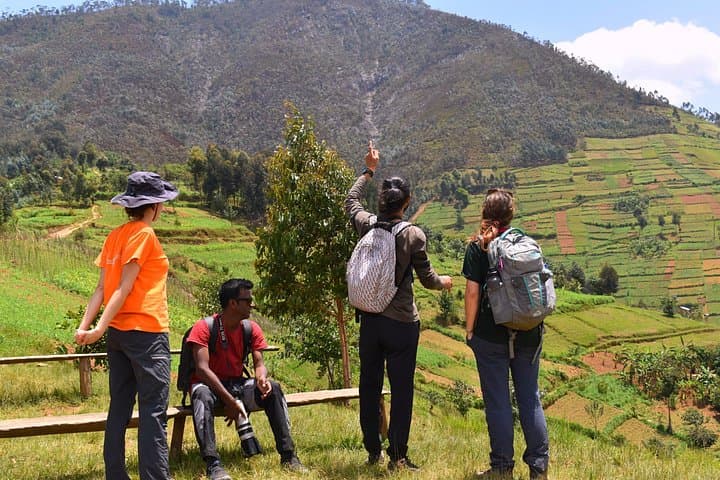
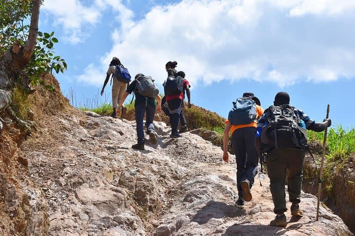
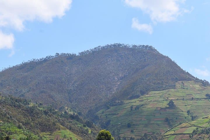
Early light catches the ridgeline as you step off the village track and begin the climb toward Mount Kabuye. Tropical air is cool at altitude; terraced fields and local houses slide past, and the slope opens to a panoramic bowl where Lake Burera and Lake Ruhondo lie like twin mirrors. The trail is a steady, well-worn path that rises through farmland, a short school-visit stop, and pockets of woodland before the final crest.
Verified experiences and guided adventures in the surrounding area.
Operated by Beyond the Gorillas Experience · Musanze, Northern Province
Early light catches the ridgeline as you step off the village track and begin the climb toward Mount Kabuye. Tropical air is cool at altitude; terraced fields and local houses slide past, and the slope opens to a panoramic bowl where Lake Burera and Lake Ruhondo lie like twin mirrors. The trail is a steady, well-worn path that rises through farmland, a short school-visit stop, and pockets of woodland before the final crest.
Geology here is volcanic highland—rolling hills formed from ancient eruptions and erosion—so expect compact volcanic soils and rocky outcrops underfoot. Culturally, the route threads through active communities in Gakenke District; you'll pass smallholder farms, banana stands, and Mushubi Primary School, where hikers often pause. The view from Kabuye’s top offers human-scale history: terraced agriculture and settlement patterns shaped by centuries of hillside farming.
Practical guidance: the ascent typically takes about 2.5 hours and the descent roughly 2 hours; the full excursion runs 7–8 hours including transfers and stops. Wear sturdy boots for uneven ground and bring 1–2 liters of water—the sun can push warm air up the slope even when mornings feel cool. A local guide is recommended (and usually provided) for navigation and to interpret village life. If you plan to camp on the summit, book in advance so hosts can prepare sleeping platforms and provisions. Start early to avoid mid-day heat and to secure the clearest lake views before afternoon clouds roll in.
moderate.
7–8 hours.
Moderately fit; able to sustain continuous uphill walking for ~2.5 hours with occasional steep pitches and uneven terrain
The active hiking time is about 2.5 hours up and 2 hours down; total tour time including transfers and stops is typically 7–8 hours.
A local guide is strongly recommended and often provided—guides handle navigation, local introductions, and safety on the route.
Yes—camping is possible but requires advance booking so hosts can arrange sleeping platforms, food, and logistics.
The drier months (roughly June–September and December–February) provide more reliable views, though mornings can be clear any time outside peak rainy periods.
The highland villages and terraced fields reflect long-standing Rwandan hillside agriculture practices; local paths have linked communities here for generations.
Keep to established trails to limit erosion on volcanic soils; support local schools and guides to ensure tourism benefits community conservation and stewardship.
Beyond the Gorillas Experience operates guided outdoor trips and adventures with an emphasis on safety, stewardship, and memorable experiences.
Early light catches the ridgeline as you step off the village track and begin the climb toward Mount Kabuye. Tropical air is cool at altitude; terraced fields and local houses slide past, and the slope opens to a panoramic bowl where Lake Burera and Lake Ruhondo lie like twin mirrors. The trail is a steady, well-worn path that rises through farmland, a short school-visit stop, and pockets of woodland before the final crest.
Early light catches the ridgeline as you step off the village track and begin the climb toward Mount Kabuye. Tropical air is cool at altitude; terraced fields and local houses slide past, and the slope opens to a panoramic bowl where Lake Burera and Lake Ruhondo lie like twin mirrors. The trail is a steady, well-worn path that rises through farmland, a short school-visit stop, and pockets of woodland before the final crest.
Geology here is volcanic highland—rolling hills formed from ancient eruptions and erosion—so expect compact volcanic soils and rocky outcrops underfoot. Culturally, the route threads through active communities in Gakenke District; you'll pass smallholder farms, banana stands, and Mushubi Primary School, where hikers often pause. The view from Kabuye’s top offers human-scale history: terraced agriculture and settlement patterns shaped by centuries of hillside farming.
Practical guidance: the ascent typically takes about 2.5 hours and the descent roughly 2 hours; the full excursion runs 7–8 hours including transfers and stops. Wear sturdy boots for uneven ground and bring 1–2 liters of water—the sun can push warm air up the slope even when mornings feel cool. A local guide is recommended (and usually provided) for navigation and to interpret village life. If you plan to camp on the summit, book in advance so hosts can prepare sleeping platforms and provisions. Start early to avoid mid-day heat and to secure the clearest lake views before afternoon clouds roll in.