THE ADVENTURE COLLECTIVE® · Independent discovery and booking for outdoor travel

Soar over Aoraki/Mount Cook on a 40-minute helicopter flight that passes the Hochstetter Icefall and lands briefly on alpine snow. Expect panoramic glacier views, a short snow landing, and weather-dependent scheduling.
Soar over Aoraki/Mount Cook on a 40-minute helicopter flight that passes the Hochstetter Icefall and lands briefly on alpine snow. Expect panoramic glacier views, a short snow landing, and weather-dependent scheduling.
The helicopter lifts and Mount Cook’s ragged ridgelines grow from a distant shape into a carved face of ice and rock. Snowfields flash blue and white; the Tasman Glacier threads below like a slow, shining river that dares you to follow it. Pilots arc the aircraft toward the Hochstetter Icefall, and the cold alpine air presses in through the windows as the machine settles for a short landing on the snow.
Verified experiences and guided adventures in the surrounding area.
Operated by Totally Tourism - The Helicopter Line · Mount Cook Village, Canterbury
The helicopter lifts and Mount Cook’s ragged ridgelines grow from a distant shape into a carved face of ice and rock. Snowfields flash blue and white; the Tasman Glacier threads below like a slow, shining river that dares you to follow it. Pilots arc the aircraft toward the Hochstetter Icefall, and the cold alpine air presses in through the windows as the machine settles for a short landing on the snow.
Aoraki/Mount Cook sits at the heart of the Southern Alps, formed by tectonic uplift where the Pacific and Indo-Australian plates push against each other. The range shaped Māori routes and later inspired Sir Edmund Hillary; the area’s glaciers fed local dairy plains and carved the Mackenzie Basin’s wide, dry floor. The Burnett Mountains and the basin’s tussock country provide a sharp contrast to the high ice, a lesson in New Zealand’s varied geology visible from one continuous 40-minute circuit.
Practically, expect 40 minutes of flight time with a 5–10 minute alpine landing for photos and brief exploration. Dress in layers—alpine sun can burn and wind can bite—and secure cameras and loose items during landing. Flights are weather-dependent; operators will rebook if conditions close in. Weight disclosures and passenger limits are enforced for safety and balance; disclose accurate body weights at booking.
For travelers, plan transport to Mount Cook Village or nearby Twizel, allow flexibility for weather delays, and bring a compact daypack with warm layers and a camera. The flight is a brief but comprehensive way to read the landscape: glaciers moving, peaks rising, and the basin spreading below—a concentrated view of the Southern Alps.
easy.
40 minutes (total).
Suitable for most fitness levels; minimal mobility required for boarding and short snow exit
The overall flight is approximately 40 minutes with a 5–10 minute alpine snow landing included, depending on conditions and passenger load.
Flights are weather-dependent; operators typically offer rebooking on another day or credit for another scenic flight at Helicopter Line locations if canceled.
Yes—accurate passenger weights are required at booking and check-in for safety and load distribution; significant differences at check-in may require rescheduling.
Children are welcome but infants must sit on an adult's lap; check provider policies and advise of ages at booking.
Aoraki/Mount Cook has deep Māori significance and later drew early European climbers; Sir Edmund Hillary trained in these ranges before Everest.
The national park is managed to protect fragile alpine ecosystems and glaciers; stick to designated areas and follow operator guidance to minimize disturbance.
Totally Tourism - The Helicopter Line operates guided outdoor trips and adventures with an emphasis on safety, stewardship, and memorable experiences.
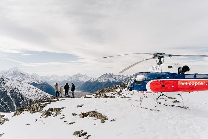
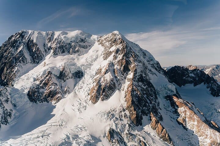
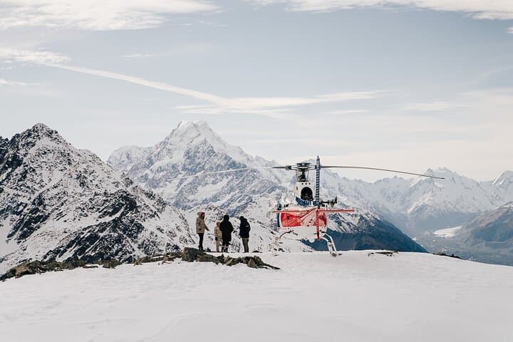
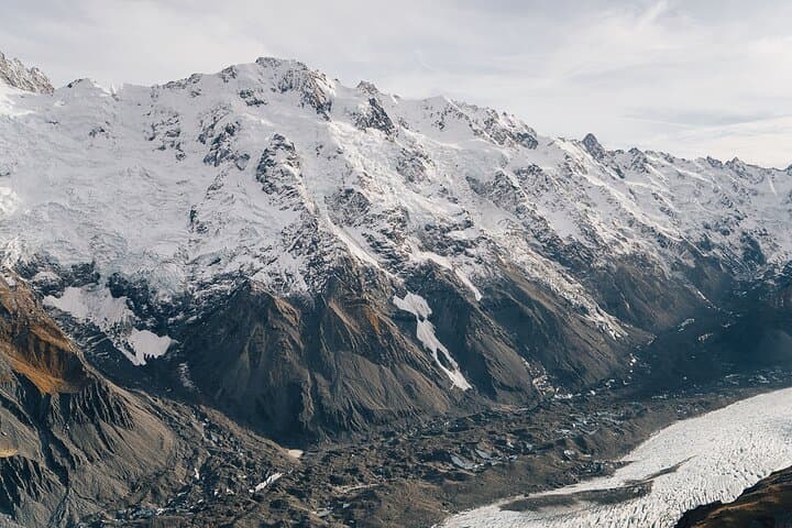
The helicopter lifts and Mount Cook’s ragged ridgelines grow from a distant shape into a carved face of ice and rock. Snowfields flash blue and white; the Tasman Glacier threads below like a slow, shining river that dares you to follow it. Pilots arc the aircraft toward the Hochstetter Icefall, and the cold alpine air presses in through the windows as the machine settles for a short landing on the snow.
The helicopter lifts and Mount Cook’s ragged ridgelines grow from a distant shape into a carved face of ice and rock. Snowfields flash blue and white; the Tasman Glacier threads below like a slow, shining river that dares you to follow it. Pilots arc the aircraft toward the Hochstetter Icefall, and the cold alpine air presses in through the windows as the machine settles for a short landing on the snow.
Aoraki/Mount Cook sits at the heart of the Southern Alps, formed by tectonic uplift where the Pacific and Indo-Australian plates push against each other. The range shaped Māori routes and later inspired Sir Edmund Hillary; the area’s glaciers fed local dairy plains and carved the Mackenzie Basin’s wide, dry floor. The Burnett Mountains and the basin’s tussock country provide a sharp contrast to the high ice, a lesson in New Zealand’s varied geology visible from one continuous 40-minute circuit.
Practically, expect 40 minutes of flight time with a 5–10 minute alpine landing for photos and brief exploration. Dress in layers—alpine sun can burn and wind can bite—and secure cameras and loose items during landing. Flights are weather-dependent; operators will rebook if conditions close in. Weight disclosures and passenger limits are enforced for safety and balance; disclose accurate body weights at booking.
For travelers, plan transport to Mount Cook Village or nearby Twizel, allow flexibility for weather delays, and bring a compact daypack with warm layers and a camera. The flight is a brief but comprehensive way to read the landscape: glaciers moving, peaks rising, and the basin spreading below—a concentrated view of the Southern Alps.