THE ADVENTURE COLLECTIVE® · Independent discovery and booking for outdoor travel

A short, rewarding climb above Trellis Bay on Beef Island that opens into a full 360° panorama of the British Virgin Islands. This private guided hike traverses scrubby singletrack, rebuilt after Hurricane Irma, and rewards you with coastal views you can’t see from a boat.
A short, rewarding climb above Trellis Bay on Beef Island that opens into a full 360° panorama of the British Virgin Islands. This private guided hike traverses scrubby singletrack, rebuilt after Hurricane Irma, and rewards you with coastal views you can’t see from a boat.
You step off the shoreline at Trellis Bay and the trail immediately tightens into scrub and limestone, the sea already calling behind you. The bush trail climbs Mount Alma—a compact 736‑foot hill on Beef Island—until the vegetation pulls back and the ocean opens in every direction: Tortola’s ridgelines to the west, Virgin Gorda’s peaks to the northeast, and the low flat ghost of Anegada on a clear day.
Verified experiences and guided adventures in the surrounding area.
Operated by HIKE BVI · Trellis Bay, Beef Island / Tortola
You step off the shoreline at Trellis Bay and the trail immediately tightens into scrub and limestone, the sea already calling behind you. The bush trail climbs Mount Alma—a compact 736‑foot hill on Beef Island—until the vegetation pulls back and the ocean opens in every direction: Tortola’s ridgelines to the west, Virgin Gorda’s peaks to the northeast, and the low flat ghost of Anegada on a clear day.
Geology here is blunt and honest: volcanic ridges capped by shallow soils and ancient coral outcrops. The route was once grazed by cattle and fed by a seasonal spring; the 2017 passage of Hurricane Irma stripped much of the path away. A small team rebuilt the track in 2020, and technicians still make the climb to service the airport navigation light occasionally, which keeps parts of the ridge cleared and navigable.
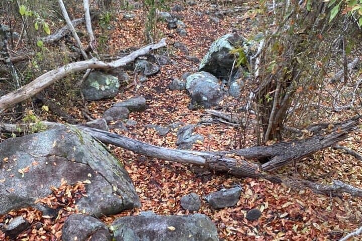
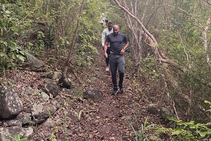
Culture on Beef Island is low‑key—sea, air travel, and small‑scale fishing—and the hike showcases that working relationship between people and place. Expect narrow singletrack, rocky steps, and sun‑exposed sections where the breeze competes with the heat.
Practical guidance: the guided, private route is about 2–3 hours round trip with roughly 736 feet of elevation to gain; trail footing is loose in places so sturdy shoes matter. Guides provide bottled water and snacks; bring sun protection, at least 1.5–2 liters of water, and a small first aid kit. Start early to avoid midday sun, watch for slick rock after rain, and respect local signs—this is a fragile, frequently wind‑blown island ecosystem. Finish at the summit and let the panorama do the rest: nature here leans toward the dramatic but keeps you honest.
moderate.
2–3 hours.
Suitable for people with a moderate level of fitness who can handle sustained uphill walking and uneven terrain.
The trail is short but steep in sections; active beginners who are comfortable with uphill walking and uneven footing can usually complete it with regular rest breaks.
This is a private tour—operators typically arrange pickup from Road Town or nearby ports on request; confirm pickup details when booking.
Yes—operators cancel in heavy rain or unsafe winds for safety and trail protection; check the cancellation policy and plan a flexible day.
Facilities are limited; use amenities in Trellis Bay before you start and carry hand sanitizer for on‑trail needs.
Mount Alma’s past includes seasonal springs and cattle grazing; the trail was heavily damaged by Hurricane Irma in 2017 and rerouted and rebuilt by a local team in 2020.
Stay on the cleared trail to prevent erosion on thin soils, pack out all trash, and avoid collecting coral or shells—local ecology is sensitive and recovery after storms is ongoing.
HIKE BVI operates guided outdoor trips and adventures with an emphasis on safety, stewardship, and memorable experiences.

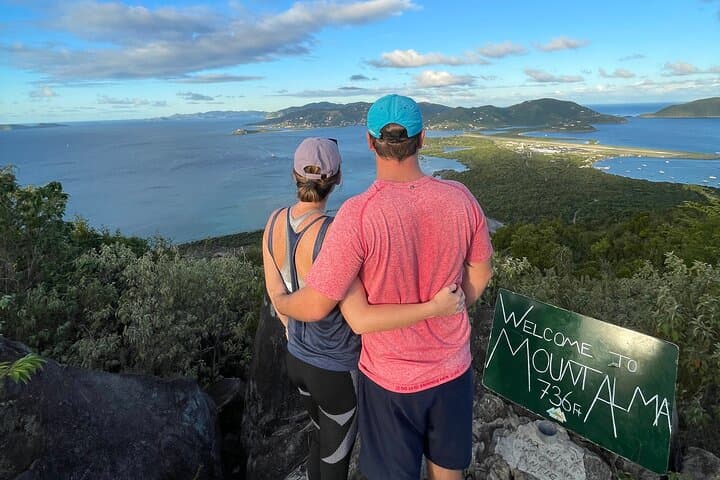
You step off the shoreline at Trellis Bay and the trail immediately tightens into scrub and limestone, the sea already calling behind you. The bush trail climbs Mount Alma—a compact 736‑foot hill on Beef Island—until the vegetation pulls back and the ocean opens in every direction: Tortola’s ridgelines to the west, Virgin Gorda’s peaks to the northeast, and the low flat ghost of Anegada on a clear day.
You step off the shoreline at Trellis Bay and the trail immediately tightens into scrub and limestone, the sea already calling behind you. The bush trail climbs Mount Alma—a compact 736‑foot hill on Beef Island—until the vegetation pulls back and the ocean opens in every direction: Tortola’s ridgelines to the west, Virgin Gorda’s peaks to the northeast, and the low flat ghost of Anegada on a clear day.
Geology here is blunt and honest: volcanic ridges capped by shallow soils and ancient coral outcrops. The route was once grazed by cattle and fed by a seasonal spring; the 2017 passage of Hurricane Irma stripped much of the path away. A small team rebuilt the track in 2020, and technicians still make the climb to service the airport navigation light occasionally, which keeps parts of the ridge cleared and navigable.
Culture on Beef Island is low‑key—sea, air travel, and small‑scale fishing—and the hike showcases that working relationship between people and place. Expect narrow singletrack, rocky steps, and sun‑exposed sections where the breeze competes with the heat.
Practical guidance: the guided, private route is about 2–3 hours round trip with roughly 736 feet of elevation to gain; trail footing is loose in places so sturdy shoes matter. Guides provide bottled water and snacks; bring sun protection, at least 1.5–2 liters of water, and a small first aid kit. Start early to avoid midday sun, watch for slick rock after rain, and respect local signs—this is a fragile, frequently wind‑blown island ecosystem. Finish at the summit and let the panorama do the rest: nature here leans toward the dramatic but keeps you honest.