THE ADVENTURE COLLECTIVE® · Independent discovery and booking for outdoor travel

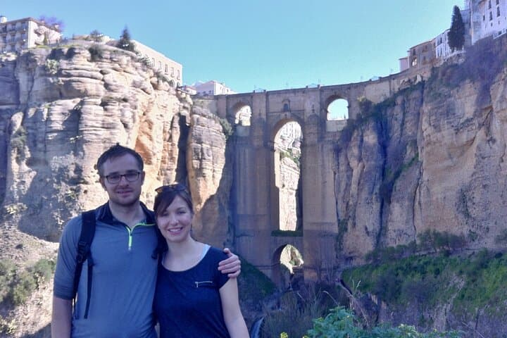
Follow original drovers’ tracks from Montejaque up limestone slopes and down into Ronda, finishing beneath the dramatic Puente Nuevo. This 11 km moderate route mixes steep stone switchbacks, quiet lanes, and expansive views across the Sierra de Grazalema.
Follow original drovers’ tracks from Montejaque up limestone slopes and down into Ronda, finishing beneath the dramatic Puente Nuevo. This 11 km moderate route mixes steep stone switchbacks, quiet lanes, and expansive views across the Sierra de Grazalema.
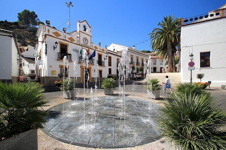
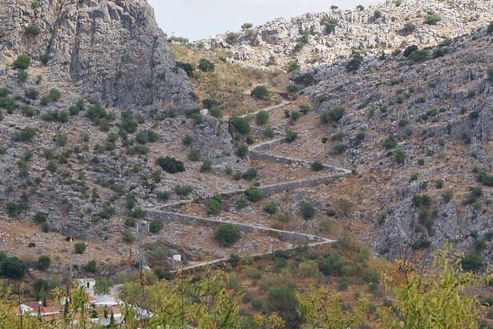
You leave Montejaque’s tight stone streets and feel the village fall behind as the trail pitches up in a staccato of stone switchbacks. The “zigzag path” forces a steady rhythm—foot, breath, foot—past a small chapel and onto a hidden plateau where agave spikes and olive rows stitch the slope.
Verified experiences and guided adventures in the surrounding area.
Operated by Hike + Bike The Sierras · Montejaque, Andalusia
You leave Montejaque’s tight stone streets and feel the village fall behind as the trail pitches up in a staccato of stone switchbacks. The “zigzag path” forces a steady rhythm—foot, breath, foot—past a small chapel and onto a hidden plateau where agave spikes and olive rows stitch the slope.
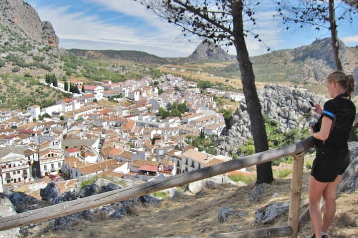
This route follows the original drovers’ ways that linked mountain hamlets to Ronda, a town whose layered past—Roman foundations, Moorish walls and later Andalusian town planning—remains visible in narrow alleys and the dramatic gorge. Geologically, you’re crossing the limestone folds of the Sierra de Grazalema; karst ridges and fast-draining soils shape steep slopes and sudden viewpoints.
Culturally, farmers and shepherds still work the terraces below; you’ll pass small holdings and stone walls that mark centuries of land use. Look for griffon vultures circling the gorge and the silhouette of Puente Nuevo as Ronda perches on its sheer escarpment.
Practical guidance: the route is mostly on firm tracks and quiet lanes but includes short steep pitches both up and down and a descent directly beneath the gorge walls. Plan for about 3–4 hours on the path, wear grippy footwear and carry at least 1.5–2 liters of water in summer. Start early in hot months to avoid midday sun and allow time to explore Barrio San Francisco at the finish. Transport is usually provided back to Montejaque on organized tours—confirm logistics when you book.
moderate.
3–4 hours.
Suitable for hikers with regular conditioning—expect sustained ascents and descents and some steep sections.
It’s rated moderate: most of the route is on wide tracks and lanes, but there are short steep climbs and descents—reasonable for regular walkers with good footwear.
Organized tours typically include air-conditioned transport; confirm pick-up and drop-off details when booking.
Yes—the path follows traditional tracks and lanes, but carry a map or GPS and be prepared for limited signage in places.
Spring and autumn offer the most comfortable temperatures and wildflowers or harvest colors; avoid midday heat in summer and check winter conditions for rain or wind.
The trail follows ancient drovers’ routes used for moving livestock and goods between mountain villages and Ronda; the town’s position on a limestone escarpment has shaped its history since Roman and Moorish times.
This area lies on the edge of the Sierra de Grazalema Protected Area—stay on tracks, avoid disturbing flora and fauna, and pack out all waste to minimize impact.
Hike + Bike The Sierras operates guided outdoor trips and adventures with an emphasis on safety, stewardship, and memorable experiences.
You leave Montejaque’s tight stone streets and feel the village fall behind as the trail pitches up in a staccato of stone switchbacks. The “zigzag path” forces a steady rhythm—foot, breath, foot—past a small chapel and onto a hidden plateau where agave spikes and olive rows stitch the slope.
You leave Montejaque’s tight stone streets and feel the village fall behind as the trail pitches up in a staccato of stone switchbacks. The “zigzag path” forces a steady rhythm—foot, breath, foot—past a small chapel and onto a hidden plateau where agave spikes and olive rows stitch the slope.
This route follows the original drovers’ ways that linked mountain hamlets to Ronda, a town whose layered past—Roman foundations, Moorish walls and later Andalusian town planning—remains visible in narrow alleys and the dramatic gorge. Geologically, you’re crossing the limestone folds of the Sierra de Grazalema; karst ridges and fast-draining soils shape steep slopes and sudden viewpoints.
Culturally, farmers and shepherds still work the terraces below; you’ll pass small holdings and stone walls that mark centuries of land use. Look for griffon vultures circling the gorge and the silhouette of Puente Nuevo as Ronda perches on its sheer escarpment.
Practical guidance: the route is mostly on firm tracks and quiet lanes but includes short steep pitches both up and down and a descent directly beneath the gorge walls. Plan for about 3–4 hours on the path, wear grippy footwear and carry at least 1.5–2 liters of water in summer. Start early in hot months to avoid midday sun and allow time to explore Barrio San Francisco at the finish. Transport is usually provided back to Montejaque on organized tours—confirm logistics when you book.