THE ADVENTURE COLLECTIVE® · Independent discovery and booking for outdoor travel

A steep, rewarding 2-hour hike that climbs through shaded singletrack to a 360° summit above the bay. Choose the Higuera Blanca approach for an easier climb or the Sayulita side for a tougher workout and bigger views.
A steep, rewarding 2-hour hike that climbs through shaded singletrack to a 360° summit above the bay. Choose the Higuera Blanca approach for an easier climb or the Sayulita side for a tougher workout and bigger views.
The trail begins on a sun-washed jeep track, riverbed rocks crunching underfoot as the canopy tightens and the ocean slips into view through the trees. After an hour of steady climbing you break above the ridge and the Pacific opens in every direction — islands, surf lines and the curve of the bay laid out in a full 360-degree panorama.
Verified experiences and guided adventures in the surrounding area.
Operated by Mita Aventuras · Punta de Mita, Nayarit
The trail begins on a sun-washed jeep track, riverbed rocks crunching underfoot as the canopy tightens and the ocean slips into view through the trees. After an hour of steady climbing you break above the ridge and the Pacific opens in every direction — islands, surf lines and the curve of the bay laid out in a full 360-degree panorama.
Geology here is volcanic headland and coastal sediment folded by decades of wind and sea, giving the slopes quick drainage and rocky steps that demand attention. Local ranching history and seasonal fishing communities shaped the access trails; Higuera Blanca and the villages toward Sayulita were waypoints long before guided hikes arrived. Cultural traces — simple stone walls and goat trails — are visible on the way up.
Expect a mix of shaded single-track and exposed ridgeline. The climb averages one hour up and one hour down over uneven ground; humidity in summer makes it tougher, while dry-season mornings offer cooler conditions. Guides commonly bring bottled water and snacks and can start from either Higuera Blanca (easier) or the Sayulita/Patzcuaro side (steeper).
Practical notes: wear grippy trail shoes, bring 1–2 liters of water, and plan for early morning or late afternoon to avoid mid-day heat. Watch for loose rock on descents and sun exposure on the ridge. The summit rewards effort with open-air views perfect for photos and quiet pauses — a short, demanding outing that fits into a half-day itinerary from nearby towns.
challenging.
2 hours.
Requires a high level of cardiovascular fitness and leg strength — steady 1‑hour ascent with uneven footing.
Plan on roughly one hour to reach the summit and about one hour to descend, depending on fitness and pace.
Higuera Blanca (Punta de Mita side) is the gentler route; the Sayulita/Patzcuaro approach is steeper and more demanding.
About 80% of the route offers shade, but the final ridge has exposed sections with direct sun and wind.
Guided outings are common; light refreshments, bottled water and snacks are typically included in guided bookings.
Local villages used these ridgelines for grazing and foot routes between coastal hamlets; informal trails predate formal tourist use.
Stay on marked trails to protect fragile dry-season vegetation and avoid disturbing nesting birds; carry out all trash and use minimal single-use plastics.
Mita Aventuras operates guided outdoor trips and adventures with an emphasis on safety, stewardship, and memorable experiences.

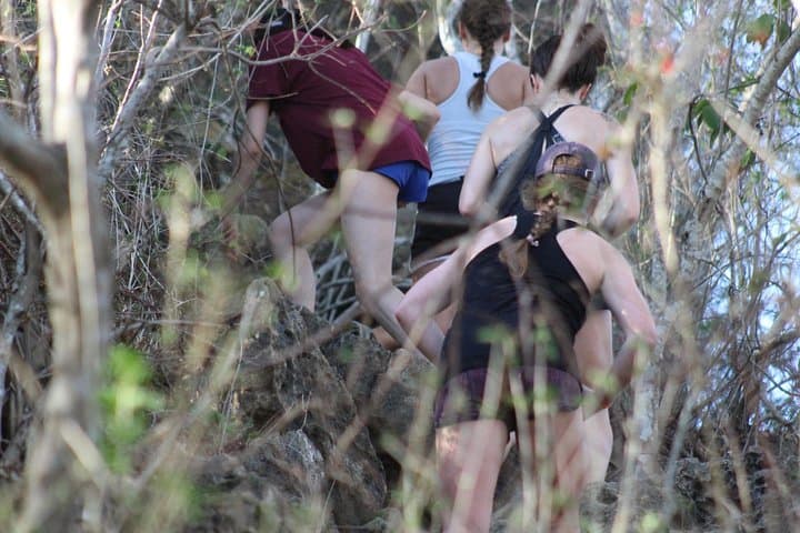
The trail begins on a sun-washed jeep track, riverbed rocks crunching underfoot as the canopy tightens and the ocean slips into view through the trees. After an hour of steady climbing you break above the ridge and the Pacific opens in every direction — islands, surf lines and the curve of the bay laid out in a full 360-degree panorama.
The trail begins on a sun-washed jeep track, riverbed rocks crunching underfoot as the canopy tightens and the ocean slips into view through the trees. After an hour of steady climbing you break above the ridge and the Pacific opens in every direction — islands, surf lines and the curve of the bay laid out in a full 360-degree panorama.
Geology here is volcanic headland and coastal sediment folded by decades of wind and sea, giving the slopes quick drainage and rocky steps that demand attention. Local ranching history and seasonal fishing communities shaped the access trails; Higuera Blanca and the villages toward Sayulita were waypoints long before guided hikes arrived. Cultural traces — simple stone walls and goat trails — are visible on the way up.
Expect a mix of shaded single-track and exposed ridgeline. The climb averages one hour up and one hour down over uneven ground; humidity in summer makes it tougher, while dry-season mornings offer cooler conditions. Guides commonly bring bottled water and snacks and can start from either Higuera Blanca (easier) or the Sayulita/Patzcuaro side (steeper).
Practical notes: wear grippy trail shoes, bring 1–2 liters of water, and plan for early morning or late afternoon to avoid mid-day heat. Watch for loose rock on descents and sun exposure on the ridge. The summit rewards effort with open-air views perfect for photos and quiet pauses — a short, demanding outing that fits into a half-day itinerary from nearby towns.