THE ADVENTURE COLLECTIVE® · Independent discovery and booking for outdoor travel

A community‑run 10‑day trek that rises from the Kali Gandaki valley to Mohare Danda (3,313 m), offering panoramic views of Annapurna, Dhaulagiri and Manaslu. Practical for hikers who want cultural immersion, village homestays and a moderate altitude challenge.
A community‑run 10‑day trek that rises from the Kali Gandaki valley to Mohare Danda (3,313 m), offering panoramic views of Annapurna, Dhaulagiri and Manaslu. Practical for hikers who want cultural immersion, village homestays and a moderate altitude challenge.
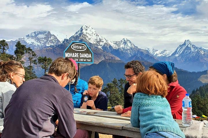
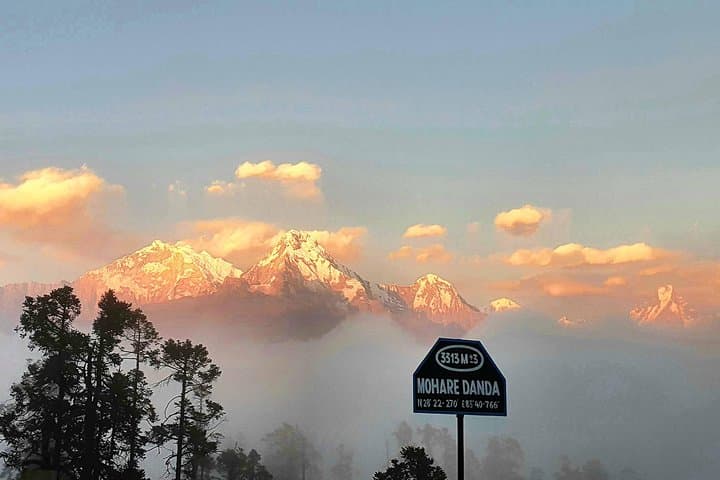
At dawn on Mohare Danda the sky is a hard, clean blue and three 8,000‑meter silhouettes—Annapurna, Dhaulagiri and Manaslu—grade from distant white to razor edge as the sun pushes across the ridgelines.
Verified experiences and guided adventures in the surrounding area.
Operated by Trekking Trail Nepal · Beni, Gandaki Province
At dawn on Mohare Danda the sky is a hard, clean blue and three 8,000‑meter silhouettes—Annapurna, Dhaulagiri and Manaslu—grade from distant white to razor edge as the sun pushes across the ridgelines.
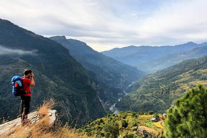
The Mohare Danda Trek is a 10‑day community‑led circuit that climbs from the Kali Gandaki valley through Magar and Poon communities into alpine pastures and high ridgelines. The route was developed to support local education, women’s initiatives and homestay economies; lodges and tea houses on the trail are managed by village groups rather than large companies. Geologically the trail runs along the rain shadow of the Annapurna massif—steep terraced slopes, limestone outcrops in the lower valleys and glacial‑polished ridgelines up high—so views open suddenly and often.
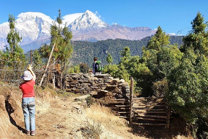
Expect mostly singletrack and village paths, sections of packed dirt and stone staircases, intermittent forested pitches of rhododendron and oak, and exposed grassy plateaus near Mohare Danda (3,313 m). Total walking distance across the trek is roughly 50–70 km with cumulative ascent near 2,400–2,500 m from Beni (≈830 m) to the high viewpoint; daily legs vary from short 3 km walks to 12 km days. Weather changes quickly: mornings can be clear and cold, afternoons warm, and nights freezing above 2,500 m.
Practical guidance: schedule sunrise at Mohare Danda for the clearest mountain window, break long drives by packing layers and snacks for the highway, use trekking poles for steep descents, and carry cash for village purchases. Altitude gain is gradual but allow time to acclimatize, hydrate deliberately, and follow the community lodge etiquette—ask before photographing or joining family spaces.
moderate.
8–10 days.
A steady base of aerobic fitness and comfort walking 4–6 hours a day on uneven terrain; prior multi‑day hikes help
Mohare Danda’s viewpoint is about 3,313 m. The itinerary gains altitude gradually over several days but mild AMS can occur; hydrate, sleep well, and report symptoms—guides carry first aid and oxygen monitor.
No technical gear is required—the route is a trekking circuit using village trails and ridgelines, not glacier travel or rock climbing.
Accommodation is community lodges and family tea houses with shared rooms and simple meals—dal bhat, local vegetables and soups; vegetarian options are available but bring snacks if you have specific preferences.
Late autumn (Oct–Nov) and spring (Mar–May) offer the clearest mountain views and stable weather; monsoon months bring cloud and trail slipperiness.
Ramche and surrounding villages are traditional Magar settlements; community trekking here is part of a recent push to keep tourism revenues local and fund schools and women’s programs.
The trek runs through delicate alpine grasslands and community forests—minimize impact by packing out waste, using village water sparingly, and supporting official community lodges that reinvest income locally.
Trekking Trail Nepal operates guided outdoor trips and adventures with an emphasis on safety, stewardship, and memorable experiences.
At dawn on Mohare Danda the sky is a hard, clean blue and three 8,000‑meter silhouettes—Annapurna, Dhaulagiri and Manaslu—grade from distant white to razor edge as the sun pushes across the ridgelines.
At dawn on Mohare Danda the sky is a hard, clean blue and three 8,000‑meter silhouettes—Annapurna, Dhaulagiri and Manaslu—grade from distant white to razor edge as the sun pushes across the ridgelines.
The Mohare Danda Trek is a 10‑day community‑led circuit that climbs from the Kali Gandaki valley through Magar and Poon communities into alpine pastures and high ridgelines. The route was developed to support local education, women’s initiatives and homestay economies; lodges and tea houses on the trail are managed by village groups rather than large companies. Geologically the trail runs along the rain shadow of the Annapurna massif—steep terraced slopes, limestone outcrops in the lower valleys and glacial‑polished ridgelines up high—so views open suddenly and often.
Expect mostly singletrack and village paths, sections of packed dirt and stone staircases, intermittent forested pitches of rhododendron and oak, and exposed grassy plateaus near Mohare Danda (3,313 m). Total walking distance across the trek is roughly 50–70 km with cumulative ascent near 2,400–2,500 m from Beni (≈830 m) to the high viewpoint; daily legs vary from short 3 km walks to 12 km days. Weather changes quickly: mornings can be clear and cold, afternoons warm, and nights freezing above 2,500 m.
Practical guidance: schedule sunrise at Mohare Danda for the clearest mountain window, break long drives by packing layers and snacks for the highway, use trekking poles for steep descents, and carry cash for village purchases. Altitude gain is gradual but allow time to acclimatize, hydrate deliberately, and follow the community lodge etiquette—ask before photographing or joining family spaces.