THE ADVENTURE COLLECTIVE® · Independent discovery and booking for outdoor travel

Ascend Meesapulimala before dawn to watch sunlight spill across the Western Ghats. This 6–8 hour trek passes shola forests, high meadows and rhododendron valleys—plan for steep sections, cold summit winds and early starts.
Ascend Meesapulimala before dawn to watch sunlight spill across the Western Ghats. This 6–8 hour trek passes shola forests, high meadows and rhododendron valleys—plan for steep sections, cold summit winds and early starts.
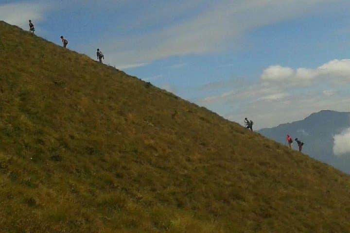
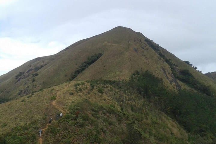
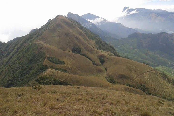
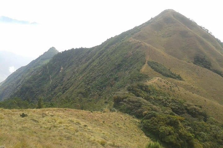
You step off the jeep into cold, thin air while stars still prick the sky; ahead, the ridgeline of Meesapulimala slices the horizon. The trail climbs through moonlit grasslands, threadlike streams murmuring beside your boots, then drops into dark shola pockets where the forest seems to hold its breath. By the time the sky lightens, the summit opens—wide grasslands folding toward distant Anamudi and the tea slopes below.
Verified experiences and guided adventures in the surrounding area.
Operated by Munnar Info · Munnar, Kerala
You step off the jeep into cold, thin air while stars still prick the sky; ahead, the ridgeline of Meesapulimala slices the horizon. The trail climbs through moonlit grasslands, threadlike streams murmuring beside your boots, then drops into dark shola pockets where the forest seems to hold its breath. By the time the sky lightens, the summit opens—wide grasslands folding toward distant Anamudi and the tea slopes below.
Geology here is old—charcoal-brown laterite under grass and rolling columns of ancient metamorphic rock that built the Western Ghats. Culturally, the highlands around Munnar have long supported small tea settlements and Tamil and Malayalam-speaking hill communities; local stories tie these ridges to seasonal cattle movements and shola management.
Practical guidance: the summit sits near 2,663 m and the outing typically takes 6–8 hours round-trip depending on start point and pace. Expect varied terrain—paved plantation tracks give way to narrow stone steps, wet meadows and occasional scree. Start pre-dawn to catch the sunrise and avoid heat; bring a headlamp, warm outer layer and waterproof shell. Hydrate before and during; trails can be muddy after monsoon. The route passes fragile shola forest and rhododendron patches—stick to trails and pack out all waste.
Permit rules and access windows can change; book through a local operator for sunrise entry. Wildlife sightings may include Nilgiri tahr or hillbird species; keep distance and minimize noise. With steady fitness and good footwear, the ridge rewards you with a clear, wind-cut panorama that makes the ascent feel earned.
challenging.
6–8 hours.
Good aerobic fitness with experience on sustained ascents; able to hike for several hours with a daypack.
Expect about 6–8 hours round trip from common trailheads; exact time depends on start point, group pace and weather.
Sunrise access is often managed locally—booking with a licensed operator provides necessary permissions, transport and local knowledge.
Dry months from October to February offer clearer skies and firmer trails; monsoon (June–September) can make routes muddy and slippery.
At ~2,663 m the altitude is moderate; those with cardiovascular issues or spinal conditions should avoid the trek or consult a doctor beforehand.
The high grasslands and shola forests of the Munnar region have long supported tea estates and small hill communities; the ridge routes were traditionally used for grazing and seasonal movement.
This montane ecosystem is fragile—stick to established trails, avoid campfires and follow local guidance to reduce erosion and disturbance to endemic flora and fauna.
Munnar Info operates guided outdoor trips and adventures with an emphasis on safety, stewardship, and memorable experiences.
You step off the jeep into cold, thin air while stars still prick the sky; ahead, the ridgeline of Meesapulimala slices the horizon. The trail climbs through moonlit grasslands, threadlike streams murmuring beside your boots, then drops into dark shola pockets where the forest seems to hold its breath. By the time the sky lightens, the summit opens—wide grasslands folding toward distant Anamudi and the tea slopes below.
You step off the jeep into cold, thin air while stars still prick the sky; ahead, the ridgeline of Meesapulimala slices the horizon. The trail climbs through moonlit grasslands, threadlike streams murmuring beside your boots, then drops into dark shola pockets where the forest seems to hold its breath. By the time the sky lightens, the summit opens—wide grasslands folding toward distant Anamudi and the tea slopes below.
Geology here is old—charcoal-brown laterite under grass and rolling columns of ancient metamorphic rock that built the Western Ghats. Culturally, the highlands around Munnar have long supported small tea settlements and Tamil and Malayalam-speaking hill communities; local stories tie these ridges to seasonal cattle movements and shola management.
Practical guidance: the summit sits near 2,663 m and the outing typically takes 6–8 hours round-trip depending on start point and pace. Expect varied terrain—paved plantation tracks give way to narrow stone steps, wet meadows and occasional scree. Start pre-dawn to catch the sunrise and avoid heat; bring a headlamp, warm outer layer and waterproof shell. Hydrate before and during; trails can be muddy after monsoon. The route passes fragile shola forest and rhododendron patches—stick to trails and pack out all waste.
Permit rules and access windows can change; book through a local operator for sunrise entry. Wildlife sightings may include Nilgiri tahr or hillbird species; keep distance and minimize noise. With steady fitness and good footwear, the ridge rewards you with a clear, wind-cut panorama that makes the ascent feel earned.