THE ADVENTURE COLLECTIVE® · Independent discovery and booking for outdoor travel

A moderate 12 km ridge hike above Masca that moves through laurel forest, pine stands and open volcanic countryside with panoramic views of Masca Gorge and Mount Teide. Expect 375 m of ascent/descent and roughly five hours on mixed terrain.
A moderate 12 km ridge hike above Masca that moves through laurel forest, pine stands and open volcanic countryside with panoramic views of Masca Gorge and Mount Teide. Expect 375 m of ascent/descent and roughly five hours on mixed terrain.
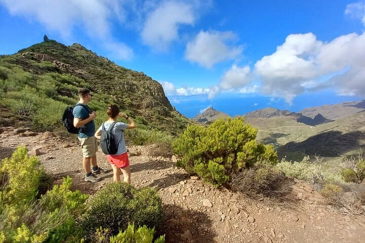
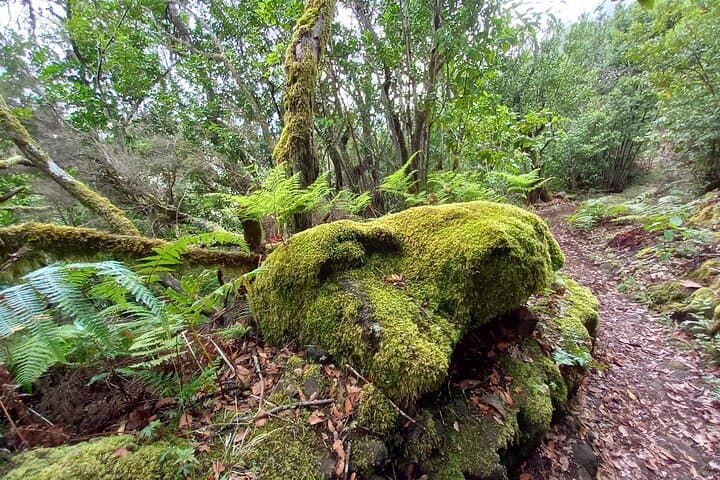
A cold wind from the Atlantic pushes across the ridge as the group crests the first hill; laurel trees hunch and sprawl along the path, their leaves dripping with moss that moves like soft ropes in the breeze. From here the route opens, folding through a high undulating ridge that keeps you close to the island’s vertebrae of volcanic rock and forest.
Verified experiences and guided adventures in the surrounding area.
Operated by Tenerife guided walks · Masca, Santa Cruz de Tenerife
A cold wind from the Atlantic pushes across the ridge as the group crests the first hill; laurel trees hunch and sprawl along the path, their leaves dripping with moss that moves like soft ropes in the breeze. From here the route opens, folding through a high undulating ridge that keeps you close to the island’s vertebrae of volcanic rock and forest.
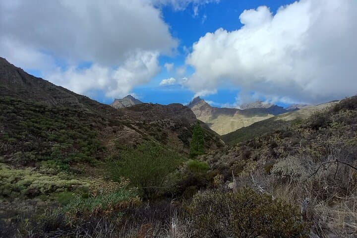
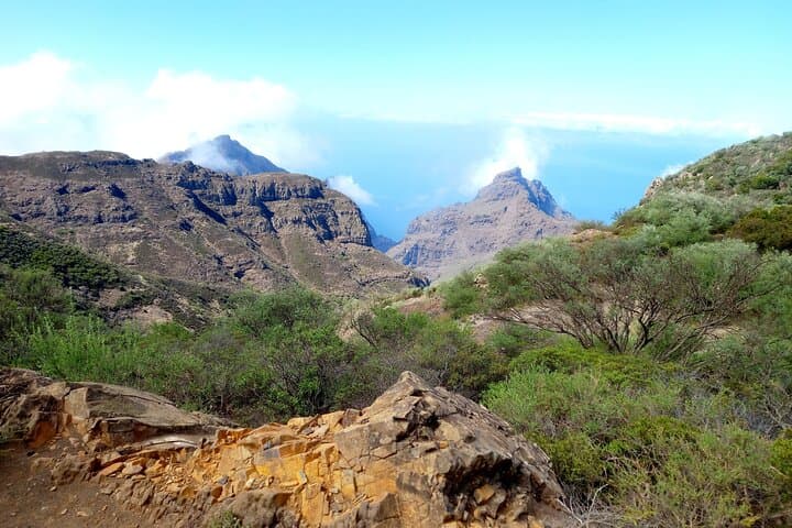
The trail traces ecological layers: ancient laurel forest—remnant of a subtropical wood that once blanketed the Canaries—gives way to open countryside and pine stands. Volcanic geology is visible in the blackened scree and hardened lava flows below; on clear days Mount Teide dominates the horizon, a distant cone watching the Santiago valley. Human history appears in scattered terraced fields and the small hamlet of Masca, a rural village shaped by shepherding and centuries of isolation.
Expect about 12 km of undulating track with 375 m of ascent and descent, a maximum altitude near 1,100 m, and roughly five hours on foot over mixed singletrack and forest paths. The route moves between shaded, humid sections where hanging lichen brushes your pack and exposed ridgelines where wind and sun are constant companions.
Practical guidance: start early to avoid mid-day heat and to secure clearer views of Teide; wear grippy hiking shoes for short steep ascents; carry 1.5–2 liters of water, layered clothing for wind and temperature swings, and a basic first-aid kit. The hike is moderate—fit walkers with steady footing will enjoy rich scenery, varied habitats, and long panoramic descents into a valley that looks unexpectedly like the English countryside.
moderate.
4–6 hours.
Suitable for hikers with regular activity who can handle sustained walking and short steep sections
No — this is a ridge-to-valley route above Masca with panoramic views; it does not descend the official Masca Gorge trail to the coast.
Private transportation is typically provided from select pickup points; confirm pickup details at booking.
A moderate fitness level is required—regular walkers who can manage 12 km with undulating terrain and 375 m elevation change will be comfortable.
Yes, a guide accompanies the hike and public liability/rescue insurance is included with the tour.
The area reflects Tenerife’s volcanic past and rural history: terraced fields and isolated hamlets grew where fresh water and arable patches allowed small-scale farming and shepherding.
The laurel forest is a protected, relic ecosystem—stay on paths, avoid disturbing lichen and moss, and pack out all waste to limit impact.
Tenerife guided walks operates guided outdoor trips and adventures with an emphasis on safety, stewardship, and memorable experiences.
A cold wind from the Atlantic pushes across the ridge as the group crests the first hill; laurel trees hunch and sprawl along the path, their leaves dripping with moss that moves like soft ropes in the breeze. From here the route opens, folding through a high undulating ridge that keeps you close to the island’s vertebrae of volcanic rock and forest.
A cold wind from the Atlantic pushes across the ridge as the group crests the first hill; laurel trees hunch and sprawl along the path, their leaves dripping with moss that moves like soft ropes in the breeze. From here the route opens, folding through a high undulating ridge that keeps you close to the island’s vertebrae of volcanic rock and forest.
The trail traces ecological layers: ancient laurel forest—remnant of a subtropical wood that once blanketed the Canaries—gives way to open countryside and pine stands. Volcanic geology is visible in the blackened scree and hardened lava flows below; on clear days Mount Teide dominates the horizon, a distant cone watching the Santiago valley. Human history appears in scattered terraced fields and the small hamlet of Masca, a rural village shaped by shepherding and centuries of isolation.
Expect about 12 km of undulating track with 375 m of ascent and descent, a maximum altitude near 1,100 m, and roughly five hours on foot over mixed singletrack and forest paths. The route moves between shaded, humid sections where hanging lichen brushes your pack and exposed ridgelines where wind and sun are constant companions.
Practical guidance: start early to avoid mid-day heat and to secure clearer views of Teide; wear grippy hiking shoes for short steep ascents; carry 1.5–2 liters of water, layered clothing for wind and temperature swings, and a basic first-aid kit. The hike is moderate—fit walkers with steady footing will enjoy rich scenery, varied habitats, and long panoramic descents into a valley that looks unexpectedly like the English countryside.