THE ADVENTURE COLLECTIVE® · Independent discovery and booking for outdoor travel

See Martha’s Vineyard’s highlights in three hours with a native guide: Oak Bluffs, Edgartown, Aquinnah cliffs and Menemsha. This compact shared tour mixes local history, coastal geology and quick viewpoint stops—ideal for ferry day-trippers.
See Martha’s Vineyard’s highlights in three hours with a native guide: Oak Bluffs, Edgartown, Aquinnah cliffs and Menemsha. This compact shared tour mixes local history, coastal geology and quick viewpoint stops—ideal for ferry day-trippers.
The van eases away from the Soldier Statue in Oak Bluffs and the island opens like a map in motion: gingerbread cottages and the carousel, wide beaches, and the sudden drop of the clay cliffs at Aquinnah. In three hours a local driver-guide threads together six towns, stopping for a short look at the multi-hued Aquinnah Cliffs and pointing out Edgartown’s whaling-era façades and Menemsha’s low-slung fishing boats.
Verified experiences and guided adventures in the surrounding area.
Operated by Marthas Vineyard Tours and Transport · Oak Bluffs, Massachusetts
The van eases away from the Soldier Statue in Oak Bluffs and the island opens like a map in motion: gingerbread cottages and the carousel, wide beaches, and the sudden drop of the clay cliffs at Aquinnah. In three hours a local driver-guide threads together six towns, stopping for a short look at the multi-hued Aquinnah Cliffs and pointing out Edgartown’s whaling-era façades and Menemsha’s low-slung fishing boats.
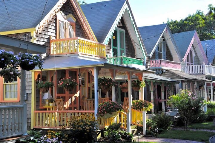
Martha’s Vineyard is a 100-square-mile patchwork of salt marshes, glacial moraines and coastal plain. Wampanoag people, 19th-century whalers, and a turn-of-the-century summer culture have all left visible marks — from Native place names to the ornate gingerbread houses of Oak Bluffs’ Camp Ground and the imposing lighthouses that still patrol the sound.
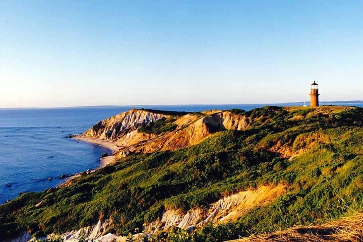
Expect narrated history and geology delivered in a compact, conversational style. The tour is paced for sightseeing rather than hiking; most stops are short photo breaks and single-point viewpoints. The Aquinnah Cliffs illustrate the island’s glacial sediments and wind-sculpted shore, while Menemsha offers a working-harbor snapshot at low tide.
Practical notes: meet at the Soldier Statue near the Steamship Authority, arrive early if you’re coming by ferry, and dress for coastal wind even on warm days. Bring a camera, binoculars for tidal flats and birdlife, and a light layer — the shore can feel several degrees cooler than inland. This is an easy, accessibility-friendly way to sample Martha’s Vineyard’s geography and culture in a single, well-paced outing.
easy.
3 hours.
Suitable for most fitness levels; the tour involves short timed stops and minimal walking
Yes — the tour departs from Oak Bluffs; you must arrive on-island by ferry or other transport before the meeting time.
Children under 10 are not permitted; older children are welcome when accompanied by an adult.
Space is limited; small bags and daypacks are fine, but large suitcases are not recommended—confirm any special arrangements in advance.
No — the stop is approximately 10–15 minutes for photos and views; longer beach or cliff walks require a separate visit.
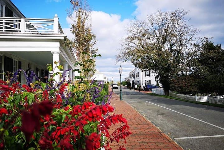
The island blends Wampanoag heritage and a 19th-century whaling economy; Edgartown’s houses and Menemsha’s working fleet reflect that maritime past.
Aquinnah’s clay cliffs are erosion-prone — stay on designated viewing areas and avoid climbing the slopes; support local efforts that limit vehicle access near sensitive dunes.
Marthas Vineyard Tours and Transport operates guided outdoor trips and adventures with an emphasis on safety, stewardship, and memorable experiences.

The van eases away from the Soldier Statue in Oak Bluffs and the island opens like a map in motion: gingerbread cottages and the carousel, wide beaches, and the sudden drop of the clay cliffs at Aquinnah. In three hours a local driver-guide threads together six towns, stopping for a short look at the multi-hued Aquinnah Cliffs and pointing out Edgartown’s whaling-era façades and Menemsha’s low-slung fishing boats.
The van eases away from the Soldier Statue in Oak Bluffs and the island opens like a map in motion: gingerbread cottages and the carousel, wide beaches, and the sudden drop of the clay cliffs at Aquinnah. In three hours a local driver-guide threads together six towns, stopping for a short look at the multi-hued Aquinnah Cliffs and pointing out Edgartown’s whaling-era façades and Menemsha’s low-slung fishing boats.
Martha’s Vineyard is a 100-square-mile patchwork of salt marshes, glacial moraines and coastal plain. Wampanoag people, 19th-century whalers, and a turn-of-the-century summer culture have all left visible marks — from Native place names to the ornate gingerbread houses of Oak Bluffs’ Camp Ground and the imposing lighthouses that still patrol the sound.
Expect narrated history and geology delivered in a compact, conversational style. The tour is paced for sightseeing rather than hiking; most stops are short photo breaks and single-point viewpoints. The Aquinnah Cliffs illustrate the island’s glacial sediments and wind-sculpted shore, while Menemsha offers a working-harbor snapshot at low tide.
Practical notes: meet at the Soldier Statue near the Steamship Authority, arrive early if you’re coming by ferry, and dress for coastal wind even on warm days. Bring a camera, binoculars for tidal flats and birdlife, and a light layer — the shore can feel several degrees cooler than inland. This is an easy, accessibility-friendly way to sample Martha’s Vineyard’s geography and culture in a single, well-paced outing.