THE ADVENTURE COLLECTIVE® · Independent discovery and booking for outdoor travel

Drive from Marrakech into the High Atlas for a day of tiered waterfalls, argan cooperatives and a Berber lunch beneath Toubkal. This full-day excursion mixes a 90-minute mountain walk with cultural stops and off-road panoramas—ideal for travelers who want mountain scenery without an overnight trek.
Drive from Marrakech into the High Atlas for a day of tiered waterfalls, argan cooperatives and a Berber lunch beneath Toubkal. This full-day excursion mixes a 90-minute mountain walk with cultural stops and off-road panoramas—ideal for travelers who want mountain scenery without an overnight trek.
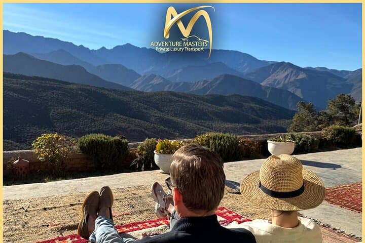
A dusted sunrise lifts off the red roofs of Marrakech and the minaret silhouettes shrink behind you as the road climbs toward the High Atlas. By midmorning the air cools and terraces step down the valley walls, olives and vegetable beds stitched between dry-stone walls. The Toubkal massif—North Africa’s highest roof at 4,167 m—hovers in the distance while the Ourika River threads the valley, daring you to follow its course toward spray and rock.
Verified experiences and guided adventures in the surrounding area.
Operated by Adventure masters · Marrakech, Marrakesh-Safi
A dusted sunrise lifts off the red roofs of Marrakech and the minaret silhouettes shrink behind you as the road climbs toward the High Atlas. By midmorning the air cools and terraces step down the valley walls, olives and vegetable beds stitched between dry-stone walls. The Toubkal massif—North Africa’s highest roof at 4,167 m—hovers in the distance while the Ourika River threads the valley, daring you to follow its course toward spray and rock.
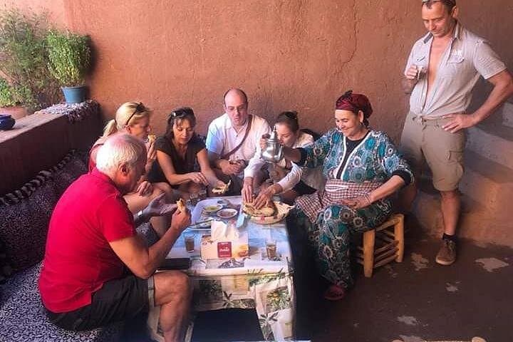
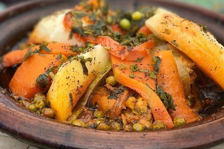
This route has fed Berber families and caravan routes for centuries; clay granaries and agadir structures still punctuate the slopes. Geologically the Atlas is an uplifted, folded range of ancient sediments and volcanic intrusions—cragged peaks give way to softer, cultivated foothills. Culture is present and direct: women's cooperatives press argan by hand, and small villages keep communal tables and traditional tagines.
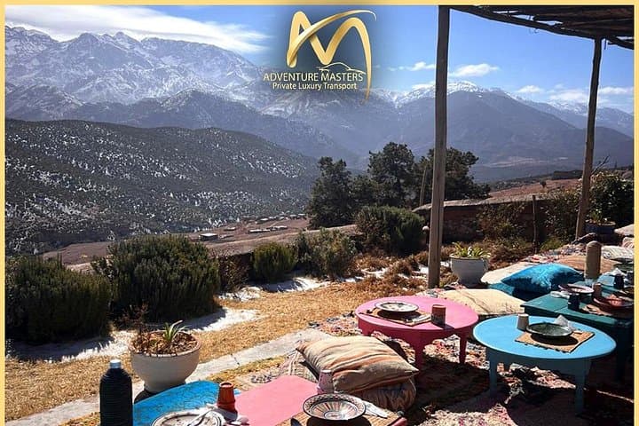
Expect a balanced day: a short guided trek to Setti Fatma’s tiered waterfalls (about 90 minutes on uneven, sometimes slippery trails), a stop at an argan-oil cooperative, off-road drives across mountain passes, and lunch in a Berber house overlooking the high peaks. Photographers will favor the panoramic viewpoints; hikers will appreciate the manageable elevation shifts but should be ready for rocky steps and stream crossings.
Practical guidance: start early to avoid midday heat, wear sturdy shoes with good grip, carry water and layered clothing for variable mountain temps, and bring cash for cooperative purchases and tips. Respect private land, accept local hospitality with modesty, and leave no trace—the valley remains fragile but generous to responsible visitors.
moderate.
6–9 hours.
Suitable for most people in moderate physical condition; able to walk 90 minutes over uneven terrain and handle short steep sections.
The guided walk lasts about 90 minutes round-trip on uneven, rocky paths with several small stream crossings; pace is moderate with stops for views.
Yes—the tour is advertised as easy in provisions, but the waterfall walk can be challenging for very young children or those with limited mobility; alternatives include shorter viewpoints and village visits.
Yes—Toubkal is visible from several viewpoints and from the lunch spot in Sidi Fares, weather permitting.
Yes—cooperatives sell traditionally made argan oil and cosmetic products; bring cash and be mindful of quality and fair prices.
The High Atlas is home to indigenous Amazigh (Berber) communities; many villages and granaries reflect centuries of mountain agriculture and trans-Saharan trade links.
Erosion and water stress are local concerns—support village cooperatives, stick to trails, and carry out waste to minimize impact.
Adventure masters operates guided outdoor trips and adventures with an emphasis on safety, stewardship, and memorable experiences.
A dusted sunrise lifts off the red roofs of Marrakech and the minaret silhouettes shrink behind you as the road climbs toward the High Atlas. By midmorning the air cools and terraces step down the valley walls, olives and vegetable beds stitched between dry-stone walls. The Toubkal massif—North Africa’s highest roof at 4,167 m—hovers in the distance while the Ourika River threads the valley, daring you to follow its course toward spray and rock.
A dusted sunrise lifts off the red roofs of Marrakech and the minaret silhouettes shrink behind you as the road climbs toward the High Atlas. By midmorning the air cools and terraces step down the valley walls, olives and vegetable beds stitched between dry-stone walls. The Toubkal massif—North Africa’s highest roof at 4,167 m—hovers in the distance while the Ourika River threads the valley, daring you to follow its course toward spray and rock.
This route has fed Berber families and caravan routes for centuries; clay granaries and agadir structures still punctuate the slopes. Geologically the Atlas is an uplifted, folded range of ancient sediments and volcanic intrusions—cragged peaks give way to softer, cultivated foothills. Culture is present and direct: women's cooperatives press argan by hand, and small villages keep communal tables and traditional tagines.
Expect a balanced day: a short guided trek to Setti Fatma’s tiered waterfalls (about 90 minutes on uneven, sometimes slippery trails), a stop at an argan-oil cooperative, off-road drives across mountain passes, and lunch in a Berber house overlooking the high peaks. Photographers will favor the panoramic viewpoints; hikers will appreciate the manageable elevation shifts but should be ready for rocky steps and stream crossings.
Practical guidance: start early to avoid midday heat, wear sturdy shoes with good grip, carry water and layered clothing for variable mountain temps, and bring cash for cooperative purchases and tips. Respect private land, accept local hospitality with modesty, and leave no trace—the valley remains fragile but generous to responsible visitors.