THE ADVENTURE COLLECTIVE® · Independent discovery and booking for outdoor travel

A lesser-crowded alternative in the Annapurna region, the Mardi Himal Trek climbs wooded ridges and alpine meadows to deliver close-up views of Annapurna South and Machhapuchhre. This 9–10 day route combines tea-house nights, high ridgelines and traditional villages with practical acclimatization and porter support.
A lesser-crowded alternative in the Annapurna region, the Mardi Himal Trek climbs wooded ridges and alpine meadows to deliver close-up views of Annapurna South and Machhapuchhre. This 9–10 day route combines tea-house nights, high ridgelines and traditional villages with practical acclimatization and porter support.
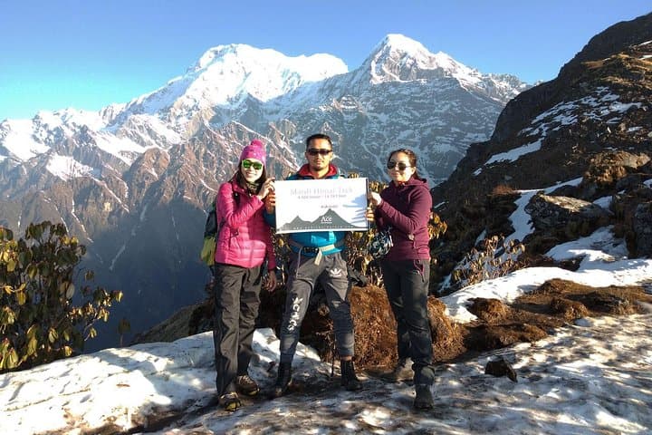
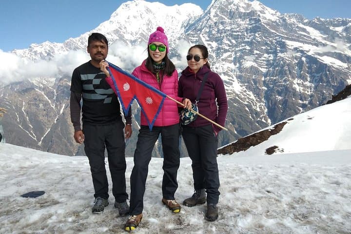
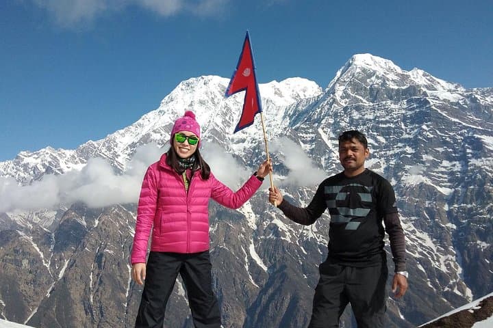
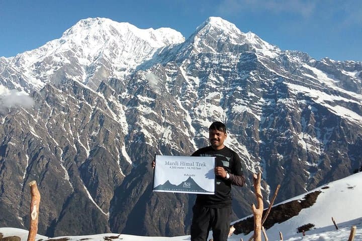
Dawn breaks over a grass-lined ridge and the Himalaya reshapes itself into a row of knives: Annapurna South, Himchuli and the sharply curved Machhapuchhre loom as you climb. The path to Mardi Himal moves through oak and rhododendron forest, opens onto high alpine meadows and finishes at a windswept viewpoint where the mountains feel close enough to touch.
Verified experiences and guided adventures in the surrounding area.
Operated by Ace the Himalaya · Pokhara, Gandaki Province
Dawn breaks over a grass-lined ridge and the Himalaya reshapes itself into a row of knives: Annapurna South, Himchuli and the sharply curved Machhapuchhre loom as you climb. The path to Mardi Himal moves through oak and rhododendron forest, opens onto high alpine meadows and finishes at a windswept viewpoint where the mountains feel close enough to touch.
Mardi Himal sits on the southern flank of the Annapurna massif and has long been a route used by local Gurung and Magar communities. Geologically the trail follows glacially carved valleys and moraines; you’ll pass terraces where centuries of subsistence farming shaped the slopes. Small villages such as Landruk and Sidhing preserve traditional stone houses and local hospitality—tea-house culture that keeps the route low-impact and community-driven.
Expect mixed terrain: steep stone steps and switchbacks, packed dirt through mixed forest, grassy ridgelines and, above ~3,500 m, seasonal snow and wind-scoured trails. Typical itinerary highlights include Australian Camp (≈2,060 m), Forest Camp (≈2,600 m), Low Camp (≈3,050 m), High Camp (≈3,900 m) and the Upper Viewpoint (~4,250 m) or Mardi Base Camp (~4,500 m).
Practical notes: permit and TIMS arrangements are routine; guided groups commonly include porters (often 1 porter per 2 clients). Pace your ascent to acclimatize—plan full rest mornings at Low or High Camp, carry water treatment, and use sturdy boots and trekking poles for steep, uneven sections. Weather can shift fast; aim to summit the viewpoint at first light for the clearest mountain views.
moderate.
9–10 days.
Suitable for hikers with regular cardio fitness who can handle sustained uphill days and multiple 4–7 hour walks; stamina for high-elevation hiking is required.
You need an Annapurna Conservation Area Project (ACAP) permit and a TIMS card; guides or operators usually arrange these before the trek begins.
Mardi Base Camp/Upper Viewpoint sits around 4,250–4,500 m; the route is non-technical but can have snow and wind—no mountaineering gear is required for the standard trail.
Spring (March–May) and autumn (September–November) offer the most stable weather and rhododendron blooms or clear post-monsoon skies; monsoon season brings heavy rain and winter can mean deep snow above 3,000 m.
Yes—tea-house style guesthouses provide twin-share or dormitory rooms, basic meals, and hot drinks; facilities become more rustic at higher camps.
The trail runs through traditional Gurung and Magar communities historically linked to transhumance farming and trade routes into the Annapurna sanctuary.
Mardi lies within the Annapurna Conservation Area—stay on trails, avoid single-use plastics, and support local tea-houses to keep trekking income in village economies.
Ace the Himalaya operates guided outdoor trips and adventures with an emphasis on safety, stewardship, and memorable experiences.
Dawn breaks over a grass-lined ridge and the Himalaya reshapes itself into a row of knives: Annapurna South, Himchuli and the sharply curved Machhapuchhre loom as you climb. The path to Mardi Himal moves through oak and rhododendron forest, opens onto high alpine meadows and finishes at a windswept viewpoint where the mountains feel close enough to touch.
Dawn breaks over a grass-lined ridge and the Himalaya reshapes itself into a row of knives: Annapurna South, Himchuli and the sharply curved Machhapuchhre loom as you climb. The path to Mardi Himal moves through oak and rhododendron forest, opens onto high alpine meadows and finishes at a windswept viewpoint where the mountains feel close enough to touch.
Mardi Himal sits on the southern flank of the Annapurna massif and has long been a route used by local Gurung and Magar communities. Geologically the trail follows glacially carved valleys and moraines; you’ll pass terraces where centuries of subsistence farming shaped the slopes. Small villages such as Landruk and Sidhing preserve traditional stone houses and local hospitality—tea-house culture that keeps the route low-impact and community-driven.
Expect mixed terrain: steep stone steps and switchbacks, packed dirt through mixed forest, grassy ridgelines and, above ~3,500 m, seasonal snow and wind-scoured trails. Typical itinerary highlights include Australian Camp (≈2,060 m), Forest Camp (≈2,600 m), Low Camp (≈3,050 m), High Camp (≈3,900 m) and the Upper Viewpoint (~4,250 m) or Mardi Base Camp (~4,500 m).
Practical notes: permit and TIMS arrangements are routine; guided groups commonly include porters (often 1 porter per 2 clients). Pace your ascent to acclimatize—plan full rest mornings at Low or High Camp, carry water treatment, and use sturdy boots and trekking poles for steep, uneven sections. Weather can shift fast; aim to summit the viewpoint at first light for the clearest mountain views.