THE ADVENTURE COLLECTIVE® · Independent discovery and booking for outdoor travel

Explore Toronto on foot with an app-led scavenger hunt that blends audio clues, photo challenges, and local trivia. Perfect for groups looking for an active city game that reveals historical corners and maple-lined streets.
Explore Toronto on foot with an app-led scavenger hunt that blends audio clues, photo challenges, and local trivia. Perfect for groups looking for an active city game that reveals historical corners and maple-lined streets.
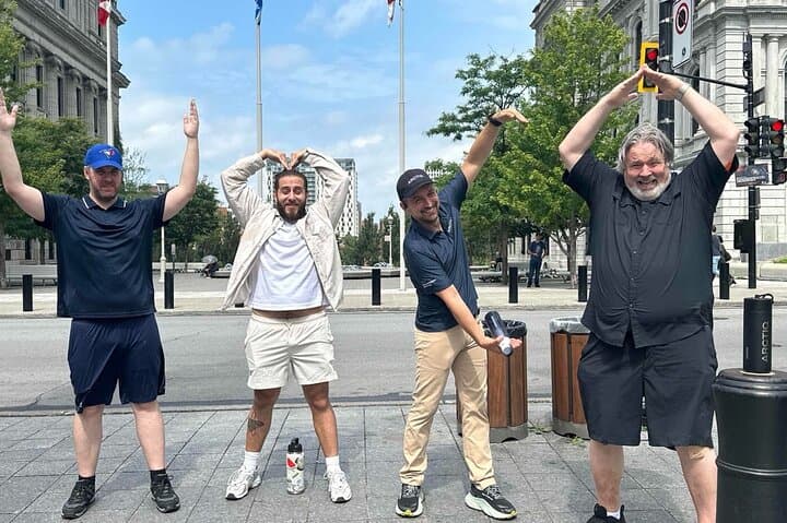
You step off the crowded sidewalk and the city opens like a map underfoot—bronze statues point, maple trees line the squares and Lake Ontario rumbles at the edge of view, daring you to look beyond the skyline.
Verified experiences and guided adventures in the surrounding area.
Operated by Let's Roam · Toronto, Ontario
You step off the crowded sidewalk and the city opens like a map underfoot—bronze statues point, maple trees line the squares and Lake Ontario rumbles at the edge of view, daring you to look beyond the skyline.
This app-led scavenger hunt threads through downtown Toronto's civic heart, pairing audio cues with photo challenges that send teams hunting for plaques, public art, and neighborhood secrets. Toronto’s grid masks layers of history: Indigenous trails once crossed these lands, colonial streets later named after British governors, and 20th‑century immigrant waves that shaped vibrant neighborhoods like Kensington and the Distillery District.
Geologically modest but culturally rich, the area sits on the edge of the Lake Iroquois shoreline—glacial action left modest ridges and the lake’s presence still controls the microclimate, encouraging groves of maples that flash color each fall.
Expect a game focused on observation and local trivia more than elevation: mostly flat pavement, frequent stops, and 1.5–2 hours of moderate walking and brainwork. The Let’s Roam app handles navigation and scoring; teams earn points with clever photos and solved puzzles.
Practical notes: download the app and pre-load the hunt, bring a charged phone and a small power bank, and plan for a mixture of paved plazas and cobbled lanes. Start earlier in the day to avoid peak pedestrian traffic and to catch softer light for photo challenges.
This is a social, low-technical urban adventure that rewards curiosity, pace control, and a readiness to read plaques, take playful photos, and move confidently through busy city blocks.
moderate.
1.5–2 hours.
Light to moderate fitness; participants should be comfortable walking 3–5 km with brief standing and bending
No—this hunt is self-guided and app-led so you can start anytime during operating hours after redeeming your ticket in the app.
Yes—public notes list the activity as wheelchair accessible, though some historic blocks may have uneven surfaces; check local streets if mobility is a concern.
The experience is designed for groups and can be played solo or in teams; check booking limitations but the app supports multiple players per hunt.
The tour runs rain or shine—bring weather-appropriate gear; refunds follow the provider’s cancellation policy if cancelled at least 24 hours prior.
Toronto grew from Indigenous routes and colonial settlement into a multicultural metropolis; many downtown plaques and statues reference 19th- and 20th-century civic history.
Stick to sidewalks and marked paths, avoid disturbing trees or public plantings, and dispose of waste properly—urban green spaces are managed for public use and biodiversity.
Let's Roam operates guided outdoor trips and adventures with an emphasis on safety, stewardship, and memorable experiences.


You step off the crowded sidewalk and the city opens like a map underfoot—bronze statues point, maple trees line the squares and Lake Ontario rumbles at the edge of view, daring you to look beyond the skyline.
You step off the crowded sidewalk and the city opens like a map underfoot—bronze statues point, maple trees line the squares and Lake Ontario rumbles at the edge of view, daring you to look beyond the skyline.
This app-led scavenger hunt threads through downtown Toronto's civic heart, pairing audio cues with photo challenges that send teams hunting for plaques, public art, and neighborhood secrets. Toronto’s grid masks layers of history: Indigenous trails once crossed these lands, colonial streets later named after British governors, and 20th‑century immigrant waves that shaped vibrant neighborhoods like Kensington and the Distillery District.
Geologically modest but culturally rich, the area sits on the edge of the Lake Iroquois shoreline—glacial action left modest ridges and the lake’s presence still controls the microclimate, encouraging groves of maples that flash color each fall.
Expect a game focused on observation and local trivia more than elevation: mostly flat pavement, frequent stops, and 1.5–2 hours of moderate walking and brainwork. The Let’s Roam app handles navigation and scoring; teams earn points with clever photos and solved puzzles.
Practical notes: download the app and pre-load the hunt, bring a charged phone and a small power bank, and plan for a mixture of paved plazas and cobbled lanes. Start earlier in the day to avoid peak pedestrian traffic and to catch softer light for photo challenges.
This is a social, low-technical urban adventure that rewards curiosity, pace control, and a readiness to read plaques, take playful photos, and move confidently through busy city blocks.