THE ADVENTURE COLLECTIVE® · Independent discovery and booking for outdoor travel

Traverse a historic coastal footpath between Porto da Cruz and Machico on Madeira’s northeast rim. Expect dramatic ocean views, exposed cliffs and a full-day trek best suited to fit, sure-footed hikers.
Traverse a historic coastal footpath between Porto da Cruz and Machico on Madeira’s northeast rim. Expect dramatic ocean views, exposed cliffs and a full-day trek best suited to fit, sure-footed hikers.
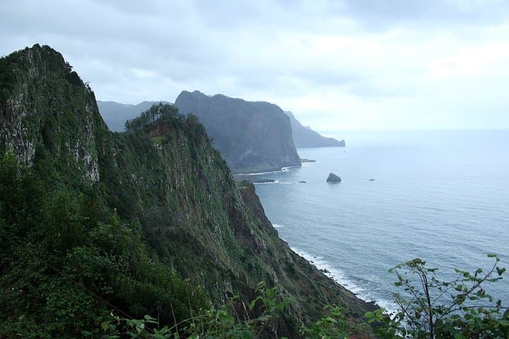
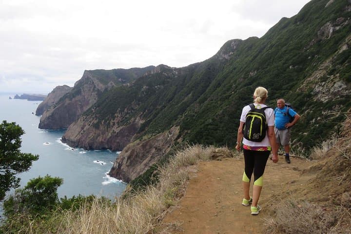
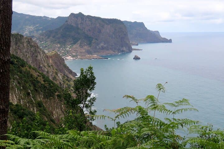
You step off the stone track and the Atlantic answers: wind pushing, spray flicking against your jacket, cliffs falling away to a hard blue. The Larano–Boca do Risco–Marócos walk threads the northeast rim of Madeira, trading village gardens and tiled roofs for sheer coastal views where the island meets the open ocean.
Verified experiences and guided adventures in the surrounding area.
Operated by Madeira Happy Tours · Machico, Madeira
You step off the stone track and the Atlantic answers: wind pushing, spray flicking against your jacket, cliffs falling away to a hard blue. The Larano–Boca do Risco–Marócos walk threads the northeast rim of Madeira, trading village gardens and tiled roofs for sheer coastal views where the island meets the open ocean.
This route follows an old footpath once used to move goods and people between Porto da Cruz and Machico; the track still keeps the geometry of those generations — compacted stone, narrow ledges and switchbacks. Geologically, the cliffs are volcanic escarpments shaped by lava flows, cliff collapse and relentless marine erosion, offering clear sightlines to Ponta de São Lourenço and, on good days, Porto Santo’s distant profile.
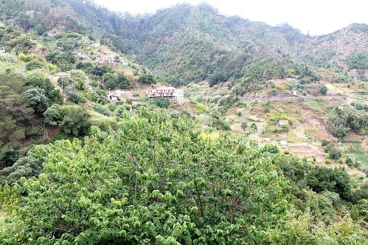
Local culture shows in roadside walled terraces, small chapels and the occasional farmer tending plots. Expect sea birds wheel overhead and the wind to set a brisk pace; the ocean here feels like an active partner, guiding your forward step.
Practical guidance: plan for 6–7 hours on the trail, bring at least 1.5–2 liters of water, sturdy shoes and a windproof layer. Sections are exposed with uneven stone; trekkers with vertigo or limited mobility should reconsider. Start early to avoid the strongest afternoon winds and check weather — coastal fog can reduce visibility. Public transport links exist to Porto da Cruz and Machico if you prefer a one-way shuttle. Stick to the footpath to reduce erosion, carry out trash, and leave marine life undisturbed — this coastline is fragile and weather can change fast.
challenging.
6–7 hours.
Requires a high level of cardiovascular fitness, endurance for a full day on uneven coastal terrain, and comfort with exposure.
The organized itinerary runs about 6–7 hours and is classified challenging—expect prolonged walking on uneven, exposed coastal trail and a need for good fitness.
This route connects Porto da Cruz and Machico using an old footpath; many groups arrange transport so you can do it one-way.
Not recommended for children under 10 or travelers with severe vertigo due to exposed cliff sections and narrow path segments.
Check the forecast before departure—high winds or heavy rain may close exposed sections; wear layers, bring a charged phone, and consider a guide if unfamiliar with the area.
The path follows long-used pedestrian trade routes between coastal villages; its stones and walls reflect centuries of local, subsistence travel and agriculture.
Erosion from foot traffic and coastal weather is a concern—stay on the path, avoid widening trails and pack out all rubbish to protect fragile coastal habitats.
Madeira Happy Tours operates guided outdoor trips and adventures with an emphasis on safety, stewardship, and memorable experiences.
You step off the stone track and the Atlantic answers: wind pushing, spray flicking against your jacket, cliffs falling away to a hard blue. The Larano–Boca do Risco–Marócos walk threads the northeast rim of Madeira, trading village gardens and tiled roofs for sheer coastal views where the island meets the open ocean.
You step off the stone track and the Atlantic answers: wind pushing, spray flicking against your jacket, cliffs falling away to a hard blue. The Larano–Boca do Risco–Marócos walk threads the northeast rim of Madeira, trading village gardens and tiled roofs for sheer coastal views where the island meets the open ocean.
This route follows an old footpath once used to move goods and people between Porto da Cruz and Machico; the track still keeps the geometry of those generations — compacted stone, narrow ledges and switchbacks. Geologically, the cliffs are volcanic escarpments shaped by lava flows, cliff collapse and relentless marine erosion, offering clear sightlines to Ponta de São Lourenço and, on good days, Porto Santo’s distant profile.
Local culture shows in roadside walled terraces, small chapels and the occasional farmer tending plots. Expect sea birds wheel overhead and the wind to set a brisk pace; the ocean here feels like an active partner, guiding your forward step.
Practical guidance: plan for 6–7 hours on the trail, bring at least 1.5–2 liters of water, sturdy shoes and a windproof layer. Sections are exposed with uneven stone; trekkers with vertigo or limited mobility should reconsider. Start early to avoid the strongest afternoon winds and check weather — coastal fog can reduce visibility. Public transport links exist to Porto da Cruz and Machico if you prefer a one-way shuttle. Stick to the footpath to reduce erosion, carry out trash, and leave marine life undisturbed — this coastline is fragile and weather can change fast.