THE ADVENTURE COLLECTIVE® · Independent discovery and booking for outdoor travel

A compact but vivid desert hike along the Lower Salt River that ends at a 19th-century limestone kiln. Expect river views, possible sightings of wild horses and bighorn sheep, and a moderate 4-mile out-and-back with 406 feet of gain.
A compact but vivid desert hike along the Lower Salt River that ends at a 19th-century limestone kiln. Expect river views, possible sightings of wild horses and bighorn sheep, and a moderate 4-mile out-and-back with 406 feet of gain.
You step out from under the ramada and the desert expands: a hard-etched canyon wall drops to the Lower Salt River while creosote and brittle cacti perfume the air. The trail runs like a seam along the cliffside, framed by honey-colored rock and the ribbon of water below that dares you to keep pace with its slow, sunlit current. In two hours you’ll be at the Lime Kiln — a squat, stone oven left by miners in the late 1800s — and back, with a strong chance of spotting wild horses threading the river flats or bighorn sheep picking their way on the cliffs above.
Verified experiences and guided adventures in the surrounding area.
Operated by Saguaro Lake Ranch, Inc. · Mesa, Arizona
You step out from under the ramada and the desert expands: a hard-etched canyon wall drops to the Lower Salt River while creosote and brittle cacti perfume the air. The trail runs like a seam along the cliffside, framed by honey-colored rock and the ribbon of water below that dares you to keep pace with its slow, sunlit current. In two hours you’ll be at the Lime Kiln — a squat, stone oven left by miners in the late 1800s — and back, with a strong chance of spotting wild horses threading the river flats or bighorn sheep picking their way on the cliffs above.
The Lime Kiln, often called the Goldfield Ovens, is simple industrial archaeology: hand-laid limestone shaped to bake ore and lime for frontier building. The kiln’s bones tell a practical story of settlement and resource use in Tonto National Forest, where miners, cattlemen and river runners moved through a landscape shaped by erosion and seasonal floods. Geologically, the canyon walls expose volcanic tuffs and river-worn conglomerates — the result of repeated uplift and arroyo-cutting that sculpted the Lower Salt into the narrow corridor you hike beside.
Culturally, this stretch of river sits in the ancestral lands of the Western Apache; for millennia these waterways were lifelines. Today the area is managed for recreation and habitat — the riparian ribbon supports birds and the curious gatherings of wild horses that have become an icon of the Lower Salt.
Practical guidance: this hike is a moderate 4.0-mile out-and-back with roughly 406 feet of elevation gain and a steepest grade near 12%. The route is mostly hard-packed desert singletrack with some loose scree near the river’s edge — good traction is helpful. Trails are exposed; start early in summer to avoid extreme heat and bring at least 2 liters of water per person. The operator provides bottled water, snacks and a Tonto parking pass, and groups are small (max five), but note a two-person minimum to operate.
Wildlife viewing is best from the rim where you can scan the flats for wild horses or watch bighorn sheep navigate cliff ledges. Respect animals by giving them distance and keeping voices low. There are no formal restrooms at the trailhead; plan accordingly.
Getting there: meet at the northern ramada in the Blue Point parking lot at Saguaro Lake Ranch. Leave your weekend plans flexible — summer thunderstorms can close the route — and pack sun protection, sturdy footwear and patience. The Lime Kiln Desert Hike is straightforward on paper, but it rewards attention: the river’s presence, the kiln’s weathered stones and the cliffside fauna combine into a short Arizona hike that feels much larger than its 4 miles.
moderate.
2 hours.
Moderate — should be comfortable walking 4 miles on uneven terrain with short climbs.
The hike is approximately 4 miles round-trip with about 406 feet of elevation gain and a top grade near 12%; it’s rated moderate.
Yes — sightings are common but never guaranteed; animals are wild, so view from a distance and keep voices down.
Yes — the guide provides a Tonto parking pass as part of the trip inclusions.
There are no formal restrooms at the immediate trailhead; plan accordingly before the meeting time.
Wear sturdy shoes, sun protection, and bring a hydration pack or bottles; the operator supplies water and snacks.
Yes — the hike requires a minimum of two people to operate and may show as sold out if fewer are booked.
The Lime Kiln (Goldfield Ovens) was built by pioneers in the late 1800s to process limestone and ore for local mining and construction.
The Lower Salt River’s riparian corridor is sensitive—stay on trails, pack out waste, and respect seasonal closures to protect habitat.
Saguaro Lake Ranch, Inc. operates guided outdoor trips and adventures with an emphasis on safety, stewardship, and memorable experiences.
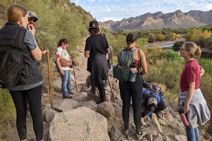
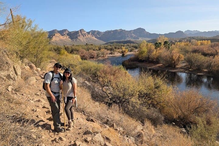
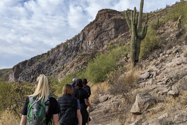
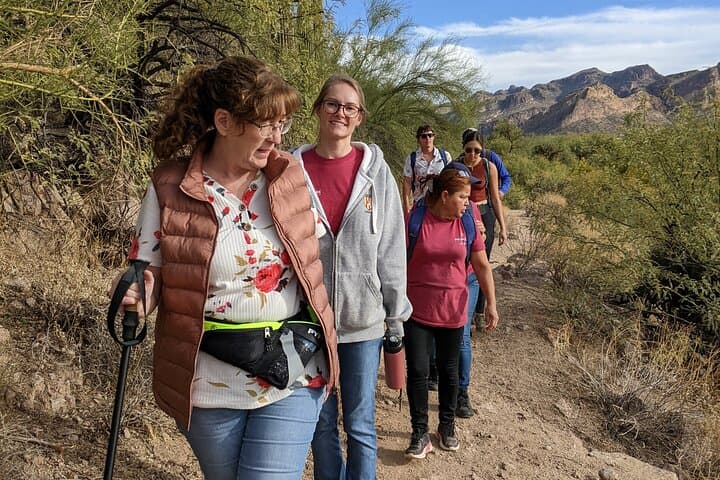
You step out from under the ramada and the desert expands: a hard-etched canyon wall drops to the Lower Salt River while creosote and brittle cacti perfume the air. The trail runs like a seam along the cliffside, framed by honey-colored rock and the ribbon of water below that dares you to keep pace with its slow, sunlit current. In two hours you’ll be at the Lime Kiln — a squat, stone oven left by miners in the late 1800s — and back, with a strong chance of spotting wild horses threading the river flats or bighorn sheep picking their way on the cliffs above.
You step out from under the ramada and the desert expands: a hard-etched canyon wall drops to the Lower Salt River while creosote and brittle cacti perfume the air. The trail runs like a seam along the cliffside, framed by honey-colored rock and the ribbon of water below that dares you to keep pace with its slow, sunlit current. In two hours you’ll be at the Lime Kiln — a squat, stone oven left by miners in the late 1800s — and back, with a strong chance of spotting wild horses threading the river flats or bighorn sheep picking their way on the cliffs above.
The Lime Kiln, often called the Goldfield Ovens, is simple industrial archaeology: hand-laid limestone shaped to bake ore and lime for frontier building. The kiln’s bones tell a practical story of settlement and resource use in Tonto National Forest, where miners, cattlemen and river runners moved through a landscape shaped by erosion and seasonal floods. Geologically, the canyon walls expose volcanic tuffs and river-worn conglomerates — the result of repeated uplift and arroyo-cutting that sculpted the Lower Salt into the narrow corridor you hike beside.
Culturally, this stretch of river sits in the ancestral lands of the Western Apache; for millennia these waterways were lifelines. Today the area is managed for recreation and habitat — the riparian ribbon supports birds and the curious gatherings of wild horses that have become an icon of the Lower Salt.
Practical guidance: this hike is a moderate 4.0-mile out-and-back with roughly 406 feet of elevation gain and a steepest grade near 12%. The route is mostly hard-packed desert singletrack with some loose scree near the river’s edge — good traction is helpful. Trails are exposed; start early in summer to avoid extreme heat and bring at least 2 liters of water per person. The operator provides bottled water, snacks and a Tonto parking pass, and groups are small (max five), but note a two-person minimum to operate.
Wildlife viewing is best from the rim where you can scan the flats for wild horses or watch bighorn sheep navigate cliff ledges. Respect animals by giving them distance and keeping voices low. There are no formal restrooms at the trailhead; plan accordingly.
Getting there: meet at the northern ramada in the Blue Point parking lot at Saguaro Lake Ranch. Leave your weekend plans flexible — summer thunderstorms can close the route — and pack sun protection, sturdy footwear and patience. The Lime Kiln Desert Hike is straightforward on paper, but it rewards attention: the river’s presence, the kiln’s weathered stones and the cliffside fauna combine into a short Arizona hike that feels much larger than its 4 miles.