THE ADVENTURE COLLECTIVE® · Independent discovery and booking for outdoor travel

An 8-day trek from Kathmandu into Langtang Valley that climbs from temperate river valleys to high alpine pastures and Kyanjin Gompa. Expect forested trails, moraine crossings, teahouse stays, and sweeping views of Langtang Lirung and Ganesh Himal.
An 8-day trek from Kathmandu into Langtang Valley that climbs from temperate river valleys to high alpine pastures and Kyanjin Gompa. Expect forested trails, moraine crossings, teahouse stays, and sweeping views of Langtang Lirung and Ganesh Himal.
The trail opens with a morning drive out of Kathmandu, towns thinning to terraced fields and roadside prayer flags flapping in a cold wind. By Syabrubesi (1,550m) the Himalayan foothills rise close; the path follows the Bhote Koshi and Langtang Khola, each bend revealing steeper ridgelines and the first glimpses of Langtang Lirung.
Verified experiences and guided adventures in the surrounding area.
Operated by Couch Adventure Nepal (CAN) · Syabrubesi, Bagmati Province
The trail opens with a morning drive out of Kathmandu, towns thinning to terraced fields and roadside prayer flags flapping in a cold wind. By Syabrubesi (1,550m) the Himalayan foothills rise close; the path follows the Bhote Koshi and Langtang Khola, each bend revealing steeper ridgelines and the first glimpses of Langtang Lirung.
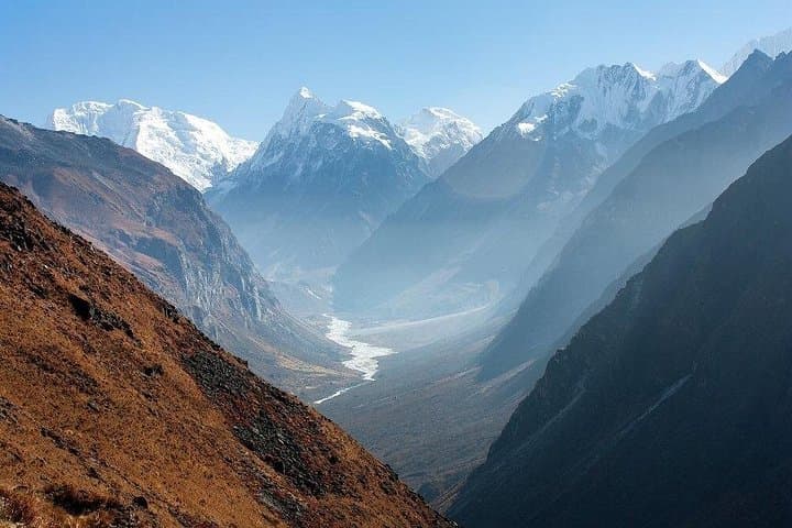
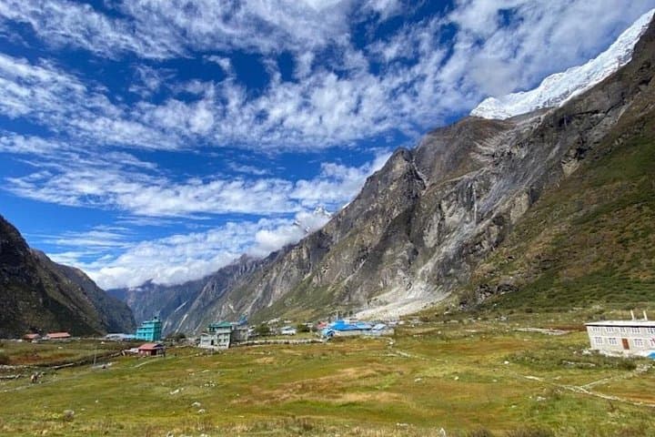
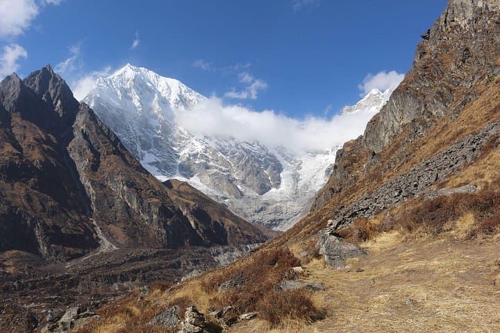
Across eight days trekkers move from verdant, rhododendron-clad forest into alpine meadows and glacial moraines, topping out at Kyanjin Gompa (3,870m). The range’s geology is raw—ancient metamorphic rock scarred by glaciers, with moraine fields and steep cirques that frame views of Ganesh Himal and Langtang Lirung. Culturally the route threads Tamang and Sherpa villages where mani stones, prayer wheels, and yak cheese-making mark daily life. The region still bears the imprint of the 2015 earthquake; rebuilding and community tourism remain central to the valley’s recovery.
Practical guide: expect 4–7 hour walking days on uneven, sometimes slippery trails with total elevation gain from Syabrubesi to Kyanjin of roughly 2,300m over multiple ascents and descents. Accommodations are teahouse guest houses—simple rooms with shared facilities. Permits required: TIMS and Langtang National Park entry. Hydration and slow pacing are essential for high-altitude adaptation; carry water purification and layers for large temperature swings between valley mornings and alpine afternoons. Trekking poles reduce knee strain on descents; allow an extra acclimatization day if you feel any altitude symptoms. The route is less crowded than Annapurna or Everest approaches, offering quieter mountain time and direct support to local communities.
moderate.
6–8 days of trekking within an 8-day itinerary.
Good cardiovascular fitness and regular hiking experience recommended; able to walk 5–7 hours over uneven terrain.
Yes—Trekking Information Management System (TIMS) and Langtang National Park entry permits are required and commonly arranged by your operator.
The trek gradually gains altitude but reaches nearly 3,900m; acclimatize by pacing, drinking water, and taking the rest/acclimatization day at Kyanjin Gompa if needed.
Teahouse guest houses offer basic private or dorm rooms, simple Nepalese meals, and often hot drinks; bring cash for extras like showers.
Active beginners with previous multi-hour hikes and good fitness can complete it, but prior altitude experience or careful pacing is strongly recommended.
The Langtang Valley is home to Tamang communities and suffered major damage in the 2015 earthquake; trekking supports ongoing reconstruction and local economies.
The route runs through Langtang National Park—stay on trails, pack out trash, and use local services to support sustainable tourism.
Couch Adventure Nepal (CAN) operates guided outdoor trips and adventures with an emphasis on safety, stewardship, and memorable experiences.
The trail opens with a morning drive out of Kathmandu, towns thinning to terraced fields and roadside prayer flags flapping in a cold wind. By Syabrubesi (1,550m) the Himalayan foothills rise close; the path follows the Bhote Koshi and Langtang Khola, each bend revealing steeper ridgelines and the first glimpses of Langtang Lirung.
The trail opens with a morning drive out of Kathmandu, towns thinning to terraced fields and roadside prayer flags flapping in a cold wind. By Syabrubesi (1,550m) the Himalayan foothills rise close; the path follows the Bhote Koshi and Langtang Khola, each bend revealing steeper ridgelines and the first glimpses of Langtang Lirung.
Across eight days trekkers move from verdant, rhododendron-clad forest into alpine meadows and glacial moraines, topping out at Kyanjin Gompa (3,870m). The range’s geology is raw—ancient metamorphic rock scarred by glaciers, with moraine fields and steep cirques that frame views of Ganesh Himal and Langtang Lirung. Culturally the route threads Tamang and Sherpa villages where mani stones, prayer wheels, and yak cheese-making mark daily life. The region still bears the imprint of the 2015 earthquake; rebuilding and community tourism remain central to the valley’s recovery.
Practical guide: expect 4–7 hour walking days on uneven, sometimes slippery trails with total elevation gain from Syabrubesi to Kyanjin of roughly 2,300m over multiple ascents and descents. Accommodations are teahouse guest houses—simple rooms with shared facilities. Permits required: TIMS and Langtang National Park entry. Hydration and slow pacing are essential for high-altitude adaptation; carry water purification and layers for large temperature swings between valley mornings and alpine afternoons. Trekking poles reduce knee strain on descents; allow an extra acclimatization day if you feel any altitude symptoms. The route is less crowded than Annapurna or Everest approaches, offering quieter mountain time and direct support to local communities.