THE ADVENTURE COLLECTIVE® · Independent discovery and booking for outdoor travel

A classic Himalayan circuit that follows old salt‑trade routes through rhododendron forest, alpine meadows, and glacial valleys to Kyanjin Gompa. This 8–10 day trek is practical for fit hikers who want high‑mountain views without technical climbing.
A classic Himalayan circuit that follows old salt‑trade routes through rhododendron forest, alpine meadows, and glacial valleys to Kyanjin Gompa. This 8–10 day trek is practical for fit hikers who want high‑mountain views without technical climbing.
You step off the winding mountain road at Syabrubesi and the air tightens—rhododendron and oak close around the trail as the Langtang River dares you to move upstream. Over the next days the valley opens and closes: forested switchbacks give way to green meadows, then to moraine and glacial rock framing Langtang Lirung’s snowband far above.
Verified experiences and guided adventures in the surrounding area.
Operated by Himalayan Smile Treks and Adventure Pvt. Ltd · Kathmandu, Bagmati Province
You step off the winding mountain road at Syabrubesi and the air tightens—rhododendron and oak close around the trail as the Langtang River dares you to move upstream. Over the next days the valley opens and closes: forested switchbacks give way to green meadows, then to moraine and glacial rock framing Langtang Lirung’s snowband far above.
Langtang sits north of Kathmandu inside Langtang National Park, established in 1976 to protect high‑altitude species including the endangered red panda. The route follows old salt‑trade tracks used by Tamang and Sherpa communities; villages you pass still keep communal farming rhythms and stone‑built gompas. Geologically the valley cuts through uplifted Himalayan thrusts—sharp ridgelines and cirques mark active glaciation that carved this corridor for millennia.
Expect 6–7 hours of walking on many days, roughly 60–70 km round‑trip, and about 2,200–2,400 m of elevation gain from Syabrubesi (~1,500 m) to Kyanjin (≈3,700–3,900 m). Optional side trips include Tserko Ri or technical ascents like Yala Peak (5,550 m) for climbers. Permits include a TIMS card and Langtang National Park fees; a guide and porter lighten logistics and speed acclimatization.
Practical edge: carry a reliable water filter, break in waterproof boots, and plan an extra day at Kyanjin to acclimatize. Walk early to avoid afternoon weather, conserve microplastics by using refillable bottles, and budget for basic teahouse meals and lodge guesthouse comfort. Solid fitness, steady pace, and respect for changing mountain weather make this classic Himalayan valley both achievable and vividly rewarding.
challenging.
8–10 days.
Good aerobic fitness; able to walk 4–7 hours per day on uneven trails and tolerate sustained uphill sections
Yes—trekkers must carry a TIMS card and pay Langtang National Park entry fees; guides usually arrange these before departure.
Typical itineraries run 8–10 days round trip from Kathmandu with 4–7 hours of walking on most days; total trekking distance is roughly 60–70 km.
Fit beginners can do the trek with a guide and extra acclimatization days, but expect basic mountain conditions and variable weather.
Spring (March–May) and fall (Sept–Nov) offer the most stable weather and clear views; monsoon brings green valleys but heavier rain and leeches in lower forests.
Langtang communities have traded across this corridor for centuries; the valley was heavily affected by the 2015 earthquake which altered some villages and glacial debris fields.
Visitors should stick to marked trails, carry out non‑biodegradable waste, and support local lodges that follow park rules to reduce pressure on fragile alpine environments.
Himalayan Smile Treks and Adventure Pvt. Ltd operates guided outdoor trips and adventures with an emphasis on safety, stewardship, and memorable experiences.
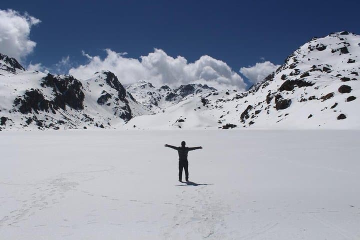
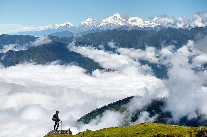
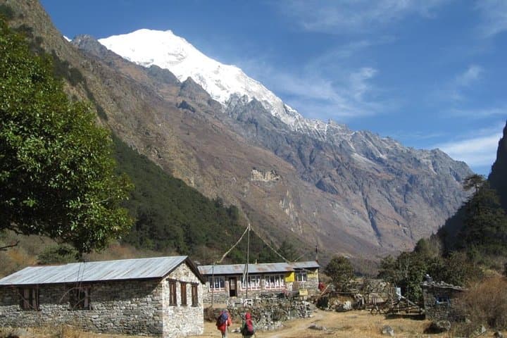
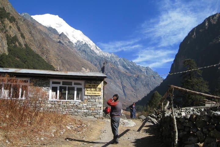
You step off the winding mountain road at Syabrubesi and the air tightens—rhododendron and oak close around the trail as the Langtang River dares you to move upstream. Over the next days the valley opens and closes: forested switchbacks give way to green meadows, then to moraine and glacial rock framing Langtang Lirung’s snowband far above.
You step off the winding mountain road at Syabrubesi and the air tightens—rhododendron and oak close around the trail as the Langtang River dares you to move upstream. Over the next days the valley opens and closes: forested switchbacks give way to green meadows, then to moraine and glacial rock framing Langtang Lirung’s snowband far above.
Langtang sits north of Kathmandu inside Langtang National Park, established in 1976 to protect high‑altitude species including the endangered red panda. The route follows old salt‑trade tracks used by Tamang and Sherpa communities; villages you pass still keep communal farming rhythms and stone‑built gompas. Geologically the valley cuts through uplifted Himalayan thrusts—sharp ridgelines and cirques mark active glaciation that carved this corridor for millennia.
Expect 6–7 hours of walking on many days, roughly 60–70 km round‑trip, and about 2,200–2,400 m of elevation gain from Syabrubesi (~1,500 m) to Kyanjin (≈3,700–3,900 m). Optional side trips include Tserko Ri or technical ascents like Yala Peak (5,550 m) for climbers. Permits include a TIMS card and Langtang National Park fees; a guide and porter lighten logistics and speed acclimatization.
Practical edge: carry a reliable water filter, break in waterproof boots, and plan an extra day at Kyanjin to acclimatize. Walk early to avoid afternoon weather, conserve microplastics by using refillable bottles, and budget for basic teahouse meals and lodge guesthouse comfort. Solid fitness, steady pace, and respect for changing mountain weather make this classic Himalayan valley both achievable and vividly rewarding.