THE ADVENTURE COLLECTIVE® · Independent discovery and booking for outdoor travel

Climb La Tourelle de Tamarin for a compact, rope-assisted summit with sweeping views over Mauritius’ western lagoon. This guided hike combines sustained elevation, loose-rock sections, and a private access route—ideal for hikers looking to build endurance and experience technical spots with professional support.
Climb La Tourelle de Tamarin for a compact, rope-assisted summit with sweeping views over Mauritius’ western lagoon. This guided hike combines sustained elevation, loose-rock sections, and a private access route—ideal for hikers looking to build endurance and experience technical spots with professional support.
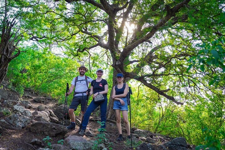
The trail begins in the village air—sea-salt on one side, wet forest on the other—as hikers step off narrow lanes into a shoulder of volcanic rock. Footsteps sink into leaf litter; the path climbs steadily, the forest canopy opening intermittently to reveal the lagoon’s blue daring you to look back.
Verified experiences and guided adventures in the surrounding area.
Operated by Horazis · Tamarin, Black River District
The trail begins in the village air—sea-salt on one side, wet forest on the other—as hikers step off narrow lanes into a shoulder of volcanic rock. Footsteps sink into leaf litter; the path climbs steadily, the forest canopy opening intermittently to reveal the lagoon’s blue daring you to look back.
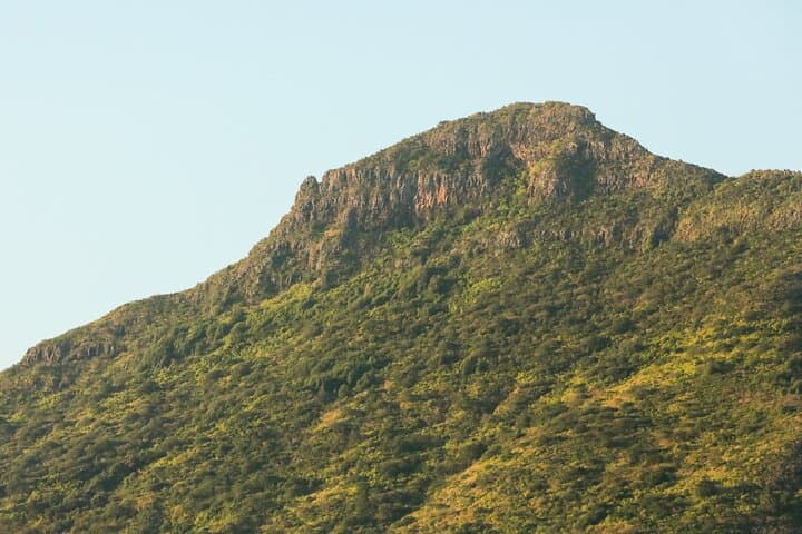
La Tourelle de Tamarin is a small, isolated peak on Mauritius’ western flank. Geologically it’s part of the island’s eroded basaltic shield, shaped by ancient lava flows and coastal uplift. Culturally the area is tied to fishing villages and Creole agricultural plots; local guides often share stories of how these ridgelines were used for navigation and shelter long before tourism arrived.
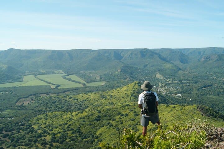
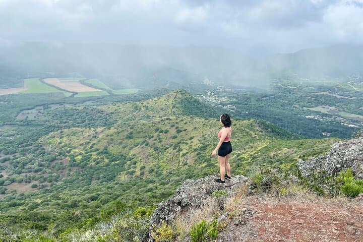
The route holds a constant, sustained grade—good for endurance training—and several unstable, slide-prone sections where ropes help hikers descend and reascend rock scars. Expect mixed terrain: packed earth, loose scree, and short scrambling pitches. From the summit the western lowlands, sugarcane fields and the Indian Ocean lay out in clear planes; clouds cross fast here, changing visibility in minutes.
Practical guidance: go early to avoid heat and building afternoon showers; wear grippy boots and gloves for rope sections; carry 1–1.5 liters of water and a lightweight rain shell. The hike is guided and privately accessed, so permits and a professional mountaineer accompany groups—good for those new to rope-assisted sections. Respect fragile vegetation and stay on the route: erosion is active and the land recovers slowly.
This trek rewards steady effort with panoramic coastal views and a close encounter with Mauritius’ volcanic bones—direct, raw and achievable with preparation.
moderate.
3–4 hours.
Suitable for hikers with moderate fitness; sustained uphill walking and short rope-assisted sections require endurance and stable footing.
Guided access with a professional mountaineer makes the route approachable for fit beginners, though participants should be comfortable with steep, uneven terrain and short rope-assisted sections.
No specialized climbing gear is required—ropes are provided and managed by guides; standard hiking gear and gloves are sufficient.
The route features a constant uphill grade over a few hours with some unstable sections; expect a moderate cardiovascular challenge and use of upper body on rope sections.
Operators may cancel for heavy rain or cyclonic conditions; light showers are common—bring waterproof layers and confirm weather policies when booking.
The western ridgelines were historically used by local communities for navigation and small-scale agriculture; the island’s volcanic origins shaped the basalt ridges hikers follow today.
Erosion and unauthorized paths damage fragile soils—stick to the guided route, avoid trampling vegetation, and carry out all trash to protect the site’s recovery.
Horazis operates guided outdoor trips and adventures with an emphasis on safety, stewardship, and memorable experiences.
The trail begins in the village air—sea-salt on one side, wet forest on the other—as hikers step off narrow lanes into a shoulder of volcanic rock. Footsteps sink into leaf litter; the path climbs steadily, the forest canopy opening intermittently to reveal the lagoon’s blue daring you to look back.
The trail begins in the village air—sea-salt on one side, wet forest on the other—as hikers step off narrow lanes into a shoulder of volcanic rock. Footsteps sink into leaf litter; the path climbs steadily, the forest canopy opening intermittently to reveal the lagoon’s blue daring you to look back.
La Tourelle de Tamarin is a small, isolated peak on Mauritius’ western flank. Geologically it’s part of the island’s eroded basaltic shield, shaped by ancient lava flows and coastal uplift. Culturally the area is tied to fishing villages and Creole agricultural plots; local guides often share stories of how these ridgelines were used for navigation and shelter long before tourism arrived.
The route holds a constant, sustained grade—good for endurance training—and several unstable, slide-prone sections where ropes help hikers descend and reascend rock scars. Expect mixed terrain: packed earth, loose scree, and short scrambling pitches. From the summit the western lowlands, sugarcane fields and the Indian Ocean lay out in clear planes; clouds cross fast here, changing visibility in minutes.
Practical guidance: go early to avoid heat and building afternoon showers; wear grippy boots and gloves for rope sections; carry 1–1.5 liters of water and a lightweight rain shell. The hike is guided and privately accessed, so permits and a professional mountaineer accompany groups—good for those new to rope-assisted sections. Respect fragile vegetation and stay on the route: erosion is active and the land recovers slowly.
This trek rewards steady effort with panoramic coastal views and a close encounter with Mauritius’ volcanic bones—direct, raw and achievable with preparation.