THE ADVENTURE COLLECTIVE® · Independent discovery and booking for outdoor travel

Ascend La Soufrière, St. Vincent’s 4,048-ft active volcano, on a day-long hike through humid forest, cloud cover, and sulfur-scarred summit flats. This guided route combines physical challenge with sweeping island views and a local lunch back in Georgetown.
Ascend La Soufrière, St. Vincent’s 4,048-ft active volcano, on a day-long hike through humid forest, cloud cover, and sulfur-scarred summit flats. This guided route combines physical challenge with sweeping island views and a local lunch back in Georgetown.
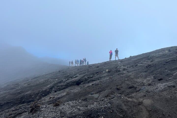
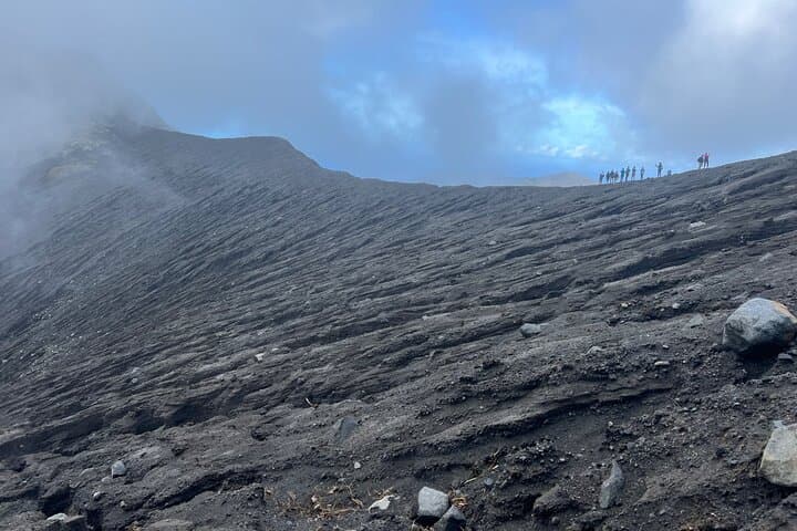
The trail begins in the humid understory east of Georgetown, where morning clouds thread through fern and ebony trees and the volcano’s cone looms above like a slow-moving weather system. Hikers move up stone and root-strewn switchbacks, the ground warming as geothermal breath becomes audible; the summit opens into wind-scoured sulfur flats and a wide view that throws both windward cliffs and leeward bays into sharp relief.
Verified experiences and guided adventures in the surrounding area.
Operated by Vincycation Adventures · Kingstown, Saint Vincent
The trail begins in the humid understory east of Georgetown, where morning clouds thread through fern and ebony trees and the volcano’s cone looms above like a slow-moving weather system. Hikers move up stone and root-strewn switchbacks, the ground warming as geothermal breath becomes audible; the summit opens into wind-scoured sulfur flats and a wide view that throws both windward cliffs and leeward bays into sharp relief.
La Soufrière rises to 4,048 ft and has shaped local culture for centuries—from Amerindian settlement patterns to colonial-era plantations and, more recently, evacuation planning around its 2021 eruption. Geologically it’s an active stratovolcano: alternating layers of ash and lava create steep, unstable slopes and sudden changes in terrain and vegetation as elevation increases.
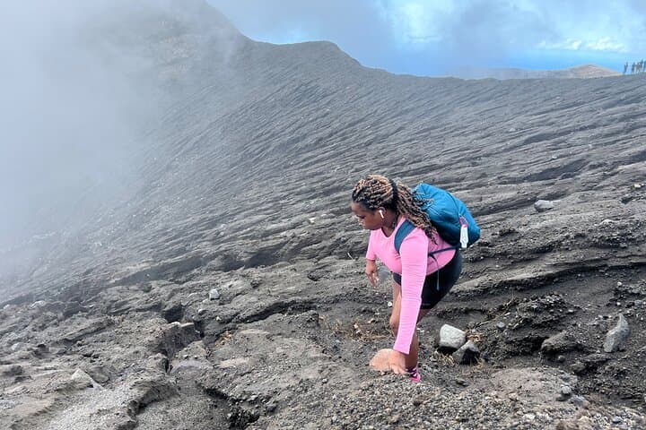
Locally guided hikes follow established routes and often finish with a village lunch, offering a taste of Vincentian cuisine and community. Expect humid forest at lower elevations, cloud forest mid-slope, and sparse, mineral-streaked ground near the crater rim. The climb tests fitness more than technical skill, but loose rock, roots, and sulfur odors demand attention.
Practical guidance: start before sunrise to avoid midday heat and reduce exposure to volcanic gases, carry at least 2–3 liters of water, wear sturdy boots with ankle support, and plan for rapid weather shifts—rain and wind are common. Certified guides monitor conditions and will alter the route if gas or instability increases. For adventurous hikers, the summit rewards sustained effort with one of St. Vincent’s most sweeping island panoramas.
challenging.
6–8 hours.
Requires high cardiovascular fitness and leg strength for sustained uphill hiking; good balance recommended.
The guided experience typically lasts 6–8 hours round-trip and is classified as challenging due to sustained elevation gain and variable trail conditions.
Guides monitor volcanic activity and gas levels; tours are adjusted or canceled if official warnings or unsafe conditions are present.
Local operators provide certified guides and handle route logistics; permits are managed by guides—independent hiking is not recommended for safety and conservation reasons.
Bring energy-dense snacks (nuts, bars), a salty electrolyte option, and at least 2 liters of water; many tours include a post-hike local lunch.
La Soufrière has shaped island life for centuries; its eruptions have driven settlement shifts and modern evacuation planning, most recently in 2021.
Stay on marked trails to protect fragile cloud forest and endemic species; follow guide instructions to minimize erosion and disturbance.
Vincycation Adventures operates guided outdoor trips and adventures with an emphasis on safety, stewardship, and memorable experiences.
The trail begins in the humid understory east of Georgetown, where morning clouds thread through fern and ebony trees and the volcano’s cone looms above like a slow-moving weather system. Hikers move up stone and root-strewn switchbacks, the ground warming as geothermal breath becomes audible; the summit opens into wind-scoured sulfur flats and a wide view that throws both windward cliffs and leeward bays into sharp relief.
The trail begins in the humid understory east of Georgetown, where morning clouds thread through fern and ebony trees and the volcano’s cone looms above like a slow-moving weather system. Hikers move up stone and root-strewn switchbacks, the ground warming as geothermal breath becomes audible; the summit opens into wind-scoured sulfur flats and a wide view that throws both windward cliffs and leeward bays into sharp relief.
La Soufrière rises to 4,048 ft and has shaped local culture for centuries—from Amerindian settlement patterns to colonial-era plantations and, more recently, evacuation planning around its 2021 eruption. Geologically it’s an active stratovolcano: alternating layers of ash and lava create steep, unstable slopes and sudden changes in terrain and vegetation as elevation increases.
Locally guided hikes follow established routes and often finish with a village lunch, offering a taste of Vincentian cuisine and community. Expect humid forest at lower elevations, cloud forest mid-slope, and sparse, mineral-streaked ground near the crater rim. The climb tests fitness more than technical skill, but loose rock, roots, and sulfur odors demand attention.
Practical guidance: start before sunrise to avoid midday heat and reduce exposure to volcanic gases, carry at least 2–3 liters of water, wear sturdy boots with ankle support, and plan for rapid weather shifts—rain and wind are common. Certified guides monitor conditions and will alter the route if gas or instability increases. For adventurous hikers, the summit rewards sustained effort with one of St. Vincent’s most sweeping island panoramas.