THE ADVENTURE COLLECTIVE® · Independent discovery and booking for outdoor travel

Ascend La Soufrière and stand on a living volcanic rim with sweeping views of St Vincent and the Grenadines. This practical guide outlines what the trail feels like, the eruption history beneath your boots, and how to prepare for the climb.
Ascend La Soufrière and stand on a living volcanic rim with sweeping views of St Vincent and the Grenadines. This practical guide outlines what the trail feels like, the eruption history beneath your boots, and how to prepare for the climb.
You step off the minibus at Bamboo Range and the island's wind draws a line along the path, daring you toward the crater rim. The trail rises quickly into fern and bamboo, the ground shifting from packed soil to volcanic scree as you climb toward La Soufrière's open throat. At the summit the crater yawns—rough, raw, and wide—while the Caribbean spreads in blue panels below.
Verified experiences and guided adventures in the surrounding area.
Operated by Lavaman · Kingstown, Saint Vincent
You step off the minibus at Bamboo Range and the island's wind draws a line along the path, daring you toward the crater rim. The trail rises quickly into fern and bamboo, the ground shifting from packed soil to volcanic scree as you climb toward La Soufrière's open throat. At the summit the crater yawns—rough, raw, and wide—while the Caribbean spreads in blue panels below.
La Soufrière is a stratovolcano reaching about 1,234 m (4,048 ft) with a crater roughly 500 m across and 60 m deep. Eruptions are recorded from 1718 through recent activity in April 2021, shaping both the island's terrain and its human history. The windward approach passes agricultural plots and coffee farms, reflecting centuries of settlement and cultivation that contrast with the volcano's geologic youth.
Expect a steady 4 km ascent from the trailhead to the rim (roughly 2 hours up for an average hiker, 2 hours back). Terrain shifts between packed soil, exposed roots, and loose volcanic rock; visibility can change fast, and the summit gets cold and windy on cloudy days. Guides commonly provide walking poles, first-aid, and transport from Kingstown.
Practical guidance: start early to avoid mid-day heat, carry cash for the entrance fee at the trail office, and wear ankle-supporting boots for the scree sections. Hydrate and layer—weather at the crater can be far cooler than the coast. Respect signage and stay on trail to protect fragile high-elevation flora and nesting habitat for endemic birds.
moderate.
4–7 hours.
Suitable for hikers with moderate fitness—able to manage sustained climbs and short sections of loose scree.
The trail from Bamboo Range is about 4 km each way; expect roughly 2 hours up and 2 hours down for an average hiker, plus transport time.
Yes—the entrance fee is payable at the trailhead office in cash and supports park management and guides.
Independent hikers attempt the trail, but guided tours are common and include transport, local route knowledge, and safety equipment.
La Soufrière is an active volcano; tours may be canceled in unsafe conditions. Follow local guidance and the operator’s notices about closures.
La Soufrière has erupted repeatedly over centuries (noted events include 1718, 1812, 1902, 1987 and April 2021), shaping island settlement and agriculture along its slopes.
Visitors should stay on trail and pack out waste; entrance fees and guided services contribute to trail maintenance and habitat protection.
Lavaman operates guided outdoor trips and adventures with an emphasis on safety, stewardship, and memorable experiences.
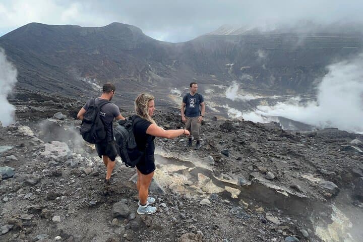
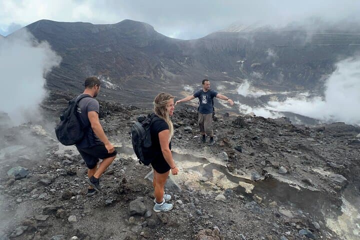
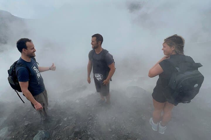

You step off the minibus at Bamboo Range and the island's wind draws a line along the path, daring you toward the crater rim. The trail rises quickly into fern and bamboo, the ground shifting from packed soil to volcanic scree as you climb toward La Soufrière's open throat. At the summit the crater yawns—rough, raw, and wide—while the Caribbean spreads in blue panels below.
You step off the minibus at Bamboo Range and the island's wind draws a line along the path, daring you toward the crater rim. The trail rises quickly into fern and bamboo, the ground shifting from packed soil to volcanic scree as you climb toward La Soufrière's open throat. At the summit the crater yawns—rough, raw, and wide—while the Caribbean spreads in blue panels below.
La Soufrière is a stratovolcano reaching about 1,234 m (4,048 ft) with a crater roughly 500 m across and 60 m deep. Eruptions are recorded from 1718 through recent activity in April 2021, shaping both the island's terrain and its human history. The windward approach passes agricultural plots and coffee farms, reflecting centuries of settlement and cultivation that contrast with the volcano's geologic youth.
Expect a steady 4 km ascent from the trailhead to the rim (roughly 2 hours up for an average hiker, 2 hours back). Terrain shifts between packed soil, exposed roots, and loose volcanic rock; visibility can change fast, and the summit gets cold and windy on cloudy days. Guides commonly provide walking poles, first-aid, and transport from Kingstown.
Practical guidance: start early to avoid mid-day heat, carry cash for the entrance fee at the trail office, and wear ankle-supporting boots for the scree sections. Hydrate and layer—weather at the crater can be far cooler than the coast. Respect signage and stay on trail to protect fragile high-elevation flora and nesting habitat for endemic birds.