THE ADVENTURE COLLECTIVE® · Independent discovery and booking for outdoor travel

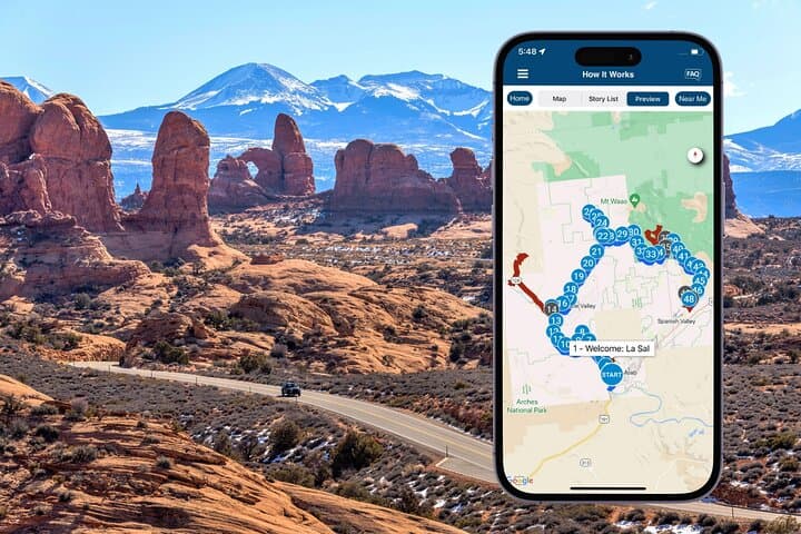
Drive a 61-mile loop from Moab with an offline audio guide that narrates the La Sal Mountains’ geology, Wild West film sites, dinosaur tracks, and scenic overlooks. Download the tour app before you go and plan a few short stops to stretch and photograph iconic formations.
Drive a 61-mile loop from Moab with an offline audio guide that narrates the La Sal Mountains’ geology, Wild West film sites, dinosaur tracks, and scenic overlooks. Download the tour app before you go and plan a few short stops to stretch and photograph iconic formations.
You turn off Highway 191 and the road climbs, the desert shrinking behind you while the La Sal range slowly asserts itself—gray-blue summits rising above red walls, their shadows stretching along the canyon. The car hums, the audio guide begins, and the landscape starts talking back: mesas, volcanic knobs, and the wide bend of the Colorado River all fall into a clearer story.
Verified experiences and guided adventures in the surrounding area.
Operated by Travel with Action · Moab, Utah
You turn off Highway 191 and the road climbs, the desert shrinking behind you while the La Sal range slowly asserts itself—gray-blue summits rising above red walls, their shadows stretching along the canyon. The car hums, the audio guide begins, and the landscape starts talking back: mesas, volcanic knobs, and the wide bend of the Colorado River all fall into a clearer story.
This loop traces geology and history: Wingate Sandstone cliffs that were once dunes, laccolithic peaks pushed up by molten rock, and Navajo and Ute presence that shaped local place names and routes. The audio spots stopping points—Castleton Tower, Parriott Mesa, La Sal Lookout—each with a short geological primer and notes on film crews, ranching history, and where dinosaur tracks still fossilize in the slickrock.
As a driving experience it’s flexible and pragmatic: 61 miles, about 2–3 hours of driving time, with 45+ short audio vignettes and multiple optional detours for hikes, lakes, and river takeouts. Nature here has attitude—the Colorado River dares you to notice its green ribbon, while the La Sals loom like guardians that change expression with the light.
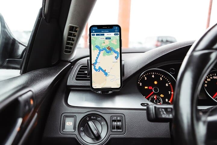
Practical tips: download the Action Tour Guide app and the specific tour while you have Wi‑Fi (the password arrives by email/text), connect your phone to your car stereo for best sound, and plan stops—some vistas require short walks or 4WD spurs. Check seasonal road conditions and park access; entrance fees and trailhead rules are separate. Bring water, layers for wind or sun exposure, and a full phone battery—this loop rewards slow driving, curiosity, and a readiness to step out and explore.
easy.
2–3 hours.
Minimal fitness required for the drive; some short walks and optional hikes are moderate and require basic stamina.
This product is designed as a self-guided audio tour; follow the app’s route and narration—no guide meets you at the start.
The loop covers about 61 miles and typically takes 2–3 hours driving; you can stop freely at designated pullouts and detours to hike or swim.
The audio download is valid for 12 months from purchase, so you can use it any day within that timeframe without rebooking.
No—park entrance fees, lake or trail permits, and paid attractions are not included; confirm hours and access before you go.
The La Sal region records Native American travel routes and later ranching and film history; many formations doubled as movie backdrops in the 20th century.
Stick to established pullouts and trails, pack out trash, and avoid driving on soft desert surfaces to protect cryptobiotic soils and fragile desert vegetation.
Travel with Action operates guided outdoor trips and adventures with an emphasis on safety, stewardship, and memorable experiences.


You turn off Highway 191 and the road climbs, the desert shrinking behind you while the La Sal range slowly asserts itself—gray-blue summits rising above red walls, their shadows stretching along the canyon. The car hums, the audio guide begins, and the landscape starts talking back: mesas, volcanic knobs, and the wide bend of the Colorado River all fall into a clearer story.
You turn off Highway 191 and the road climbs, the desert shrinking behind you while the La Sal range slowly asserts itself—gray-blue summits rising above red walls, their shadows stretching along the canyon. The car hums, the audio guide begins, and the landscape starts talking back: mesas, volcanic knobs, and the wide bend of the Colorado River all fall into a clearer story.
This loop traces geology and history: Wingate Sandstone cliffs that were once dunes, laccolithic peaks pushed up by molten rock, and Navajo and Ute presence that shaped local place names and routes. The audio spots stopping points—Castleton Tower, Parriott Mesa, La Sal Lookout—each with a short geological primer and notes on film crews, ranching history, and where dinosaur tracks still fossilize in the slickrock.
As a driving experience it’s flexible and pragmatic: 61 miles, about 2–3 hours of driving time, with 45+ short audio vignettes and multiple optional detours for hikes, lakes, and river takeouts. Nature here has attitude—the Colorado River dares you to notice its green ribbon, while the La Sals loom like guardians that change expression with the light.
Practical tips: download the Action Tour Guide app and the specific tour while you have Wi‑Fi (the password arrives by email/text), connect your phone to your car stereo for best sound, and plan stops—some vistas require short walks or 4WD spurs. Check seasonal road conditions and park access; entrance fees and trailhead rules are separate. Bring water, layers for wind or sun exposure, and a full phone battery—this loop rewards slow driving, curiosity, and a readiness to step out and explore.