THE ADVENTURE COLLECTIVE® · Independent discovery and booking for outdoor travel

Catch sunrise over Monterrey on a guided, private hike to the "M" summit in Chipinque National Park. This morning tour blends pine-forested trails, limestone canyons, and panoramic city views with local geology and cultural insights.
Catch sunrise over Monterrey on a guided, private hike to the "M" summit in Chipinque National Park. This morning tour blends pine-forested trails, limestone canyons, and panoramic city views with local geology and cultural insights.
Dawn pushes color across the ridgeline as you meet your guide at HEB Gómez Morín and drive toward Chipinque National Park. The vehicle hums along for roughly 5 miles (8 km) before the pavement gives way to pines and limestone outcrops; the air cools and the city’s noise thins to a distant pulse.
Verified experiences and guided adventures in the surrounding area.
Operated by Gaia Xtreme Tours · San Pedro Garza García, Nuevo León
Dawn pushes color across the ridgeline as you meet your guide at HEB Gómez Morín and drive toward Chipinque National Park. The vehicle hums along for roughly 5 miles (8 km) before the pavement gives way to pines and limestone outcrops; the air cools and the city’s noise thins to a distant pulse.
Chipinque sits on the eastern flank of the Sierra Madre Oriental, where folded limestone and volcanic intrusions have created tight canyons, rocky ledges, and panoramic overlooks. The park has long been used by local communities for grazing and now for recreation; the painted “M” is a modern landmark that marks the summit route and looks out over Monterrey. Your guide will point out geologic layers, local legends about the ridgelines, and the role these slopes play in regional water capture.
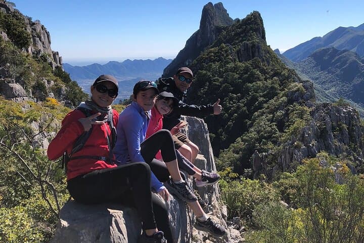
The route is a mix of maintained trail and short rock scrambles through pine forest, with intermittent vistas that frame the city and the serrated skyline. Expect several kilometers of hiking and an estimated elevation change of a few hundred meters — moderate effort rewarded by sunrise light on red rock and city below.
Practical notes: start early for cooler temperatures and better light, carry 1–2 liters of water, sturdy shoes with grip, and layers for wind exposure. Photography opportunities are frequent; keep gear light and protected from dust. The tour returns to the meeting point in the morning, leaving time to explore San Pedro afterward. Respect trail closures and stick with your guide to access the more rugged canyons safely.
moderate.
4–6 hours.
Moderately fit: comfortable with sustained uphill walking and short scrambling; able to hike on uneven terrain.
The guided outing typically covers several kilometers with a few hundred meters of elevation gain; plan on 4–6 hours including travel time and stops.
It’s best for hikers with moderate fitness; the trail includes uneven terrain and short rock scrambles—beginners comfortable with uphill walking can join a guided group.
This private tour includes park entry as listed in the operator’s inclusions; confirm any additional local fees with the guide when booking.
Mornings are usually cooler with possible wind on ridgelines; visibility depends on seasonal haze—early starts improve the chance of clear views.
Chipinque lies within the larger Cumbres de Monterrey region used historically for grazing and seasonal paths; the park was later protected to preserve its native pine-oak ecosystems and provide urban access to nature.
Stay on trails to limit erosion on fragile limestone slopes; local operators emphasize leaving no trace and avoiding disturbance of native plants and nesting birds.
Gaia Xtreme Tours operates guided outdoor trips and adventures with an emphasis on safety, stewardship, and memorable experiences.



Dawn pushes color across the ridgeline as you meet your guide at HEB Gómez Morín and drive toward Chipinque National Park. The vehicle hums along for roughly 5 miles (8 km) before the pavement gives way to pines and limestone outcrops; the air cools and the city’s noise thins to a distant pulse.
Dawn pushes color across the ridgeline as you meet your guide at HEB Gómez Morín and drive toward Chipinque National Park. The vehicle hums along for roughly 5 miles (8 km) before the pavement gives way to pines and limestone outcrops; the air cools and the city’s noise thins to a distant pulse.
Chipinque sits on the eastern flank of the Sierra Madre Oriental, where folded limestone and volcanic intrusions have created tight canyons, rocky ledges, and panoramic overlooks. The park has long been used by local communities for grazing and now for recreation; the painted “M” is a modern landmark that marks the summit route and looks out over Monterrey. Your guide will point out geologic layers, local legends about the ridgelines, and the role these slopes play in regional water capture.
The route is a mix of maintained trail and short rock scrambles through pine forest, with intermittent vistas that frame the city and the serrated skyline. Expect several kilometers of hiking and an estimated elevation change of a few hundred meters — moderate effort rewarded by sunrise light on red rock and city below.
Practical notes: start early for cooler temperatures and better light, carry 1–2 liters of water, sturdy shoes with grip, and layers for wind exposure. Photography opportunities are frequent; keep gear light and protected from dust. The tour returns to the meeting point in the morning, leaving time to explore San Pedro afterward. Respect trail closures and stick with your guide to access the more rugged canyons safely.