THE ADVENTURE COLLECTIVE® · Independent discovery and booking for outdoor travel

A compact, scenic 8 km hike from Kuzun to Laza through the Gusarchay river valley. Expect river crossings, waterfalls, meadows and a final tea in Laza village—perfect for hikers with moderate fitness.
A compact, scenic 8 km hike from Kuzun to Laza through the Gusarchay river valley. Expect river crossings, waterfalls, meadows and a final tea in Laza village—perfect for hikers with moderate fitness.
You step out of the minivan and the Gusarchay river is already in motion—cold, insistent, daring you downstream as the trail climbs from Kuzun. The path threads between sparse beech and hornbeam stands, crosses bright mountain meadows and sidles beneath limestone cliffs that hold small waterfalls like secrets. Air is thinner as the trail rises from about 1,380 m toward Laza’s 1,720 m, and the valley opens in sudden frames of river, rock and distant peaks.
Verified experiences and guided adventures in the surrounding area.
Operated by ecohiking · Laza, Gusar District
You step out of the minivan and the Gusarchay river is already in motion—cold, insistent, daring you downstream as the trail climbs from Kuzun. The path threads between sparse beech and hornbeam stands, crosses bright mountain meadows and sidles beneath limestone cliffs that hold small waterfalls like secrets. Air is thinner as the trail rises from about 1,380 m toward Laza’s 1,720 m, and the valley opens in sudden frames of river, rock and distant peaks.
This route follows a traditional shepherd and village connection in the Gusar district of northeastern Azerbaijan. The geology is classic Greater Caucasus: folded sedimentary layers, steep ravines carved by seasonal runoff and springs that fed the rivers local communities relied on for centuries. Laza village retains a rural highland culture—tea, simple lamb dishes, and terraces where animals graze during summer.
Expect a clear trail with mixed ascents and descents over roughly 8 km and about 360 m of net elevation gain. The hike takes roughly 3 hours of walking time; transport from Baku or nearby Qusar adds several hours. In spring the river is brawnier; summer brings wildflowers and easier access; autumn colors are short but vivid; winter closes much of the route behind snow and ice.
Practical: wear supportive boots, bring 2–3 liters of water, a windproof layer, and snacks for a riverside lunch. Navigation is straightforward on the marked path, but weather can change quickly—start early to avoid afternoon storms and aim for daylight arrival in Laza for the village tea and return drive.
moderate.
3–4 hours (walking portion).
Moderate fitness: steady ascents and descents over uneven ground; comfortable on sustained uphill stretches.
The marked route is about 8 km and typically takes around 3 hours of walking, depending on pace and breaks.
No formal permit is required and the trail is marked, but many visitors join organized transfers or guides for logistics and local insight.
Expect mixed terrain: dirt paths, rocky sections, meadow tracks and wet ground near waterfalls; clear signage makes navigation straightforward.
It’s suitable for families with older children used to uphill walking, but those with very young children or limited mobility may find the ascents challenging.
The valley has long connected highland villages and grazing areas; Laza historically served as a summer pasture settlement in the Greater Caucasus foothills.
Stick to marked paths to protect fragile alpine meadows; avoid washing in river pools and carry out waste to reduce impact.
ecohiking operates guided outdoor trips and adventures with an emphasis on safety, stewardship, and memorable experiences.
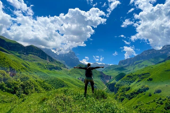
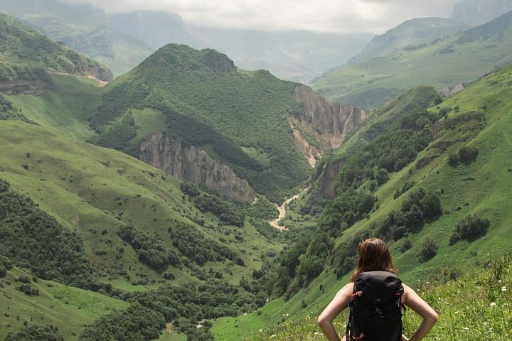
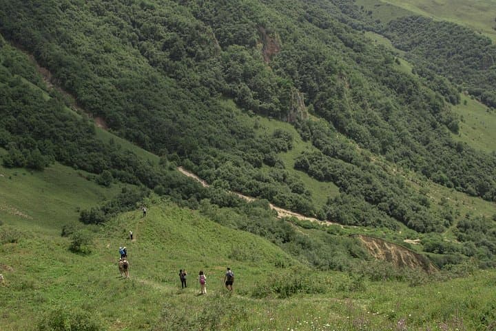
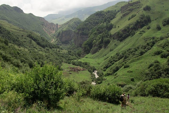
You step out of the minivan and the Gusarchay river is already in motion—cold, insistent, daring you downstream as the trail climbs from Kuzun. The path threads between sparse beech and hornbeam stands, crosses bright mountain meadows and sidles beneath limestone cliffs that hold small waterfalls like secrets. Air is thinner as the trail rises from about 1,380 m toward Laza’s 1,720 m, and the valley opens in sudden frames of river, rock and distant peaks.
You step out of the minivan and the Gusarchay river is already in motion—cold, insistent, daring you downstream as the trail climbs from Kuzun. The path threads between sparse beech and hornbeam stands, crosses bright mountain meadows and sidles beneath limestone cliffs that hold small waterfalls like secrets. Air is thinner as the trail rises from about 1,380 m toward Laza’s 1,720 m, and the valley opens in sudden frames of river, rock and distant peaks.
This route follows a traditional shepherd and village connection in the Gusar district of northeastern Azerbaijan. The geology is classic Greater Caucasus: folded sedimentary layers, steep ravines carved by seasonal runoff and springs that fed the rivers local communities relied on for centuries. Laza village retains a rural highland culture—tea, simple lamb dishes, and terraces where animals graze during summer.
Expect a clear trail with mixed ascents and descents over roughly 8 km and about 360 m of net elevation gain. The hike takes roughly 3 hours of walking time; transport from Baku or nearby Qusar adds several hours. In spring the river is brawnier; summer brings wildflowers and easier access; autumn colors are short but vivid; winter closes much of the route behind snow and ice.
Practical: wear supportive boots, bring 2–3 liters of water, a windproof layer, and snacks for a riverside lunch. Navigation is straightforward on the marked path, but weather can change quickly—start early to avoid afternoon storms and aim for daylight arrival in Laza for the village tea and return drive.