THE ADVENTURE COLLECTIVE® · Independent discovery and booking for outdoor travel

Join Katla Geopark on a one-day expedition to Krossárjökull where participants collect real glacier data, trek a secluded canyon, and witness dead-ice formations. Expect a strenuous, equipment-led experience with meaningful scientific contributions.
Join Katla Geopark on a one-day expedition to Krossárjökull where participants collect real glacier data, trek a secluded canyon, and witness dead-ice formations. Expect a strenuous, equipment-led experience with meaningful scientific contributions.
A low sun cuts the moraine into hard relief as the convoy climbs from the black sand plain toward Thórsmörk. You strap into a 4x4 and cross braided glacial rivers that dare you to keep pace; the machine hums, tires spray slurry, and the highland opens into a canyon that leads toward Krossárjökull’s pale ice.
Verified experiences and guided adventures in the surrounding area.
Operated by Gravel Travel · Vík, Southern Region
A low sun cuts the moraine into hard relief as the convoy climbs from the black sand plain toward Thórsmörk. You strap into a 4x4 and cross braided glacial rivers that dare you to keep pace; the machine hums, tires spray slurry, and the highland opens into a canyon that leads toward Krossárjökull’s pale ice.
This day-long expedition combines field science with off-trail exploration. Krossárjökull is an outlet of Mýrdalsjökull; its flows and melt patterns have shaped the nearby valleys for centuries and feed the restless Krossá River. Katla Geopark’s program trains participants to collect standardized glaciological data—measurements that feed long-term monitoring of retreat, dead-ice pockets, and sediment transport.
Culturally, the area sits within lands shaped by eruptions and glacial floods that influenced local farming and folklore; guides will frame observations with regional geology and recent climate trends. Expect moraine walks, a 1–1.5 hour moderate canyon hike each way, glacier-edge observations, and hands-on data collection after a safety briefing and gear lesson.
Practical guidance: dress in waterproof layers, bring sturdy boots with ankle support, and be ready for wind and sudden weather shifts common in South Iceland. The group provides glacier safety equipment and instruction, but a baseline of cardiovascular fitness is required for sustained hiking and river crossings. Allow a full day (about 8–10 hours), charge your camera, and plan for cancellations in poor weather. The payoff is direct: learned skills, a Citizen Scientist certificate, and a closer view of one of Iceland’s least-visited glacial outlets.
challenging.
8–10 hours.
Suitable for hikers with good cardiovascular fitness and leg strength; comfortable with sustained uphill and uneven terrain.
No formal glacier experience is required; the trip includes a safety briefing and all scientific and glacier-safety equipment, but participants should be comfortable hiking on uneven terrain.
The tour includes 4x4 transport, guide, scientific equipment, safety briefing, ongoing data updates, and a Citizen Scientist certificate and processed results sent by email.
Not recommended for pregnant travelers or those with serious spinal, heart, or cardiovascular conditions; guests should have at least moderate fitness.
The operator may cancel for safety; full refunds are available if canceled at least 24 hours before departure per the policy.
Krossárjökull is an outlet of Mýrdalsjökull; local landscapes bear marks of historical jökulhlaups (glacial outburst floods) and volcanic activity tied to Katla.
Glacial margins are fragile—stay on durable surfaces, pack out waste, and follow guide instructions; participant data supports monitoring and conservation planning.
Gravel Travel operates guided outdoor trips and adventures with an emphasis on safety, stewardship, and memorable experiences.
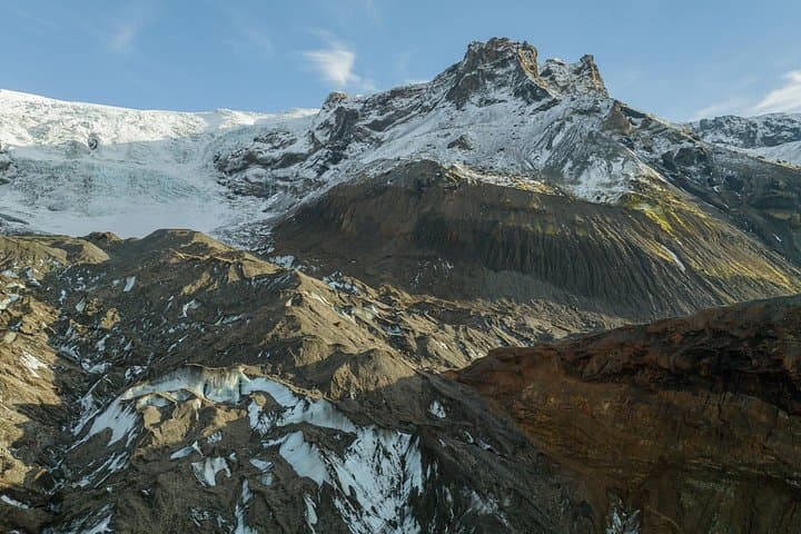
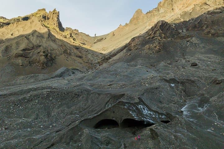
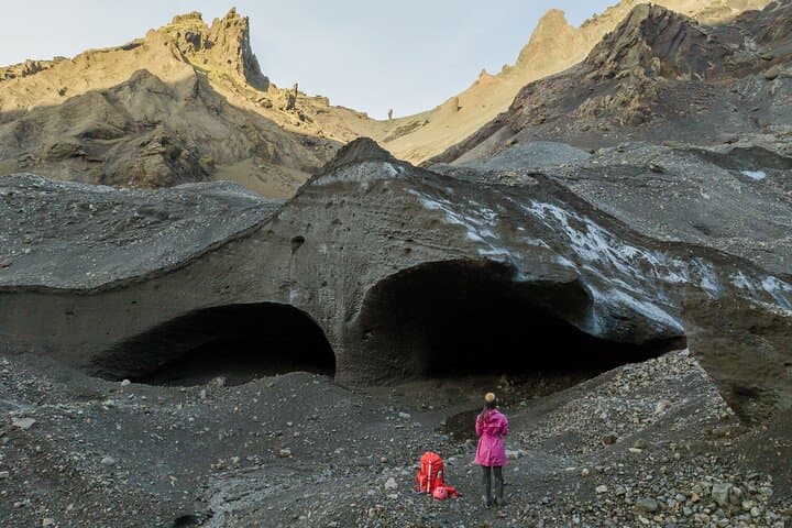
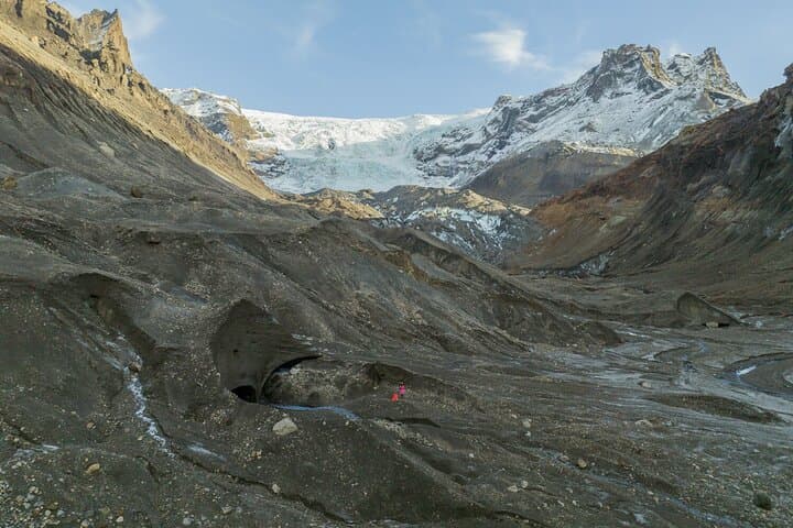
A low sun cuts the moraine into hard relief as the convoy climbs from the black sand plain toward Thórsmörk. You strap into a 4x4 and cross braided glacial rivers that dare you to keep pace; the machine hums, tires spray slurry, and the highland opens into a canyon that leads toward Krossárjökull’s pale ice.
A low sun cuts the moraine into hard relief as the convoy climbs from the black sand plain toward Thórsmörk. You strap into a 4x4 and cross braided glacial rivers that dare you to keep pace; the machine hums, tires spray slurry, and the highland opens into a canyon that leads toward Krossárjökull’s pale ice.
This day-long expedition combines field science with off-trail exploration. Krossárjökull is an outlet of Mýrdalsjökull; its flows and melt patterns have shaped the nearby valleys for centuries and feed the restless Krossá River. Katla Geopark’s program trains participants to collect standardized glaciological data—measurements that feed long-term monitoring of retreat, dead-ice pockets, and sediment transport.
Culturally, the area sits within lands shaped by eruptions and glacial floods that influenced local farming and folklore; guides will frame observations with regional geology and recent climate trends. Expect moraine walks, a 1–1.5 hour moderate canyon hike each way, glacier-edge observations, and hands-on data collection after a safety briefing and gear lesson.
Practical guidance: dress in waterproof layers, bring sturdy boots with ankle support, and be ready for wind and sudden weather shifts common in South Iceland. The group provides glacier safety equipment and instruction, but a baseline of cardiovascular fitness is required for sustained hiking and river crossings. Allow a full day (about 8–10 hours), charge your camera, and plan for cancellations in poor weather. The payoff is direct: learned skills, a Citizen Scientist certificate, and a closer view of one of Iceland’s least-visited glacial outlets.