THE ADVENTURE COLLECTIVE® · Independent discovery and booking for outdoor travel

A demanding full-day trek through tea fields, bamboo and cloud forest in Sri Lanka’s Knuckles Range. Expect steep, wet terrain, dramatic ridgelines and a strong chance of misty panoramic views.
A demanding full-day trek through tea fields, bamboo and cloud forest in Sri Lanka’s Knuckles Range. Expect steep, wet terrain, dramatic ridgelines and a strong chance of misty panoramic views.
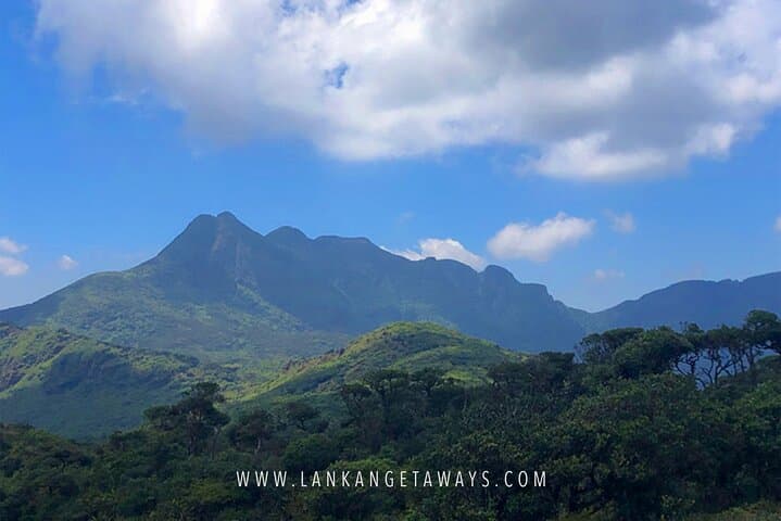
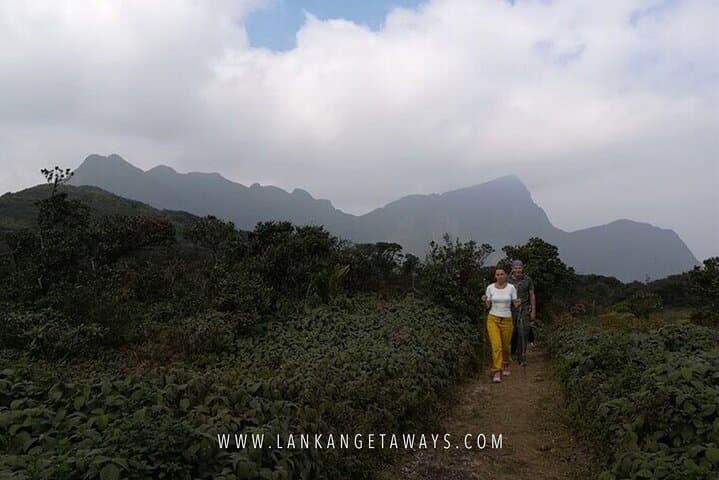
You step off the jeep into thin, cool air and the ridge ahead is a patchwork of tea terraces, bamboo groves and cloud-shrouded peaks. The trail slips between cultivated slopes and wild montane forest, the river below daring you with its constant rush until it thunders across a platform and frees the valley.
Verified experiences and guided adventures in the surrounding area.
Operated by Lankan Getaways · Kandy, Central Province
You step off the jeep into thin, cool air and the ridge ahead is a patchwork of tea terraces, bamboo groves and cloud-shrouded peaks. The trail slips between cultivated slopes and wild montane forest, the river below daring you with its constant rush until it thunders across a platform and frees the valley.
The Knuckles Range—named by colonial mapmakers for five peaks that look like knuckles—sits in Sri Lanka’s central highlands. Geologically it is a compact of folded rock and tropical montane soils; elevation ranges from roughly 900–1,900 meters and the higher ground often lives in mist, feeding streams that shaped the valleys and supported tea estates since the 19th century. Local villages keep hill country customs: small-scale tea working, spice plots and simple guest hospitality.
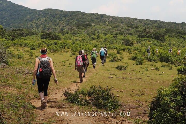
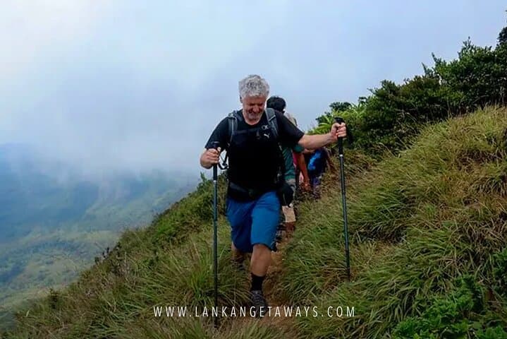
On trail you’ll cross bamboo tangles, muddy switchbacks and open ridgelines that expose sweeping views when the clouds lift. The terrain can be steep and root-strewn; expect frequent elevation changes and wet sections. Wildlife is discreet—birdsong, purple-faced langurs and endemic frogs are common if you move quietly.
Practical guide: start at first light to avoid mid-day heat and afternoon cloud build-up; wear grippy boots and a breathable waterproof layer; carry 2–3 liters of water and a high-energy lunch (many tours include a picnic). Hire a local guide for navigation and cultural context; they know the seasonal river crossings and best viewpoints. Leave no trace—pack out plastics and respect cultivated land boundaries. With moderate fitness this full-day route rewards effort with dramatic panoramas and a real taste of Sri Lanka’s montane interior.
challenging.
8–10 hours.
Requires moderate to strong cardiovascular fitness and good leg strength for sustained climbs and rough terrain.
Most popular routes are on public or community land; organized tours and local guides handle any access arrangements—check with your operator.
January–March and September–November often offer more stable weather and clearer views; avoid the heaviest monsoon months if possible.
Expect sustained climbs and uneven, wet terrain; hikers should be comfortable with all-day outings and repeated elevation changes.
Yes—many tours include private transport from Kandy or nearby towns; travel time varies by pickup point and road conditions.
The Knuckles area has long been home to hill-country communities and tea estate workers; British colonial surveyors named the range and tea planting expanded in the 1800s.
Knuckles Conservation Forest is part of the Central Highlands UNESCO natural heritage site; stick to trails and minimize waste to protect fragile montane ecosystems.
Lankan Getaways operates guided outdoor trips and adventures with an emphasis on safety, stewardship, and memorable experiences.
You step off the jeep into thin, cool air and the ridge ahead is a patchwork of tea terraces, bamboo groves and cloud-shrouded peaks. The trail slips between cultivated slopes and wild montane forest, the river below daring you with its constant rush until it thunders across a platform and frees the valley.
You step off the jeep into thin, cool air and the ridge ahead is a patchwork of tea terraces, bamboo groves and cloud-shrouded peaks. The trail slips between cultivated slopes and wild montane forest, the river below daring you with its constant rush until it thunders across a platform and frees the valley.
The Knuckles Range—named by colonial mapmakers for five peaks that look like knuckles—sits in Sri Lanka’s central highlands. Geologically it is a compact of folded rock and tropical montane soils; elevation ranges from roughly 900–1,900 meters and the higher ground often lives in mist, feeding streams that shaped the valleys and supported tea estates since the 19th century. Local villages keep hill country customs: small-scale tea working, spice plots and simple guest hospitality.
On trail you’ll cross bamboo tangles, muddy switchbacks and open ridgelines that expose sweeping views when the clouds lift. The terrain can be steep and root-strewn; expect frequent elevation changes and wet sections. Wildlife is discreet—birdsong, purple-faced langurs and endemic frogs are common if you move quietly.
Practical guide: start at first light to avoid mid-day heat and afternoon cloud build-up; wear grippy boots and a breathable waterproof layer; carry 2–3 liters of water and a high-energy lunch (many tours include a picnic). Hire a local guide for navigation and cultural context; they know the seasonal river crossings and best viewpoints. Leave no trace—pack out plastics and respect cultivated land boundaries. With moderate fitness this full-day route rewards effort with dramatic panoramas and a real taste of Sri Lanka’s montane interior.