THE ADVENTURE COLLECTIVE® · Independent discovery and booking for outdoor travel

A seven-day push from Machame Gate to Uhuru Peak, the Machame Route delivers rainforest, high moorland and an arctic summit night. Expect steep terrain, critical acclimatization days and a sunrise on Africa’s highest point.
A seven-day push from Machame Gate to Uhuru Peak, the Machame Route delivers rainforest, high moorland and an arctic summit night. Expect steep terrain, critical acclimatization days and a sunrise on Africa’s highest point.
The night is a slow river of headlamps as the group moves off Barafu Camp at midnight, each light a small insistence against the cold and the dark. Breathing sharpens into a rhythm—step, rest, sip—and the mountain presses close: wind that wants to push you sideways, volcanic scree that slides beneath boots, and the pale bulk of Kibo, ice-scarred and absolute, growing clearer with every laboring step.
Verified experiences and guided adventures in the surrounding area.
Operated by Sirikwa Travel · Moshi, Kilimanjaro Region
The night is a slow river of headlamps as the group moves off Barafu Camp at midnight, each light a small insistence against the cold and the dark. Breathing sharpens into a rhythm—step, rest, sip—and the mountain presses close: wind that wants to push you sideways, volcanic scree that slides beneath boots, and the pale bulk of Kibo, ice-scarred and absolute, growing clearer with every laboring step.
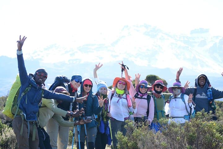
The Machame Route, often called the "Whiskey" route, makes that ascent a scenic argument. It begins under an old-growth rain forest—giant camphor and moss-draped trunks that hush the climb—then opens onto the Shira Plateau, a high moor of windswept heather and volcanic rock where views stretch to the rim of East Africa.
Geologically Kilimanjaro is a stratovolcano with three cones—Kibo, Mawenzi and Shira—formed by millions of years of eruptions. Glaciers cling to Kibo’s summit but have retreated noticeably over decades, a visible reminder of climate change on equatorial ice.
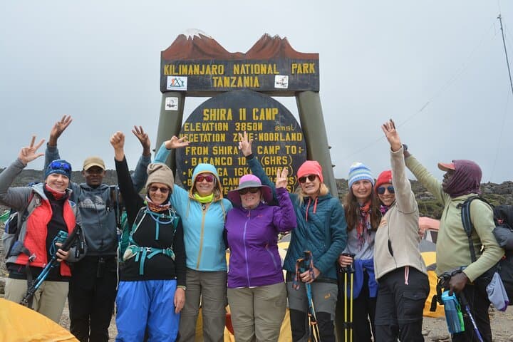
Culturally the slopes are Chagga country. Villages around Moshi have long balanced subsistence farming with the services that climbing tourism brings: guides, porters and locally run campsites. The Machame route’s seven-day itinerary is intentionally compact and scenic: Machame Gate (5,380 ft) to Machame Camp, across the Shira Plateau, past the 300-ft Lava Tower (15,190 ft), up the Barranco Wall, onto Karanga and Barafu Camps, and the final push to Uhuru Peak (19,341 ft) before descending to Mweka.
Practicalities matter as much as scenery. The itinerary packs both long ascents and critical acclimatization days—expect daily hiking of 3–7 hours, with the summit night clocking 7–8 strenuous hours uphill in arctic conditions. Altitude, not technical difficulty, is the primary hazard: take it slow, hydrate deliberately, and communicate any AMS symptoms early. Trekking poles reduce knee strain on the rocky descent; a warm, high-quality sleeping bag and layered clothing are non-negotiable. Porters manage camp logistics, but personal daypacks should carry water, snacks and layers.
Timing your summit push to arrive at Stella Point for sunrise pays off—clear mornings reveal Mawenzi’s serrated peak and the East African plains below. Respect park regulations: camp only in permitted sites, pack out waste where required, and follow your guide’s lead on route conditions.
In short, Machame is for hikers who want variety—rain forest to alpine desert—packable logistics, and a tough, rewarding summit day. It’s cinematic, uncompromising, and utterly straightforward if you prepare for cold, altitude and long, rocky kilometers underfoot.
difficult.
7 days.
Good cardiovascular fitness and prior multi-day hiking experience; comfortable carrying a light daypack for 5–8 hour days.
No formal experience is required, but prior multi-day trekking and time above 3,000 m helps; fitness and proper acclimatization are critical.
Success depends on fitness, acclimatization and weather; Machame’s shorter itinerary is scenic but can be harder for some—follow guides’ pacing to improve odds.
Camps provide basic latrine facilities; hygiene stations and hand sanitizer are recommended.
Expect arctic conditions—temperatures can fall well below freezing with strong winds, especially around the midnight summit push.
Porters typically handle camp gear and communal items; climbers should carry a light daypack with water, snacks and layers as instructed by the outfitter.
Dry months (January–March, June–October) offer more stable conditions; weather can still change rapidly at altitude.
Local Chagga communities have lived on Kilimanjaro’s slopes for centuries; the mountain has both cultural significance and a growing tourism economy centered on guiding and porter services.
Kilimanjaro National Park enforces permitted camping and waste rules; climate-driven glacier retreat is visible—stick to marked trails and follow park guidance to reduce impact.
Sirikwa Travel operates guided outdoor trips and adventures with an emphasis on safety, stewardship, and memorable experiences.
The night is a slow river of headlamps as the group moves off Barafu Camp at midnight, each light a small insistence against the cold and the dark. Breathing sharpens into a rhythm—step, rest, sip—and the mountain presses close: wind that wants to push you sideways, volcanic scree that slides beneath boots, and the pale bulk of Kibo, ice-scarred and absolute, growing clearer with every laboring step.
The night is a slow river of headlamps as the group moves off Barafu Camp at midnight, each light a small insistence against the cold and the dark. Breathing sharpens into a rhythm—step, rest, sip—and the mountain presses close: wind that wants to push you sideways, volcanic scree that slides beneath boots, and the pale bulk of Kibo, ice-scarred and absolute, growing clearer with every laboring step.
The Machame Route, often called the "Whiskey" route, makes that ascent a scenic argument. It begins under an old-growth rain forest—giant camphor and moss-draped trunks that hush the climb—then opens onto the Shira Plateau, a high moor of windswept heather and volcanic rock where views stretch to the rim of East Africa.
Geologically Kilimanjaro is a stratovolcano with three cones—Kibo, Mawenzi and Shira—formed by millions of years of eruptions. Glaciers cling to Kibo’s summit but have retreated noticeably over decades, a visible reminder of climate change on equatorial ice.
Culturally the slopes are Chagga country. Villages around Moshi have long balanced subsistence farming with the services that climbing tourism brings: guides, porters and locally run campsites. The Machame route’s seven-day itinerary is intentionally compact and scenic: Machame Gate (5,380 ft) to Machame Camp, across the Shira Plateau, past the 300-ft Lava Tower (15,190 ft), up the Barranco Wall, onto Karanga and Barafu Camps, and the final push to Uhuru Peak (19,341 ft) before descending to Mweka.
Practicalities matter as much as scenery. The itinerary packs both long ascents and critical acclimatization days—expect daily hiking of 3–7 hours, with the summit night clocking 7–8 strenuous hours uphill in arctic conditions. Altitude, not technical difficulty, is the primary hazard: take it slow, hydrate deliberately, and communicate any AMS symptoms early. Trekking poles reduce knee strain on the rocky descent; a warm, high-quality sleeping bag and layered clothing are non-negotiable. Porters manage camp logistics, but personal daypacks should carry water, snacks and layers.
Timing your summit push to arrive at Stella Point for sunrise pays off—clear mornings reveal Mawenzi’s serrated peak and the East African plains below. Respect park regulations: camp only in permitted sites, pack out waste where required, and follow your guide’s lead on route conditions.
In short, Machame is for hikers who want variety—rain forest to alpine desert—packable logistics, and a tough, rewarding summit day. It’s cinematic, uncompromising, and utterly straightforward if you prepare for cold, altitude and long, rocky kilometers underfoot.