THE ADVENTURE COLLECTIVE® · Independent discovery and booking for outdoor travel

A guided 5.5-mile roundtrip mountain trek from Ketchikan to an alpine overlook with 360° views of Tongass Narrows. Gain about 1,650 feet as you move from lake shore through old-growth rainforest to exposed alpine bench.
A guided 5.5-mile roundtrip mountain trek from Ketchikan to an alpine overlook with 360° views of Tongass Narrows. Gain about 1,650 feet as you move from lake shore through old-growth rainforest to exposed alpine bench.
You step off the dock into that wet, bracing air of Southeast Alaska and walk toward the glass shelter at Berth 3, city noise thinning as the trail swallows the sound. The route climbs from a gravel lakeshore into old-growth rainforest, then pushes above treeline to an alpine bench where the wind tests your jacket and the Tongass Narrows spreads below like a moving slate.
Verified experiences and guided adventures in the surrounding area.
Operated by Tongass Teague LLC · Ketchikan, Alaska
You step off the dock into that wet, bracing air of Southeast Alaska and walk toward the glass shelter at Berth 3, city noise thinning as the trail swallows the sound. The route climbs from a gravel lakeshore into old-growth rainforest, then pushes above treeline to an alpine bench where the wind tests your jacket and the Tongass Narrows spreads below like a moving slate.
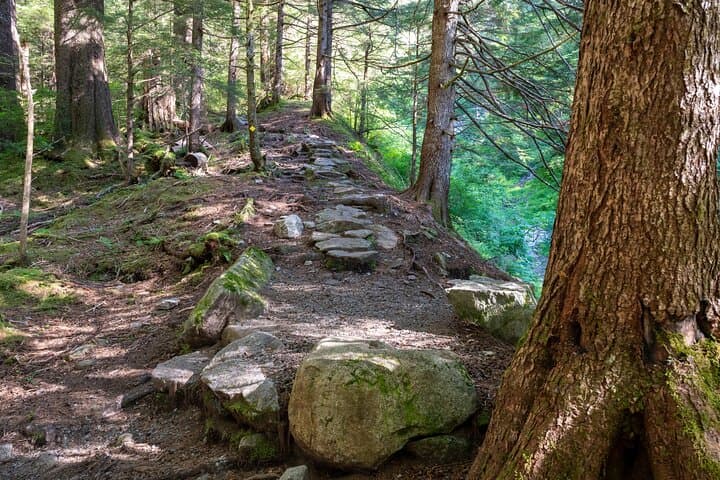
This guided 5.5-mile roundtrip trek gains roughly 1,650 feet of elevation in stages — about 1,100 feet through improved trail and rooted, rocky tread, then a steeper 3/4-mile climb of roughly 550 feet to the overlook. Geologically, the hike traverses glacially scoured valleys and avalanche chutes carved into coastal mountains of the Alexander Archipelago. Culturally, you’re walking in the heart of Tongass National Forest, lands long stewarded by Tlingit communities; guides often weave natural-history anecdotes and local stewardship practices into the route.
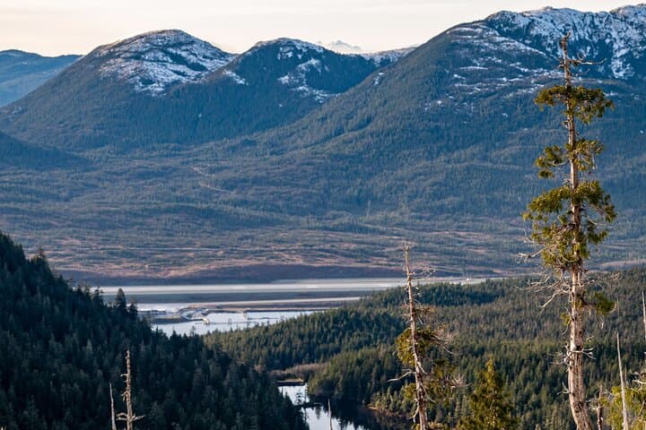
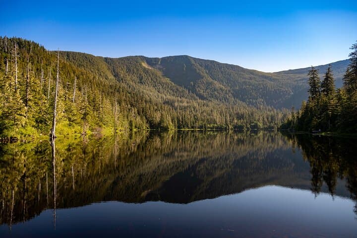
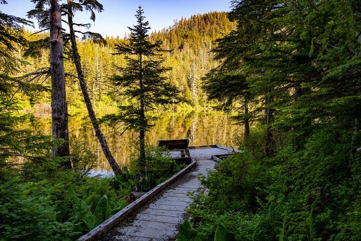
Expect Sitka spruce and western hemlock in the lower half, shifting to low alpine vegetation and lichen-slick rocks near the top. Photography opportunities are constant: a mirror lake, steep forested corridors, and a 360-degree summit view of outboard islands and neighboring peaks.
Practically, this is a sustained, moderately steep mountain hike. Bring waterproof layers, sturdy boots, and a full 1–2 liters of water; the operator provides bottled water, poles, and backpacks but personal comfort items matter. Start early for stable weather and to avoid later cloud build-up; the provider limits this trail to two guided groups per day to protect the area, so book in advance.
challenging.
3–4 hours.
You should be in good aerobic condition and comfortable with sustained uphill hiking and uneven terrain.
The tour is about 5.5 miles roundtrip with roughly 1,650 feet of total elevation gain; it’s a sustained climb and rated challenging—expect 3–4 hours depending on group pace.
Dress in layers with a breathable waterproof shell; temperatures can change rapidly and wind on the alpine bench can make it much colder than town.
The operator lists trekking poles, backpacks, and binoculars as included, but many hikers bring their own poles and a personal daypack for comfort.
Bookings are final with no refunds; tours may be canceled by the operator for bad weather or insufficient travelers, so plan accordingly.
The trail sits within Tongass National Forest on land historically used and managed by Tlingit communities; guides often share local place-names and stewardship perspectives.
Visitor access is tightly managed—only two guided groups per day—to protect fragile alpine plants and old-growth forest; practice strict leave-no-trace principles.
Tongass Teague LLC operates guided outdoor trips and adventures with an emphasis on safety, stewardship, and memorable experiences.
You step off the dock into that wet, bracing air of Southeast Alaska and walk toward the glass shelter at Berth 3, city noise thinning as the trail swallows the sound. The route climbs from a gravel lakeshore into old-growth rainforest, then pushes above treeline to an alpine bench where the wind tests your jacket and the Tongass Narrows spreads below like a moving slate.
You step off the dock into that wet, bracing air of Southeast Alaska and walk toward the glass shelter at Berth 3, city noise thinning as the trail swallows the sound. The route climbs from a gravel lakeshore into old-growth rainforest, then pushes above treeline to an alpine bench where the wind tests your jacket and the Tongass Narrows spreads below like a moving slate.
This guided 5.5-mile roundtrip trek gains roughly 1,650 feet of elevation in stages — about 1,100 feet through improved trail and rooted, rocky tread, then a steeper 3/4-mile climb of roughly 550 feet to the overlook. Geologically, the hike traverses glacially scoured valleys and avalanche chutes carved into coastal mountains of the Alexander Archipelago. Culturally, you’re walking in the heart of Tongass National Forest, lands long stewarded by Tlingit communities; guides often weave natural-history anecdotes and local stewardship practices into the route.
Expect Sitka spruce and western hemlock in the lower half, shifting to low alpine vegetation and lichen-slick rocks near the top. Photography opportunities are constant: a mirror lake, steep forested corridors, and a 360-degree summit view of outboard islands and neighboring peaks.
Practically, this is a sustained, moderately steep mountain hike. Bring waterproof layers, sturdy boots, and a full 1–2 liters of water; the operator provides bottled water, poles, and backpacks but personal comfort items matter. Start early for stable weather and to avoid later cloud build-up; the provider limits this trail to two guided groups per day to protect the area, so book in advance.