THE ADVENTURE COLLECTIVE® · Independent discovery and booking for outdoor travel

Trade Kathmandu’s bustle for ridge-top trails on this three-day loop from Sundarijal to Nagarkot. Expect mixed forest, village culture, and sweeping Himalayan views with moderate climbs and teahouse stays.
Trade Kathmandu’s bustle for ridge-top trails on this three-day loop from Sundarijal to Nagarkot. Expect mixed forest, village culture, and sweeping Himalayan views with moderate climbs and teahouse stays.
You set out from the humidity of Kathmandu and quickly trade traffic for trail: steep switchbacks through oak and rhododendron, a river’s voice fading behind you, and a steady climb that pushes the valley below into a wide, living map.
Verified experiences and guided adventures in the surrounding area.
Operated by View Nepal Treks and Expedition · Kathmandu, Bagmati Province
You set out from the humidity of Kathmandu and quickly trade traffic for trail: steep switchbacks through oak and rhododendron, a river’s voice fading behind you, and a steady climb that pushes the valley below into a wide, living map.
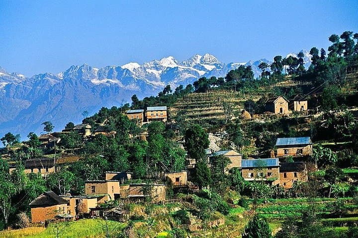
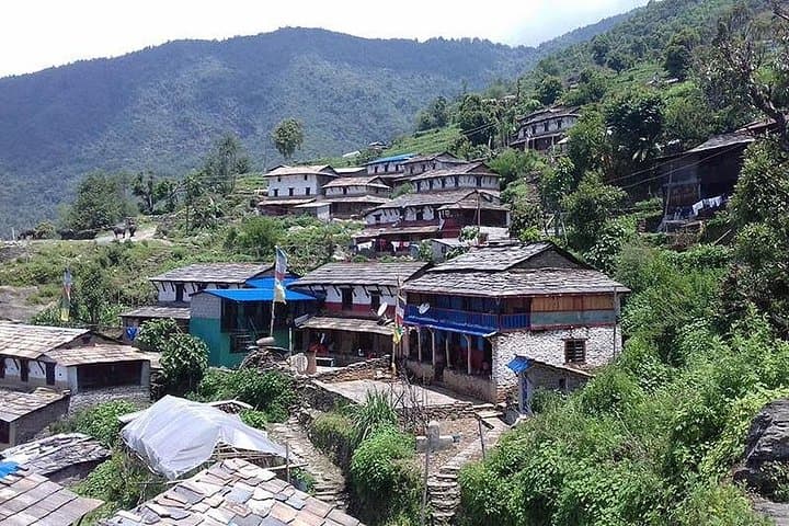
This three-day rim hike follows traditional farm tracks and forest trails from Sundarijal to Chisapani, onward to Nagarkot, and finishes at the Changunarayan temple before returning to Kathmandu. Geologically the route skirts the northern edge of the Kathmandu graben, where folded ridges expose weathered schists and the steep slopes that feed the valley’s rivulets. Culturally the walk threads small Newar and Tamang villages—terraced fields, prayer flags, and stone shrines mark a landscape shaped by centuries of valley agriculture and temple traditions; Changunarayan itself dates back over a thousand years.
Expect a multi-day rhythm: mornings of steady climbing (up to about 1,000 m of ascent on day one), afternoons of open ridgelines and panoramic views of Langtang, Ganesh, Gaurishankar and parts of the Everest range, and nights in simple guesthouses. Terrain ranges from compact dirt tracks and forest steps to exposed ridge paths; trail conditions can be slippery after rain.
Practical guidance: travel light but carry warm layers for pre-dawn sunrises at Nagarkot, bring 2–3 liters of water, and allow 4–7 hours of walking on main trekking days. The route is accessible to fit hikers with basic trail-navigation skills; hire a local guide if you want language support and cultural context. Leave no trace—these hills recover slowly when littered.
moderate.
3 days.
Suitable for hikers who can walk 4–7 hours a day with sustained uphill sections; good cardiovascular fitness and steady balance recommended
No special trekking permit is required for the Kathmandu Valley rim routes, but carry your passport and any local entry fees if visiting protected areas like Shivapuri Nagarjun National Park.
The route rises to roughly 2,100–2,200 m at ridge viewpoints—altitudes that rarely cause acute altitude sickness for visitors arriving from Kathmandu, but go slow if you feel unwell.
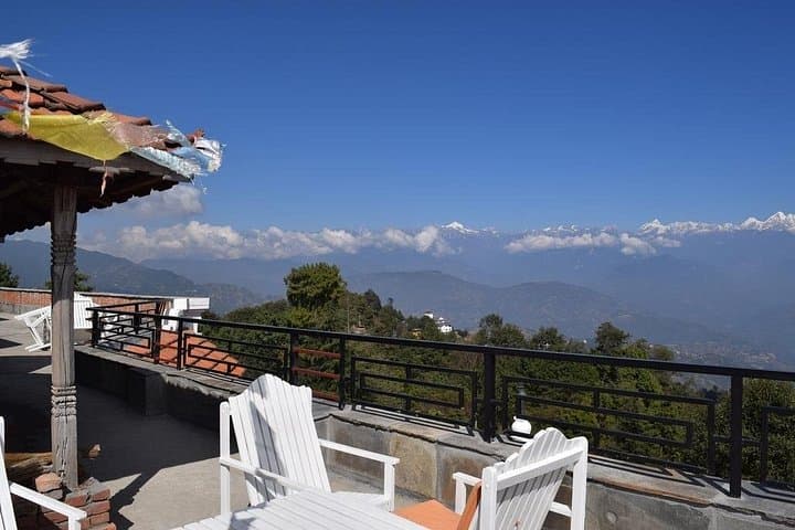
Yes—simple teahouses and guesthouses operate in Chisapani, Nagarkot and other villages offering local meals and basic rooms; bring cash for smaller establishments.
The trail is generally safe, but solo hikers should inform someone of their plan, consider hiring a local guide for navigation and cultural context, and avoid isolated sections after dark.
The route skirts traditional Newar and Tamang settlements and finishes at Changunarayan, one of the valley’s oldest temples with inscriptions and sculptures dating back many centuries.
Sections fall within or near Shivapuri Nagarjun National Park; stick to marked trails, pack out waste, and use local guides and teahouses to support community-based tourism.
View Nepal Treks and Expedition operates guided outdoor trips and adventures with an emphasis on safety, stewardship, and memorable experiences.
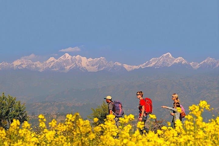
You set out from the humidity of Kathmandu and quickly trade traffic for trail: steep switchbacks through oak and rhododendron, a river’s voice fading behind you, and a steady climb that pushes the valley below into a wide, living map.
You set out from the humidity of Kathmandu and quickly trade traffic for trail: steep switchbacks through oak and rhododendron, a river’s voice fading behind you, and a steady climb that pushes the valley below into a wide, living map.
This three-day rim hike follows traditional farm tracks and forest trails from Sundarijal to Chisapani, onward to Nagarkot, and finishes at the Changunarayan temple before returning to Kathmandu. Geologically the route skirts the northern edge of the Kathmandu graben, where folded ridges expose weathered schists and the steep slopes that feed the valley’s rivulets. Culturally the walk threads small Newar and Tamang villages—terraced fields, prayer flags, and stone shrines mark a landscape shaped by centuries of valley agriculture and temple traditions; Changunarayan itself dates back over a thousand years.
Expect a multi-day rhythm: mornings of steady climbing (up to about 1,000 m of ascent on day one), afternoons of open ridgelines and panoramic views of Langtang, Ganesh, Gaurishankar and parts of the Everest range, and nights in simple guesthouses. Terrain ranges from compact dirt tracks and forest steps to exposed ridge paths; trail conditions can be slippery after rain.
Practical guidance: travel light but carry warm layers for pre-dawn sunrises at Nagarkot, bring 2–3 liters of water, and allow 4–7 hours of walking on main trekking days. The route is accessible to fit hikers with basic trail-navigation skills; hire a local guide if you want language support and cultural context. Leave no trace—these hills recover slowly when littered.