THE ADVENTURE COLLECTIVE® · Independent discovery and booking for outdoor travel

Drive the Kancamagus Scenic Byway with a self‑guided audio tour that maps history, geology, and the best overlooks. Download the tour before you go, plan for 2–3 hours, and use pullouts to enjoy Sabbaday Falls, Rocky Gorge, and moose‑watching spots.
Drive the Kancamagus Scenic Byway with a self‑guided audio tour that maps history, geology, and the best overlooks. Download the tour before you go, plan for 2–3 hours, and use pullouts to enjoy Sabbaday Falls, Rocky Gorge, and moose‑watching spots.
You pull onto NH‑112 and the forest leans in: maples flare orange, birch trunks band the road, and the Saco River dares you to slow down for every curve. The audio guide begins and a clear narrator pins the route—35 miles of highway threaded through the White Mountain National Forest—so you can watch the landscape, not a map.
Verified experiences and guided adventures in the surrounding area.
Operated by Stories with Action · Lincoln, New Hampshire
You pull onto NH‑112 and the forest leans in: maples flare orange, birch trunks band the road, and the Saco River dares you to slow down for every curve. The audio guide begins and a clear narrator pins the route—35 miles of highway threaded through the White Mountain National Forest—so you can watch the landscape, not a map.
This road follows old logging lanes and seasonal sled routes, carved through granite bedrock uplifted during the last Ice Age. Early Abenaki and Pennacook families lived off these rivers and ridges; later, 19th‑century logging and tourism reshaped the corridor. The guide weaves geology and local lore—from the lost silhouette of the Old Man of the Mountain to Chief Kancamagus’ stories—while pointing out overlooks, falls, and historic covered bridges.
Expect quick pullouts at Sabbaday Falls, Hancock and Pemigewasset overlooks, Rocky Gorge, and the Albany Covered Bridge—each stop framed by short audio chapters. Wildlife is active at dawn and dusk: moose and black bears frequent lowlands; river otters sun themselves on boulders.
Practical edge: download the Action Tour Guide app and the tour before you arrive, buy one tour per car, and bring a paper or mobile day‑use pass for fee sites. Drive slowly through pullouts, keep binoculars and a charged phone handy, and plan 2–3 hours with extra time for hikes and photos. The audio lets you set the pace—pause at a viewpoint, skip a story, and let the highway teach its history while you take it in.
easy.
2–3 hours.
Minimal fitness required for the drive; moderate fitness if you plan added short hikes at overlooks.
The complete route runs about 35+ miles and takes approximately 2–3 hours, not including extra stops or hikes.
No—download the tour in the Action app while you have data or Wi‑Fi; after that it works offline.
You can start in Lincoln (West) or Conway/Saco Ranger Station (East); the audio supports either direction—choose the version matching your start point.
No—day‑use parking passes for fee sites are separate; America the Beautiful passes are accepted at many federal sites.
The byway follows routes used by native Pennacook and Abenaki peoples and later by 19th‑century loggers; the road opened to tourism as automobile travel grew.
Respect posted day‑use rules, stay in designated pullouts, and never feed wildlife; the Forest Service manages parking and fees to limit impact.
Stories with Action operates guided outdoor trips and adventures with an emphasis on safety, stewardship, and memorable experiences.

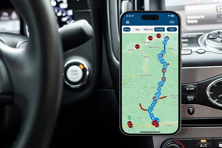


You pull onto NH‑112 and the forest leans in: maples flare orange, birch trunks band the road, and the Saco River dares you to slow down for every curve. The audio guide begins and a clear narrator pins the route—35 miles of highway threaded through the White Mountain National Forest—so you can watch the landscape, not a map.
You pull onto NH‑112 and the forest leans in: maples flare orange, birch trunks band the road, and the Saco River dares you to slow down for every curve. The audio guide begins and a clear narrator pins the route—35 miles of highway threaded through the White Mountain National Forest—so you can watch the landscape, not a map.
This road follows old logging lanes and seasonal sled routes, carved through granite bedrock uplifted during the last Ice Age. Early Abenaki and Pennacook families lived off these rivers and ridges; later, 19th‑century logging and tourism reshaped the corridor. The guide weaves geology and local lore—from the lost silhouette of the Old Man of the Mountain to Chief Kancamagus’ stories—while pointing out overlooks, falls, and historic covered bridges.
Expect quick pullouts at Sabbaday Falls, Hancock and Pemigewasset overlooks, Rocky Gorge, and the Albany Covered Bridge—each stop framed by short audio chapters. Wildlife is active at dawn and dusk: moose and black bears frequent lowlands; river otters sun themselves on boulders.
Practical edge: download the Action Tour Guide app and the tour before you arrive, buy one tour per car, and bring a paper or mobile day‑use pass for fee sites. Drive slowly through pullouts, keep binoculars and a charged phone handy, and plan 2–3 hours with extra time for hikes and photos. The audio lets you set the pace—pause at a viewpoint, skip a story, and let the highway teach its history while you take it in.