THE ADVENTURE COLLECTIVE® · Independent discovery and booking for outdoor travel

Board a panga from Loreto for a six-hour ocean safari among the rock faces of South Carmen and Danzante Islands. Hike exposed island ridges, snorkel clear reefs, and picnic on secluded white-sand beaches in Bahía de Loreto National Park.
Board a panga from Loreto for a six-hour ocean safari among the rock faces of South Carmen and Danzante Islands. Hike exposed island ridges, snorkel clear reefs, and picnic on secluded white-sand beaches in Bahía de Loreto National Park.
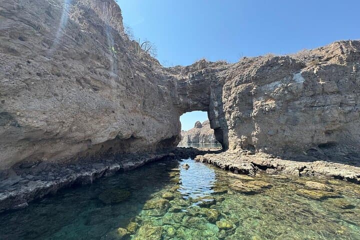
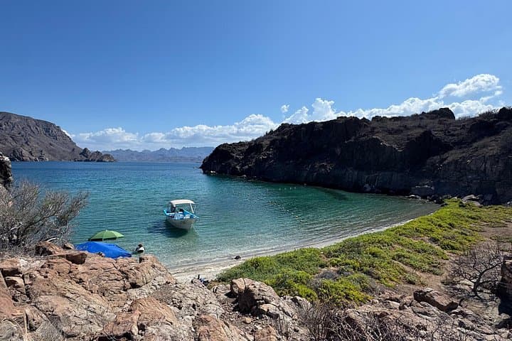
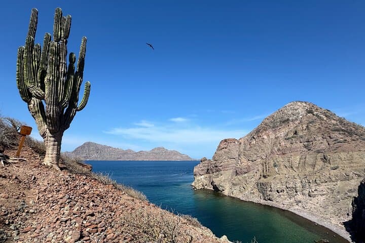
A small panga cuts loose from Loreto at first light, the town falling away and the sea opening into a bowl of blue. Salt-slick wind presses against the hull as granite and dark rock of South Carmen rise from the water, their sheer faces daring the boat to come closer. Onshore, a trail angles up through low scrub and weathered shale to a ridge that frames the bay; below, fingers of sand and reef hold schools of brightly patterned fish.
Verified experiences and guided adventures in the surrounding area.
Operated by BAJA MIA ACTIVITIES · Loreto, Baja California Sur
A small panga cuts loose from Loreto at first light, the town falling away and the sea opening into a bowl of blue. Salt-slick wind presses against the hull as granite and dark rock of South Carmen rise from the water, their sheer faces daring the boat to come closer. Onshore, a trail angles up through low scrub and weathered shale to a ridge that frames the bay; below, fingers of sand and reef hold schools of brightly patterned fish.
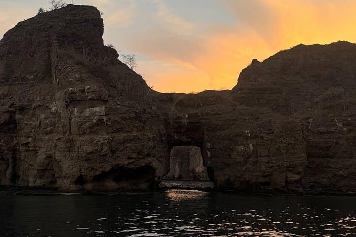
These islands sit in Bahía de Loreto National Park, protected in 1996, in waters shaped by tectonics and persistent wave erosion. The coastline tells a simple geological story—steep cliffs, coves carved by currents, and offshore rocks that mark old lava flows and marine terraces. The town of Loreto, the first Spanish mission site on Baja’s Pacific side, supplies the cultural backdrop: fishermen, mission history, and a quiet hospitality that still threads the region.
Expect a mixed day: two short hikes (roughly 1.5–3 km total; ~100–200 m cumulative elevation gain) over rocky, uneven trails with panoramic views, plus guided snorkeling at shallow reefs where rays, surgeonfish and occasional sea lions forage. Lunch is a beach picnic on powdery white sand; snorkeling gear and lunch are included.
Practical edge: depart early to avoid afternoon winds, wear closed-toe water shoes for reef entries, carry reef-safe sunscreen and a dry bag. Keep to marked trails, surface slowly from dives, and follow your guide’s brief on wildlife distance. The day blends easy exploration with marine adventure—salt on your lips, current nudging you forward.
moderate.
6 hours.
Suitable for most travelers who can board small boats, swim short distances, and hike 1–3 miles on uneven terrain.
Yes—snorkeling equipment is included, but many guests bring a personal mask for a better fit.
No; basic swimming comfort is sufficient. Guides stick to shallow reefs and provide flotation when needed.
Hikes are short (roughly 1.5–3 km total) over uneven, rocky terrain with modest climbs—suitable for most fitness levels.
Expect dolphins, sea lions, rays and tropical fish; keep respectful distance, avoid touching animals, and follow guide instructions.
Loreto served as the first Spanish mission and colonial base in Baja California (mission founded 1697); the islands later gained protection as Bahía de Loreto National Park in 1996.
The park emphasizes minimal-impact visiting—use reef-safe sunscreen, stay on trails, and avoid collecting shells to protect fragile marine ecosystems.
BAJA MIA ACTIVITIES operates guided outdoor trips and adventures with an emphasis on safety, stewardship, and memorable experiences.
A small panga cuts loose from Loreto at first light, the town falling away and the sea opening into a bowl of blue. Salt-slick wind presses against the hull as granite and dark rock of South Carmen rise from the water, their sheer faces daring the boat to come closer. Onshore, a trail angles up through low scrub and weathered shale to a ridge that frames the bay; below, fingers of sand and reef hold schools of brightly patterned fish.
A small panga cuts loose from Loreto at first light, the town falling away and the sea opening into a bowl of blue. Salt-slick wind presses against the hull as granite and dark rock of South Carmen rise from the water, their sheer faces daring the boat to come closer. Onshore, a trail angles up through low scrub and weathered shale to a ridge that frames the bay; below, fingers of sand and reef hold schools of brightly patterned fish.
These islands sit in Bahía de Loreto National Park, protected in 1996, in waters shaped by tectonics and persistent wave erosion. The coastline tells a simple geological story—steep cliffs, coves carved by currents, and offshore rocks that mark old lava flows and marine terraces. The town of Loreto, the first Spanish mission site on Baja’s Pacific side, supplies the cultural backdrop: fishermen, mission history, and a quiet hospitality that still threads the region.
Expect a mixed day: two short hikes (roughly 1.5–3 km total; ~100–200 m cumulative elevation gain) over rocky, uneven trails with panoramic views, plus guided snorkeling at shallow reefs where rays, surgeonfish and occasional sea lions forage. Lunch is a beach picnic on powdery white sand; snorkeling gear and lunch are included.
Practical edge: depart early to avoid afternoon winds, wear closed-toe water shoes for reef entries, carry reef-safe sunscreen and a dry bag. Keep to marked trails, surface slowly from dives, and follow your guide’s brief on wildlife distance. The day blends easy exploration with marine adventure—salt on your lips, current nudging you forward.