THE ADVENTURE COLLECTIVE® · Independent discovery and booking for outdoor travel

Trade gym plastic for real stone on a full-day intro to outdoor climbing just east of Seattle. Learn knots, belaying, and movement on Exit 38’s approachable volcanic cliffs while the South Fork Snoqualmie keeps you honest and the forest keeps you focused.
Trade gym plastic for real stone on a full-day intro to outdoor climbing just east of Seattle. Learn knots, belaying, and movement on Exit 38’s approachable volcanic cliffs while the South Fork Snoqualmie keeps you honest and the forest keeps you focused.
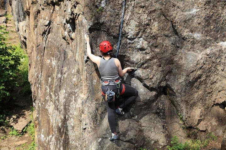
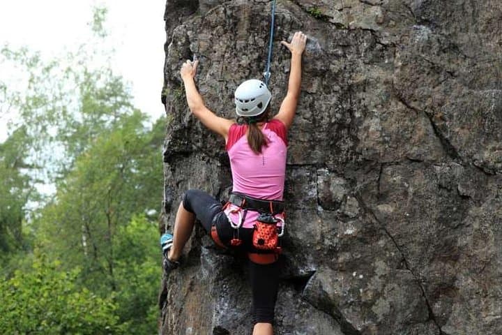
Morning mist hangs in the firs as you step off the gravel shoulder at Exit 38, the South Fork Snoqualmie River chattering below like it’s daring you to trust your feet. The trail climbs in short, punchy steps through salal and sword fern, then the cliff appears—dark volcanic stone stitched with bolts and cracks, dry to the touch even after a night of drizzle. Guides lay out ropes like bright lifelines, helmets clink, and the forest draws a green curtain around the crag. It’s the Pacific Northwest’s classroom for first ascents, and today you get chalk on your hands.
Verified experiences and guided adventures in the surrounding area.
Operated by Miyar Adventures, LLC · North Bend, Washington
Morning mist hangs in the firs as you step off the gravel shoulder at Exit 38, the South Fork Snoqualmie River chattering below like it’s daring you to trust your feet. The trail climbs in short, punchy steps through salal and sword fern, then the cliff appears—dark volcanic stone stitched with bolts and cracks, dry to the touch even after a night of drizzle. Guides lay out ropes like bright lifelines, helmets clink, and the forest draws a green curtain around the crag. It’s the Pacific Northwest’s classroom for first ascents, and today you get chalk on your hands.
This full-day introductory outing transitions climbers from indoor plastic to real rock, or welcomes true first-timers with a calm, methodical pace. Expect a 5–20 minute approach (0.5–1 mile, 200–400 feet of gain) on well-worn climber trails to top-rope lines in Olallie State Park’s Exit 38 area near North Bend. The stone here is hard, textured volcanic rock—sticky in cool weather, surprisingly grippy when dry. Glaciers once pressed over this valley, smoothing boulders and carving the river’s path; today the routes wander up edges and rails left behind by deep geologic time.
Guides start with a ground school: harness fit, helmet checks, and the language of climbing—On belay? Belay on. You’ll tie a figure-eight follow-through, practice a solid belay with an ATC or assisted device, and learn to catch a fall. Then it’s movement: quiet feet, hips to the wall, trust in friction. Over the course of the day most groups sample 5–6 lines with different features—slab, edges, gentle crack systems—building repetition and confidence. The pace is communal and patient; belayers swap in, climbers cycle through, and the forest keeps time with a breeze that nudges the ropes.
Beyond the rock, the corridor carries a layered story. “Olallie” comes from Chinook jargon for berry, and seasonal huckleberries still stain the trails in late summer. The I‑90 route followed historic rail and logging corridors, now repurposed into a recreation gateway. Modern climbers share walls with nesting raptors in spring, and Leave No Trace ethics are the quiet rules of the road: stick to established paths, keep a low chalk footprint, pack out tape and snacks.
Practicalities are straightforward. A Discover Pass is required for state park parking. Dress for changeable Cascades weather—light rain is common and manageable. Wear sturdy approach shoes for the hike and bring fingerless gloves if you prefer comfort while belaying. Count on a full day with breaks for lunch and water filters or bottles to stay ahead of the mild, mossy humidity that likes to sneak up on new climbers.
By the last lap, the river sounds like applause and your knot-tying is as automatic as breathing. The cliff doesn’t boast; it simply invites you back for one more clean top-out.
moderate.
6–8 hours.
Comfortably hike 1–2 miles with 200–400 ft gain carrying a light pack; able to stand and belay for multiple short sessions.
No. This course is designed for first-timers and gym climbers transitioning outside. All essential skills are taught on site.
Most intro days run at Exit 38 in Olallie State Park near North Bend, though exact crags may vary based on conditions and group needs.
Professional instruction, ropes, anchors, belay devices, and a group medical kit are provided. You bring personal clothing, food, water, and any preferred personal gear.
Expect a 5–20 minute hike (0.5–1 mile) with 200–400 feet of elevation gain on well-used climber trails.
This outing suits most teens and adults; reach out to the operator about younger participants and supervision requirements.
Light rain is typical and often climbable. In heavy rain, electrical storms, or unsafe conditions, the day may be adjusted, relocated, or rescheduled.
“Olallie” derives from Chinook jargon for berry; seasonal huckleberries still dot the trails. The I‑90 corridor traces historic logging routes and former rail grades now reclaimed for recreation.
Use existing climber trails and established anchors, minimize chalk marks, and pack out all tape and trash. Watch for seasonal raptor nesting closures and respect posted signs.
Miyar Adventures, LLC operates guided outdoor trips and adventures with an emphasis on safety, stewardship, and memorable experiences.
Morning mist hangs in the firs as you step off the gravel shoulder at Exit 38, the South Fork Snoqualmie River chattering below like it’s daring you to trust your feet. The trail climbs in short, punchy steps through salal and sword fern, then the cliff appears—dark volcanic stone stitched with bolts and cracks, dry to the touch even after a night of drizzle. Guides lay out ropes like bright lifelines, helmets clink, and the forest draws a green curtain around the crag. It’s the Pacific Northwest’s classroom for first ascents, and today you get chalk on your hands.
Morning mist hangs in the firs as you step off the gravel shoulder at Exit 38, the South Fork Snoqualmie River chattering below like it’s daring you to trust your feet. The trail climbs in short, punchy steps through salal and sword fern, then the cliff appears—dark volcanic stone stitched with bolts and cracks, dry to the touch even after a night of drizzle. Guides lay out ropes like bright lifelines, helmets clink, and the forest draws a green curtain around the crag. It’s the Pacific Northwest’s classroom for first ascents, and today you get chalk on your hands.
This full-day introductory outing transitions climbers from indoor plastic to real rock, or welcomes true first-timers with a calm, methodical pace. Expect a 5–20 minute approach (0.5–1 mile, 200–400 feet of gain) on well-worn climber trails to top-rope lines in Olallie State Park’s Exit 38 area near North Bend. The stone here is hard, textured volcanic rock—sticky in cool weather, surprisingly grippy when dry. Glaciers once pressed over this valley, smoothing boulders and carving the river’s path; today the routes wander up edges and rails left behind by deep geologic time.
Guides start with a ground school: harness fit, helmet checks, and the language of climbing—On belay? Belay on. You’ll tie a figure-eight follow-through, practice a solid belay with an ATC or assisted device, and learn to catch a fall. Then it’s movement: quiet feet, hips to the wall, trust in friction. Over the course of the day most groups sample 5–6 lines with different features—slab, edges, gentle crack systems—building repetition and confidence. The pace is communal and patient; belayers swap in, climbers cycle through, and the forest keeps time with a breeze that nudges the ropes.
Beyond the rock, the corridor carries a layered story. “Olallie” comes from Chinook jargon for berry, and seasonal huckleberries still stain the trails in late summer. The I‑90 route followed historic rail and logging corridors, now repurposed into a recreation gateway. Modern climbers share walls with nesting raptors in spring, and Leave No Trace ethics are the quiet rules of the road: stick to established paths, keep a low chalk footprint, pack out tape and snacks.
Practicalities are straightforward. A Discover Pass is required for state park parking. Dress for changeable Cascades weather—light rain is common and manageable. Wear sturdy approach shoes for the hike and bring fingerless gloves if you prefer comfort while belaying. Count on a full day with breaks for lunch and water filters or bottles to stay ahead of the mild, mossy humidity that likes to sneak up on new climbers.
By the last lap, the river sounds like applause and your knot-tying is as automatic as breathing. The cliff doesn’t boast; it simply invites you back for one more clean top-out.