THE ADVENTURE COLLECTIVE® · Independent discovery and booking for outdoor travel

Turn a monotonous interstate drive into a narrated road trip. This self-guided audio tour along I‑55 from St. Louis to Springfield combines history, roadside oddities, and practical driving advice to help you get more out of the miles.
Turn a monotonous interstate drive into a narrated road trip. This self-guided audio tour along I‑55 from St. Louis to Springfield combines history, roadside oddities, and practical driving advice to help you get more out of the miles.
The highway unspools ahead — a ribbon of concrete that catches sunlight and carries you past river bluffs, cornfields, and towns that remember older rhythms. In the driver’s seat, the voice on your phone times a story to the mile markers: industrial St. Louis gives way to small Midwestern main streets, and the landscape loosens into Illinois farm country.
Verified experiences and guided adventures in the surrounding area.
Operated by VoiceMap Audio Tours · St. Louis, Missouri
The highway unspools ahead — a ribbon of concrete that catches sunlight and carries you past river bluffs, cornfields, and towns that remember older rhythms. In the driver’s seat, the voice on your phone times a story to the mile markers: industrial St. Louis gives way to small Midwestern main streets, and the landscape loosens into Illinois farm country.
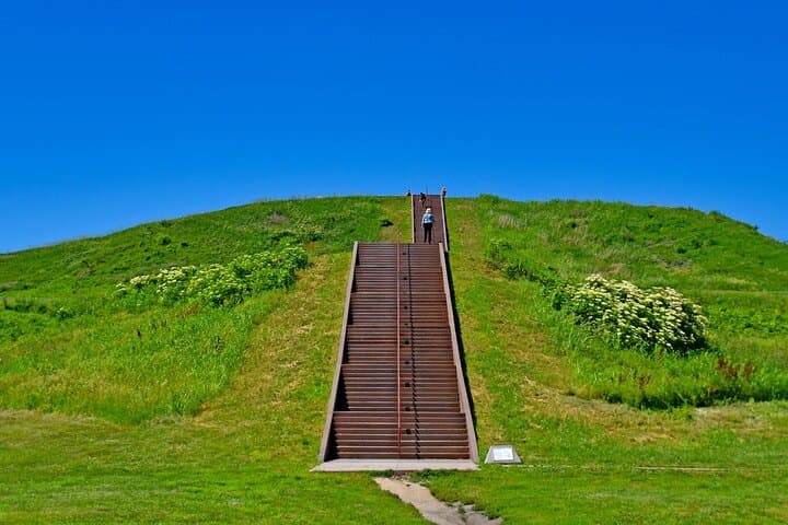
This route follows a corridor that’s been a trade and migration artery for centuries. Cahokia’s earthen mounds — visible as raised shapes on the horizon — are reminders of pre-Columbian engineers who shaped the riverlands. Later, the roadways and rail lines that parallel I-55 fed coal, grain, and people through towns like Litchfield and Livingston; labor history and Route 66 kitsch remain on view.
Geology here is simple and honest: glacial plains, loess soils, and the hidden channels of tributaries that the interstate bridges. Culture is practical — diners, veteran monuments, oddball roadside art — and the tour points out where to exit for the best vantage points rather than trying to see everything from the freeway.
Practical guidance: download the VoiceMap file before leaving and mount your phone securely. Treat the audio as a companion — not a substitute for attention to traffic. Plan 80–120 minutes for the straight run, longer if you detour to Cahokia Mounds, Lincoln’s New Salem, or roadside oddities. Bring water, sunglasses, and a portable charger; midwestern weather can shift quickly and rest areas or small-town services are spaced unevenly. Use designated pullouts to explore — the best views and stories live off the interstate, waiting where you decide to get out and walk a short stretch.
easy.
1–1.5 hours (80 minutes recommended).
No special fitness required — typical car travel stamina; able-bodied enough to step out for short walks at pullouts
The audio is GPS-triggered in the VoiceMap app; start at the indicated gas station on Chouteau Avenue, then press play — the narration will begin as you reach programmed points.
No — you can download the tour for offline use; however, cell service helps if you want live map updates or need to re-download.
Yes — content is suitable for audiences, but drivers should keep focus on the road; plan to exit for any longer stops or to let kids stretch their legs.
Yes — the tour can be paused and restarted at your convenience; if you detour, use local roads and the app will resume when you reach the next trigger point.
This corridor overlays older indigenous trade routes and, later, 19th‑century migration and Route 66-era commerce; Cahokia Mounds near the Mississippi predate European settlement by centuries.
Respect roadside habitats by using designated pullouts for stops, pack out trash, and avoid impacting archaeological sites like mound complexes by observing from marked areas.
VoiceMap Audio Tours operates guided outdoor trips and adventures with an emphasis on safety, stewardship, and memorable experiences.
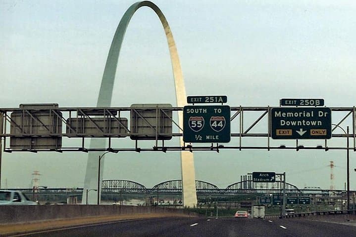


The highway unspools ahead — a ribbon of concrete that catches sunlight and carries you past river bluffs, cornfields, and towns that remember older rhythms. In the driver’s seat, the voice on your phone times a story to the mile markers: industrial St. Louis gives way to small Midwestern main streets, and the landscape loosens into Illinois farm country.
The highway unspools ahead — a ribbon of concrete that catches sunlight and carries you past river bluffs, cornfields, and towns that remember older rhythms. In the driver’s seat, the voice on your phone times a story to the mile markers: industrial St. Louis gives way to small Midwestern main streets, and the landscape loosens into Illinois farm country.
This route follows a corridor that’s been a trade and migration artery for centuries. Cahokia’s earthen mounds — visible as raised shapes on the horizon — are reminders of pre-Columbian engineers who shaped the riverlands. Later, the roadways and rail lines that parallel I-55 fed coal, grain, and people through towns like Litchfield and Livingston; labor history and Route 66 kitsch remain on view.
Geology here is simple and honest: glacial plains, loess soils, and the hidden channels of tributaries that the interstate bridges. Culture is practical — diners, veteran monuments, oddball roadside art — and the tour points out where to exit for the best vantage points rather than trying to see everything from the freeway.
Practical guidance: download the VoiceMap file before leaving and mount your phone securely. Treat the audio as a companion — not a substitute for attention to traffic. Plan 80–120 minutes for the straight run, longer if you detour to Cahokia Mounds, Lincoln’s New Salem, or roadside oddities. Bring water, sunglasses, and a portable charger; midwestern weather can shift quickly and rest areas or small-town services are spaced unevenly. Use designated pullouts to explore — the best views and stories live off the interstate, waiting where you decide to get out and walk a short stretch.