THE ADVENTURE COLLECTIVE® · Independent discovery and booking for outdoor travel

A compact, action-packed alternative to the classic Inca Trail: three days of downhill biking from Abra Malaga, whitewater on the Urubamba, zip lines across the valley and a sunrise approach to Machu Picchu. Expect varied ecosystems, local coffee farms and steady climbs and descents.
A compact, action-packed alternative to the classic Inca Trail: three days of downhill biking from Abra Malaga, whitewater on the Urubamba, zip lines across the valley and a sunrise approach to Machu Picchu. Expect varied ecosystems, local coffee farms and steady climbs and descents.
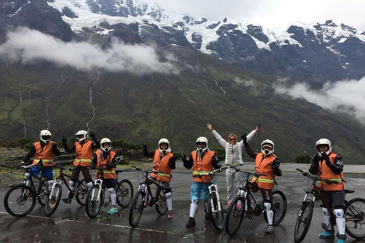
Dawn breaks over the high pass and the road falls away beneath your wheels—sharp air at 4,316 m, the ridgeline a raw cut against sky. You push off on a downhill that threads cloud forest and scree, the Urubamba River daring you with whitewater flashes far below. By afternoon you're on a raft, then a zip line, then walking a railway track toward a small town of steam and hot showers: Machupicchu Pueblo.
Verified experiences and guided adventures in the surrounding area.
Operated by Aita Peru Adventures · Machupicchu Pueblo (Aguas Calientes), Cusco
Dawn breaks over the high pass and the road falls away beneath your wheels—sharp air at 4,316 m, the ridgeline a raw cut against sky. You push off on a downhill that threads cloud forest and scree, the Urubamba River daring you with whitewater flashes far below. By afternoon you're on a raft, then a zip line, then walking a railway track toward a small town of steam and hot showers: Machupicchu Pueblo.
This compact Inca Jungle route stitches together disparate landscapes: Andean puna at the Malaga pass, steep mid-elevation cloud forest, and the subtropical Urubamba valley. Geologically the corridor is young and tectonically active—steep slopes and deep river incision that shaped Inca routes and modern trails. Culturally, the trip moves through coffee and fruit plots and villages tied to Quechua traditions; local guides illuminate how pre-Hispanic trail networks connected highland communities to river valleys.
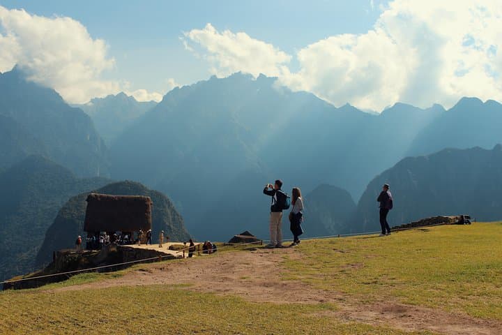
Practical rhythm: day one is a long drive to 4,316 m and a technical, mostly downhill bike section into Wayopata, plus a short canoe session on the Urubamba. Day two mixes zip lines (five cables, the longest ~1,000 m at ~200 m above the valley) and a walk along the railway into Aguas Calientes. Day three starts very early to climb the zigzag road from ~2,000 m to Machu Picchu at ~2,440 m for the sunrise visit, then return by train to Ollantaytambo and on to Cusco.
Plan to acclimatize in Cusco (24–48 hours), carry rain protection and insect repellent, and use sturdy shoes for uneven tracks. Hydrate, pace the biking sections conservatively, and bring soles that handle wet roots and river crossings.
moderate.
3 days.
Moderate fitness: regular cardio and leg strength will make biking descents and the final climb more comfortable.
No advanced skills are required, but basic mountain-biking comfort on dirt descents and confidence with brakes and balance is recommended.
You begin near 4,316 m at Abra Malaga; altitude can affect anyone—acclimatize in Cusco and watch for symptoms like headache or nausea.
This itinerary includes guided access to Machu Picchu as described; confirm ticket type at booking and bring passport used for the booking.
Moderate fitness—participants should be able to cycle for a few hours downhill, do short hikes, and handle a morning climb to Machu Picchu.
The route follows corridors long used by local communities and runners of the Inca road network; Machu Picchu itself dates to the 15th century Inca period.
The cloud forest and river corridors are fragile—stick to marked trails, avoid single-use plastics, and support local guides and enterprises to keep tourism sustainable.
Aita Peru Adventures operates guided outdoor trips and adventures with an emphasis on safety, stewardship, and memorable experiences.
Dawn breaks over the high pass and the road falls away beneath your wheels—sharp air at 4,316 m, the ridgeline a raw cut against sky. You push off on a downhill that threads cloud forest and scree, the Urubamba River daring you with whitewater flashes far below. By afternoon you're on a raft, then a zip line, then walking a railway track toward a small town of steam and hot showers: Machupicchu Pueblo.
Dawn breaks over the high pass and the road falls away beneath your wheels—sharp air at 4,316 m, the ridgeline a raw cut against sky. You push off on a downhill that threads cloud forest and scree, the Urubamba River daring you with whitewater flashes far below. By afternoon you're on a raft, then a zip line, then walking a railway track toward a small town of steam and hot showers: Machupicchu Pueblo.
This compact Inca Jungle route stitches together disparate landscapes: Andean puna at the Malaga pass, steep mid-elevation cloud forest, and the subtropical Urubamba valley. Geologically the corridor is young and tectonically active—steep slopes and deep river incision that shaped Inca routes and modern trails. Culturally, the trip moves through coffee and fruit plots and villages tied to Quechua traditions; local guides illuminate how pre-Hispanic trail networks connected highland communities to river valleys.
Practical rhythm: day one is a long drive to 4,316 m and a technical, mostly downhill bike section into Wayopata, plus a short canoe session on the Urubamba. Day two mixes zip lines (five cables, the longest ~1,000 m at ~200 m above the valley) and a walk along the railway into Aguas Calientes. Day three starts very early to climb the zigzag road from ~2,000 m to Machu Picchu at ~2,440 m for the sunrise visit, then return by train to Ollantaytambo and on to Cusco.
Plan to acclimatize in Cusco (24–48 hours), carry rain protection and insect repellent, and use sturdy shoes for uneven tracks. Hydrate, pace the biking sections conservatively, and bring soles that handle wet roots and river crossings.