THE ADVENTURE COLLECTIVE® · Independent discovery and booking for outdoor travel

A half-day private hike from Marrakech into Imlil’s High Atlas introduces easy mule tracks, waterfalls and Berber village life. This practical guide covers what to expect on the trail, cultural notes and essential planning tips.
A half-day private hike from Marrakech into Imlil’s High Atlas introduces easy mule tracks, waterfalls and Berber village life. This practical guide covers what to expect on the trail, cultural notes and essential planning tips.
Morning sunlight slides down a narrow valley as the minibus winds out of Marrakech toward the High Atlas. By the time the road gives way to mule tracks, the air is cooler and stone terraces step up the hills like stacked promises. In Imlil, at roughly 1,700–1,800 m, a Berber guide meets guests and leads a two-hour ridge-and-waterfall loop past irrigation channels and compact stone farms; water tugs at the valley floor and the trails urge the walker onward.
Verified experiences and guided adventures in the surrounding area.
Operated by AGtours · Imlil, Marrakech-Safi
Morning sunlight slides down a narrow valley as the minibus winds out of Marrakech toward the High Atlas. By the time the road gives way to mule tracks, the air is cooler and stone terraces step up the hills like stacked promises. In Imlil, at roughly 1,700–1,800 m, a Berber guide meets guests and leads a two-hour ridge-and-waterfall loop past irrigation channels and compact stone farms; water tugs at the valley floor and the trails urge the walker onward.
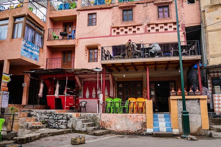
The Atlas wears its history plainly: dry-stone houses, muleteers ferrying supplies, and springs that once marked seasonal grazing routes. Geologically the range is young and sharply folded, capped by Jebel Toubkal at 4,167 m not far to the south; glacial action and seasonal torrents carved the steep gullies around Imlil. Culturally, tourism has shifted livelihoods—many locals now work as guides, muleteers or hosts—and visitors typically sample home-cooked tagines and mint tea in family houses.
Expect dirt mule tracks, short rocky pitches and steady ascents totaling 200–400 m of elevation change depending on the loop. The two-hour hike is non-technical but can be steep in parts; well-placed switchbacks and mule paths keep footing predictable. Practical planning: start early to avoid midday sun, carry 1.5–2 L water, wear grippy boots and layers for wind at higher viewpoints. Respect local customs—ask before photographing inside homes—and leave no trace: trails tighten quickly and erosion is visible after heavy rains. Return to Marrakech in the late afternoon with a clearer sense of why climbers and trekkers call this the roof of North Africa.
moderate.
6–7 hours (including transport).
Suitable for reasonably fit travelers able to handle sustained uphill walking and short steep sections
Expect about 1.5–2 hours one way depending on traffic and road conditions; the valley road narrows as you near Imlil.
The route is non-technical and suitable for active children and older travelers who can manage uneven paths and short steep pitches; choose a gentler loop if mobility is limited.
Imlil sits around 1,700–1,800 m—most visitors experience little altitude effect, but those sensitive to elevation should ascend slowly and stay hydrated.
Typical private day trips include a local lunch and tea with a host family, offering a chance to sample Berber hospitality.
Imlil developed as a seasonal grazing and trade hub for Berber communities; the arrival of trekking and mule transport connected it to Marrakech and the Toubkal ascent routes.
Water is a scarce, managed resource in the High Atlas—avoid single-use plastics and stay on established trails to limit erosion and protect terraces.
AGtours operates guided outdoor trips and adventures with an emphasis on safety, stewardship, and memorable experiences.
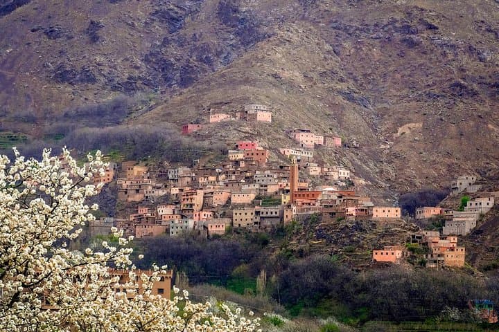
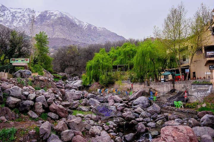
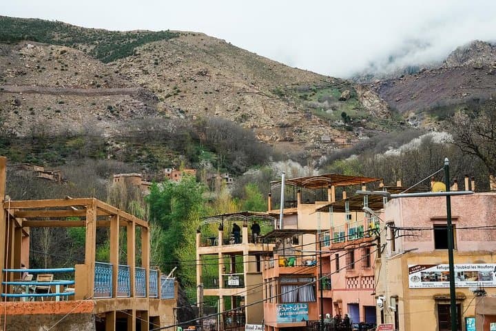
Morning sunlight slides down a narrow valley as the minibus winds out of Marrakech toward the High Atlas. By the time the road gives way to mule tracks, the air is cooler and stone terraces step up the hills like stacked promises. In Imlil, at roughly 1,700–1,800 m, a Berber guide meets guests and leads a two-hour ridge-and-waterfall loop past irrigation channels and compact stone farms; water tugs at the valley floor and the trails urge the walker onward.
Morning sunlight slides down a narrow valley as the minibus winds out of Marrakech toward the High Atlas. By the time the road gives way to mule tracks, the air is cooler and stone terraces step up the hills like stacked promises. In Imlil, at roughly 1,700–1,800 m, a Berber guide meets guests and leads a two-hour ridge-and-waterfall loop past irrigation channels and compact stone farms; water tugs at the valley floor and the trails urge the walker onward.
The Atlas wears its history plainly: dry-stone houses, muleteers ferrying supplies, and springs that once marked seasonal grazing routes. Geologically the range is young and sharply folded, capped by Jebel Toubkal at 4,167 m not far to the south; glacial action and seasonal torrents carved the steep gullies around Imlil. Culturally, tourism has shifted livelihoods—many locals now work as guides, muleteers or hosts—and visitors typically sample home-cooked tagines and mint tea in family houses.
Expect dirt mule tracks, short rocky pitches and steady ascents totaling 200–400 m of elevation change depending on the loop. The two-hour hike is non-technical but can be steep in parts; well-placed switchbacks and mule paths keep footing predictable. Practical planning: start early to avoid midday sun, carry 1.5–2 L water, wear grippy boots and layers for wind at higher viewpoints. Respect local customs—ask before photographing inside homes—and leave no trace: trails tighten quickly and erosion is visible after heavy rains. Return to Marrakech in the late afternoon with a clearer sense of why climbers and trekkers call this the roof of North Africa.