THE ADVENTURE COLLECTIVE® · Independent discovery and booking for outdoor travel

A full-day trek from Marrakech into Imlil and the High Atlas offers village paths, terraces, and close-up views of Jebel Toubkal. Expect 6–8 hours of walking, a Berber family lunch, and varied mountain terrain with options to ride mules.
A full-day trek from Marrakech into Imlil and the High Atlas offers village paths, terraces, and close-up views of Jebel Toubkal. Expect 6–8 hours of walking, a Berber family lunch, and varied mountain terrain with options to ride mules.
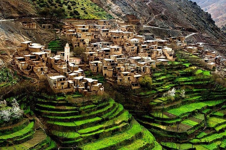
The road leaves Marrakech before dawn and climbs into a landscape of stone terraces and red earth, the city’s heat thinning as cedar and almond trees take over.
Verified experiences and guided adventures in the surrounding area.
Operated by Desertbrise Travel · Imlil, Marrakech-Safi
The road leaves Marrakech before dawn and climbs into a landscape of stone terraces and red earth, the city’s heat thinning as cedar and almond trees take over.
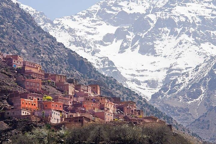
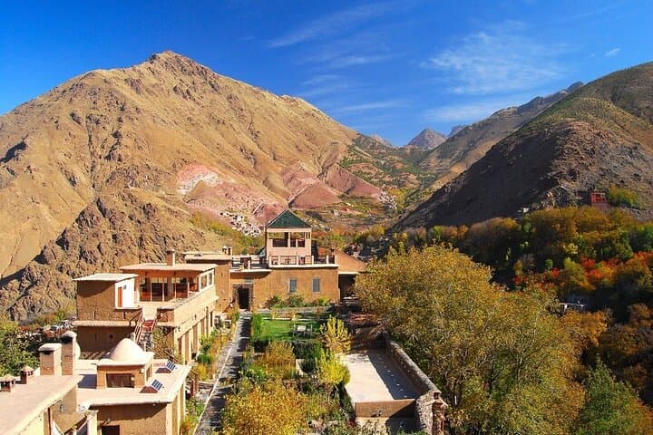
By midmorning you arrive in Imlil (1,740 m), a cluster of Berber villages where a glass of mint tea greets walkers and mule riders alike. The route threads ancient footpaths and irrigation channels, winding past walnut and cherry orchards, a small waterfall, and fields cut into the slope — all set beneath the imposing silhouette of Jebel Toubkal, North Africa’s highest peak at 4,167 m.
Geology and history are visible in the landscape: the High Atlas is a young, folded mountain range carved by rivers and freeze-thaw cycles, and the villages here reflect centuries of Amazigh (Berber) farming traditions tied to terraced irrigation.
Expect uneven dirt tracks, stone steps, short steep pitches, and panoramic viewpoints at villages such as Armed (approx. 1,900 m). The full-day itinerary typically covers 8–12 km of walking over 6–8 hours with cumulative elevation changes of a few hundred meters; mules are available for steeper sections.
Practical guidance: wear sturdy hiking shoes, layer for temperature swings, carry 2–3 liters of water, and bring sun protection and cash for small purchases. Start early to avoid afternoon heat and to maximize clear vistas of Toubkal. The day balances cultural contact — a home-cooked Berber lunch — with manageable alpine walking, making it a satisfying full-day introduction to the High Atlas for moderately fit travelers.
moderate.
8 hours.
Suitable for people with regular walking fitness able to manage several hours on uneven terrain and short steep sections
The guided full-day route typically involves 6–12 km of walking over 6–8 hours with several short climbs; it’s moderate in difficulty and suitable for people with regular walking fitness.
Yes — mules are commonly available for steeper or longer sections; confirm availability with the operator and note that mules carry limited personal gear.
Lunch is included on this trip and is usually a home-prepared Berber meal at a local family’s home featuring seasonal vegetables, tagine, and tea.
The route stays below 2,000 m for most of the day, but travelers with spine issues or pregnancy are advised not to join; moderate fitness is recommended.
The High Atlas has long been home to Amazigh (Berber) communities whose terraced farming and irrigation systems shape the landscape you walk through.
The mountain environment is fragile; stick to trails, avoid single-use plastics, and support local guides to help sustain village economies.
Desertbrise Travel operates guided outdoor trips and adventures with an emphasis on safety, stewardship, and memorable experiences.
The road leaves Marrakech before dawn and climbs into a landscape of stone terraces and red earth, the city’s heat thinning as cedar and almond trees take over.
The road leaves Marrakech before dawn and climbs into a landscape of stone terraces and red earth, the city’s heat thinning as cedar and almond trees take over.
By midmorning you arrive in Imlil (1,740 m), a cluster of Berber villages where a glass of mint tea greets walkers and mule riders alike. The route threads ancient footpaths and irrigation channels, winding past walnut and cherry orchards, a small waterfall, and fields cut into the slope — all set beneath the imposing silhouette of Jebel Toubkal, North Africa’s highest peak at 4,167 m.
Geology and history are visible in the landscape: the High Atlas is a young, folded mountain range carved by rivers and freeze-thaw cycles, and the villages here reflect centuries of Amazigh (Berber) farming traditions tied to terraced irrigation.
Expect uneven dirt tracks, stone steps, short steep pitches, and panoramic viewpoints at villages such as Armed (approx. 1,900 m). The full-day itinerary typically covers 8–12 km of walking over 6–8 hours with cumulative elevation changes of a few hundred meters; mules are available for steeper sections.
Practical guidance: wear sturdy hiking shoes, layer for temperature swings, carry 2–3 liters of water, and bring sun protection and cash for small purchases. Start early to avoid afternoon heat and to maximize clear vistas of Toubkal. The day balances cultural contact — a home-cooked Berber lunch — with manageable alpine walking, making it a satisfying full-day introduction to the High Atlas for moderately fit travelers.