THE ADVENTURE COLLECTIVE® · Independent discovery and booking for outdoor travel

A full-day drive along Iceland’s south coast delivers black-sand beaches, dramatic basalt, retreating glacier tongues and towering waterfalls. This tour strings together the region’s geological highlights with accessible short walks and ample photo stops.
A full-day drive along Iceland’s south coast delivers black-sand beaches, dramatic basalt, retreating glacier tongues and towering waterfalls. This tour strings together the region’s geological highlights with accessible short walks and ample photo stops.
The bus eases away from Reykjavík and the land opens up into slow-moving weather and high horizons—black sand plains meet slab-sided cliffs, and glaciers hang like pale roofs above the coast. You begin with the roar of the Atlantic at Reynisfjara, where basalt columns and pounding surf give the black beach a stark, elemental personality. A half-hour later Dyrhólaey rises into view, once an island, now a promontory where puffins stake summer territory and winds test your balance.
Verified experiences and guided adventures in the surrounding area.
Operated by G spot Iceland · Vík, Southern Region
The bus eases away from Reykjavík and the land opens up into slow-moving weather and high horizons—black sand plains meet slab-sided cliffs, and glaciers hang like pale roofs above the coast. You begin with the roar of the Atlantic at Reynisfjara, where basalt columns and pounding surf give the black beach a stark, elemental personality. A half-hour later Dyrhólaey rises into view, once an island, now a promontory where puffins stake summer territory and winds test your balance.
This stretch of coast tells Iceland’s recent geological biography: volcanic shields and collapsing calderas shaped long before Mýrdalsjökull and Eyjafjallajökull left fresh signatures. Eyjafjallajökull’s 2010 eruption is local lore—its ash cloud redirected global air traffic and is still referenced when guides talk about how fire and ice shape the island. Glacial tongues like those off Mýrdalsjökull are visible, retreating measurably over decades and offering on-the-ground evidence of climate change.
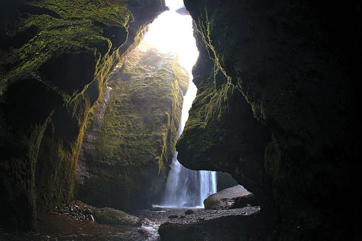
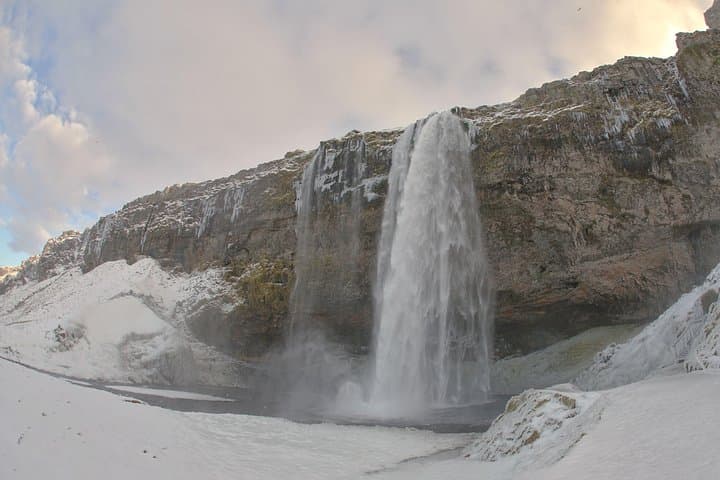
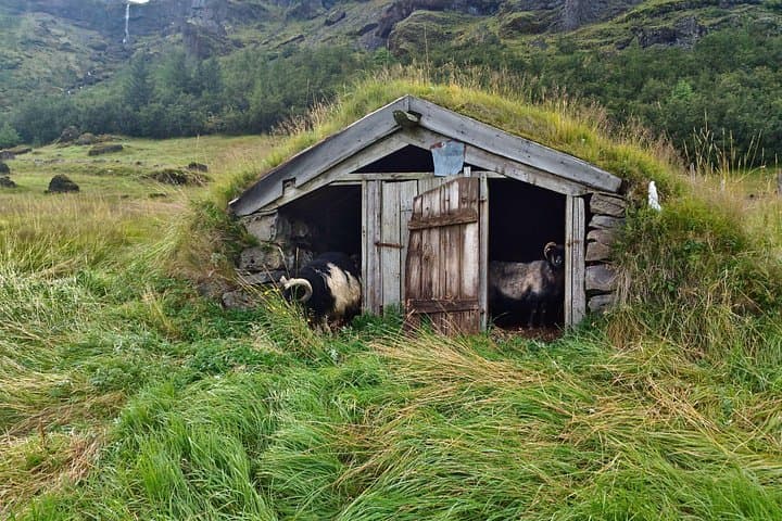
Cultural notes are straightforward: farms punctuate the black sand, and sagas live in place names; the waterfalls—Seljalandsfoss and nearby falls—have been film locations and community landmarks for generations.
Practical guidance: expect a long day (9–10 hours) with multiple short walks on uneven, often wet terrain. Waterproof layers, sturdy boots, and a charged camera are essentials. Keep distance from sneaker waves on the black beaches, follow guide instructions near cliffs, and allow extra time at viewpoints—this itinerary is deliberately unhurried to let you photograph and absorb each scene.
moderate.
9–10 hours.
Moderate—comfortable being on your feet through several short hikes totaling a few hours and sitting during drives.
The tour lasts about 9–10 hours and typically departs from Reykjavík with multiple stops along the south coast.
Yes—Seljalandsfoss (the waterfall often described as 60m) has a path behind it; expect wet conditions and uneven footing.
Puffins are common at Dyrhólaey in the summer months (late spring to early autumn), but sightings aren’t guaranteed and depend on nesting cycles.
The tour is billed as physically easy overall, but many viewpoints require walking on uneven surfaces; discuss mobility needs with the operator before booking.
The 2010 eruption of Eyjafjallajökull is a recent historical marker—its ash cloud disrupted European air travel and highlighted Iceland’s active geology.
Coastal habitats are fragile—stay on marked paths, avoid disturbing nesting birds, and carry out all waste; groups should follow guide instructions to minimize impact.
G spot Iceland operates guided outdoor trips and adventures with an emphasis on safety, stewardship, and memorable experiences.
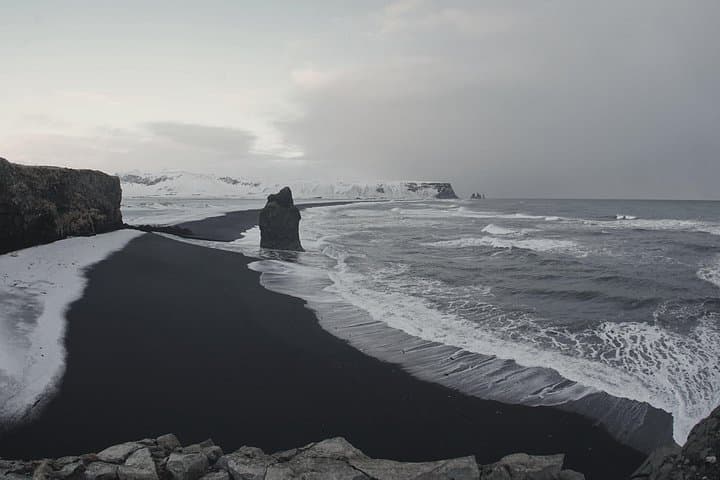
The bus eases away from Reykjavík and the land opens up into slow-moving weather and high horizons—black sand plains meet slab-sided cliffs, and glaciers hang like pale roofs above the coast. You begin with the roar of the Atlantic at Reynisfjara, where basalt columns and pounding surf give the black beach a stark, elemental personality. A half-hour later Dyrhólaey rises into view, once an island, now a promontory where puffins stake summer territory and winds test your balance.
The bus eases away from Reykjavík and the land opens up into slow-moving weather and high horizons—black sand plains meet slab-sided cliffs, and glaciers hang like pale roofs above the coast. You begin with the roar of the Atlantic at Reynisfjara, where basalt columns and pounding surf give the black beach a stark, elemental personality. A half-hour later Dyrhólaey rises into view, once an island, now a promontory where puffins stake summer territory and winds test your balance.
This stretch of coast tells Iceland’s recent geological biography: volcanic shields and collapsing calderas shaped long before Mýrdalsjökull and Eyjafjallajökull left fresh signatures. Eyjafjallajökull’s 2010 eruption is local lore—its ash cloud redirected global air traffic and is still referenced when guides talk about how fire and ice shape the island. Glacial tongues like those off Mýrdalsjökull are visible, retreating measurably over decades and offering on-the-ground evidence of climate change.
Cultural notes are straightforward: farms punctuate the black sand, and sagas live in place names; the waterfalls—Seljalandsfoss and nearby falls—have been film locations and community landmarks for generations.
Practical guidance: expect a long day (9–10 hours) with multiple short walks on uneven, often wet terrain. Waterproof layers, sturdy boots, and a charged camera are essentials. Keep distance from sneaker waves on the black beaches, follow guide instructions near cliffs, and allow extra time at viewpoints—this itinerary is deliberately unhurried to let you photograph and absorb each scene.