THE ADVENTURE COLLECTIVE® · Independent discovery and booking for outdoor travel

Follow a forested side trail from Puerto Río Tranquilo to viewpoints that put the Exploradores Glacier’s ice face, lagoons and surrounding peaks within reach. This guided, moderate 6 km hike combines geology, wildlife spotting and clear, close glacier views.
Follow a forested side trail from Puerto Río Tranquilo to viewpoints that put the Exploradores Glacier’s ice face, lagoons and surrounding peaks within reach. This guided, moderate 6 km hike combines geology, wildlife spotting and clear, close glacier views.
You step out of the vehicle into a cool, resin-scented forest; the trail slips between lenga and coihue, and ahead the glacier’s blue face waits above the treeline. The route follows a side trail that skirts the Exploradores River valley, opening at several rocky vantage points that put crevasses, melt lagoons and the serrated ridges of Cordón de Plata and Mount Valentine within view.
Verified experiences and guided adventures in the surrounding area.
Operated by Cayutuehike · Puerto Río Tranquilo, Aysén
You step out of the vehicle into a cool, resin-scented forest; the trail slips between lenga and coihue, and ahead the glacier’s blue face waits above the treeline. The route follows a side trail that skirts the Exploradores River valley, opening at several rocky vantage points that put crevasses, melt lagoons and the serrated ridges of Cordón de Plata and Mount Valentine within view.
The landscape here is written by ice: Patagonia’s last great ice flows carved deep valleys and left moraines that now host temperate rainforest. Indigenous Aonikenk people and later Patagonian explorers moved through these valleys; the modern park protects an ecological and geological record of post-glacial recovery. Guides on this route interpret striations, moraine formations and the glacier’s seasonal dynamics while pointing out how warming trends alter the snout year to year.
Expect roughly 6 km round-trip with about 108 m of elevation gain on a moderately steep, often rocky trail. Forest shade gives way to exposed viewpoints where wind and sun are immediate — the glacier seems to push the air forward with each meltwater trickle. Wildlife is subtle: look for condors riding the thermals and pudú tracks in soft mud.
Practical: bring sturdy hiking shoes, layered clothing for wind and sun, and 1–2 liters of water. The tour includes transport from Puerto Río Tranquilo, park entrance and a box lunch. Plan for a 3–4 hour outing on trail plus transfers; the guide handles navigation and interpretation but prepare for uneven footing and sudden weather shifts.
moderate.
3–4 hours (on-trail); total tour ~7 hours including transfers.
Moderate fitness: able to sustain uphill walking on uneven terrain for several hours.
The trail is about 6 km round-trip with roughly 108 m of elevation gain; it’s rated medium/moderate—uneven footing but no technical climbing.
Transportation from Puerto Río Tranquilo, park entrance, a certified guide and a boxed lunch are included.
Many families and older hikers can complete the route if they are steady on uneven ground; disclose mobility limits when booking.
Viewpoints offer panoramic and relatively close visual access to the glacier’s face and lagoons; direct glacier travel or ice walking is not part of this hike.
The valley’s form is the product of successive Patagonian ice advances; local routes were used by indigenous Aonikenk groups and later explorers mapping interior fjords.
Exploradores and nearby protected areas are sensitive to climate change and visitor impact—stay on trails, pack out waste and heed park rules to reduce erosion and disturbance.
Cayutuehike operates guided outdoor trips and adventures with an emphasis on safety, stewardship, and memorable experiences.
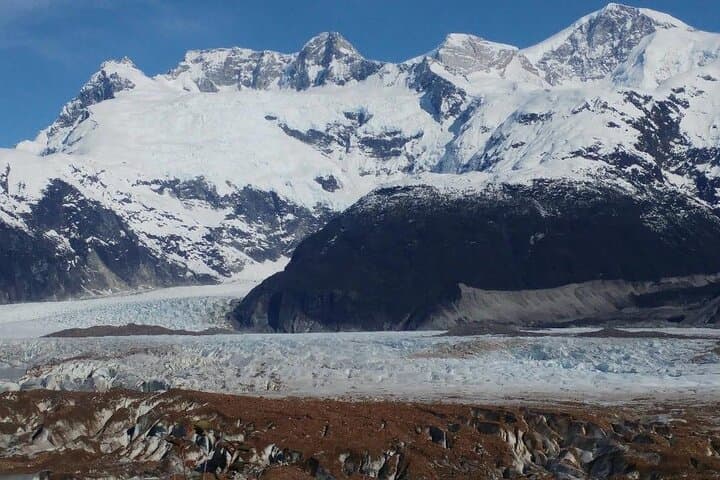
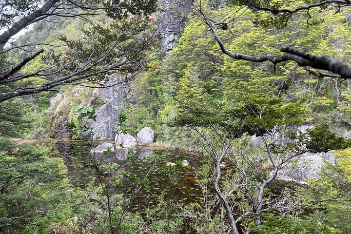
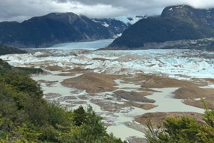
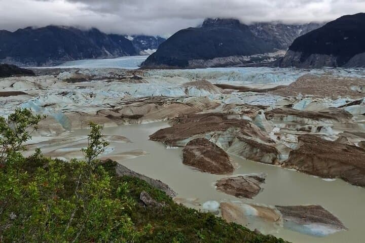
You step out of the vehicle into a cool, resin-scented forest; the trail slips between lenga and coihue, and ahead the glacier’s blue face waits above the treeline. The route follows a side trail that skirts the Exploradores River valley, opening at several rocky vantage points that put crevasses, melt lagoons and the serrated ridges of Cordón de Plata and Mount Valentine within view.
You step out of the vehicle into a cool, resin-scented forest; the trail slips between lenga and coihue, and ahead the glacier’s blue face waits above the treeline. The route follows a side trail that skirts the Exploradores River valley, opening at several rocky vantage points that put crevasses, melt lagoons and the serrated ridges of Cordón de Plata and Mount Valentine within view.
The landscape here is written by ice: Patagonia’s last great ice flows carved deep valleys and left moraines that now host temperate rainforest. Indigenous Aonikenk people and later Patagonian explorers moved through these valleys; the modern park protects an ecological and geological record of post-glacial recovery. Guides on this route interpret striations, moraine formations and the glacier’s seasonal dynamics while pointing out how warming trends alter the snout year to year.
Expect roughly 6 km round-trip with about 108 m of elevation gain on a moderately steep, often rocky trail. Forest shade gives way to exposed viewpoints where wind and sun are immediate — the glacier seems to push the air forward with each meltwater trickle. Wildlife is subtle: look for condors riding the thermals and pudú tracks in soft mud.
Practical: bring sturdy hiking shoes, layered clothing for wind and sun, and 1–2 liters of water. The tour includes transport from Puerto Río Tranquilo, park entrance and a box lunch. Plan for a 3–4 hour outing on trail plus transfers; the guide handles navigation and interpretation but prepare for uneven footing and sudden weather shifts.