THE ADVENTURE COLLECTIVE® · Independent discovery and booking for outdoor travel

A compact day hike from Grab ethno village to Sokolina (1,400 m) delivers high-alpine views with two route options: a brisk 4 km approach or a longer 5 km ridge route. Expect mixed forest, limestone ridges and nearly 940 m of ascent from the camp.
A compact day hike from Grab ethno village to Sokolina (1,400 m) delivers high-alpine views with two route options: a brisk 4 km approach or a longer 5 km ridge route. Expect mixed forest, limestone ridges and nearly 940 m of ascent from the camp.
Morning light finds the trailhead at Camp Grab, where a last stretch of gravel gives way to a narrow path threading into mixed beech and fir forest. The air carries the scent of damp earth and resin; branches part to reveal a slow climb that pushes the view wider with every switchback. By the time you reach the open ridge of Sokolina, the valley below feels small and immediate—a living map of past grazing routes and stony fields.
Verified experiences and guided adventures in the surrounding area.
Operated by Camp Grab · Plav, Montenegro
Morning light finds the trailhead at Camp Grab, where a last stretch of gravel gives way to a narrow path threading into mixed beech and fir forest. The air carries the scent of damp earth and resin; branches part to reveal a slow climb that pushes the view wider with every switchback. By the time you reach the open ridge of Sokolina, the valley below feels small and immediate—a living map of past grazing routes and stony fields.
This route crosses landscapes shaped by tectonic lift and karst weathering: limestone ridges and plateaus that collect snow and feed stubborn springs. The area around Crkvicko polje has long been part of local mountain culture—seasonal shepherding, small ethno-villages like Grab, and trails used for trade and transhumance for centuries.
Expect two common line options: a quicker 4 km / ~90-minute approach from Crkvicko polje, or a longer 5 km / ~2-hour route via Maricina Greda (1100 m) that adds steeper sections and broader views. Total elevation is approximately 460 m at Camp Grab up to Sokolina’s 1,400 m—roughly 940 m of climb if you start at the camp.
Practical guidance: start early to avoid midday sun, carry at least 2 liters of water, and wear sturdy boots—trail surfaces shift between packed dirt, loose scree and exposed limestone slabs. Navigation is straightforward but not always signed; a local guide or GPX track reduces uncertainty. Weather can swing quickly at these elevations—pack layers and a windproof shell. Leave no trace: grazing and local farms depend on the same springs you’ll drink from, so treat water sources and trails with care.
moderate.
3–4 hours (round trip).
Reasonable cardiovascular fitness and comfort with steady uphill hiking for 1–2 hours at a stretch
Routes vary: the Crkvicko polje approach is about 4 km and ~90 minutes one-way; the longer route via Maricina Greda is about 5 km and ~2 hours one-way.
No—routes are manageable for fit hikers, but a local guide adds cultural insight and removes navigation stress on lesser-signed sections.
Starting from Camp Grab (≈460 m) to Sokolina (≈1,400 m) is roughly 940 m of elevation gain if you hike from the camp.
Late spring through early autumn provides the most stable conditions; snow can linger into spring at higher elevations and storms appear in late summer.
The trails around Sokolina follow centuries-old pastoral routes; ethno-villages like Grab reflect a tradition of seasonal grazing and mountain agriculture.
Water sources and alpine meadows are sensitive—stick to established trails, pack out waste, and respect grazing lands to protect biodiversity and local livelihoods.
Camp Grab operates guided outdoor trips and adventures with an emphasis on safety, stewardship, and memorable experiences.
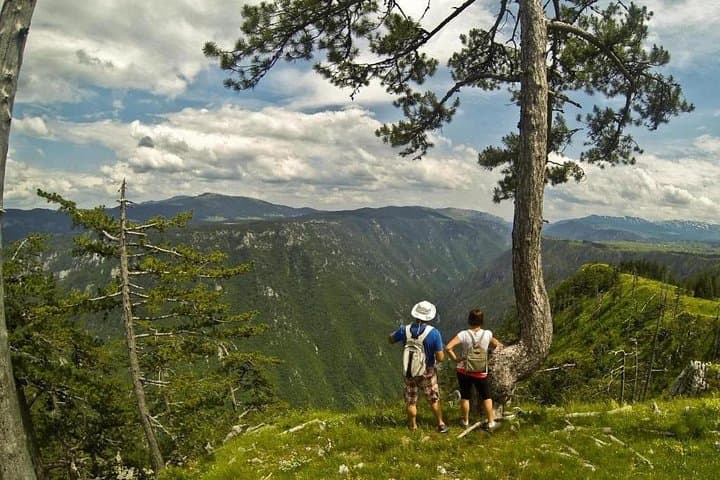
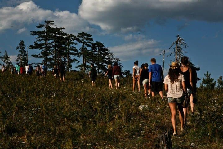
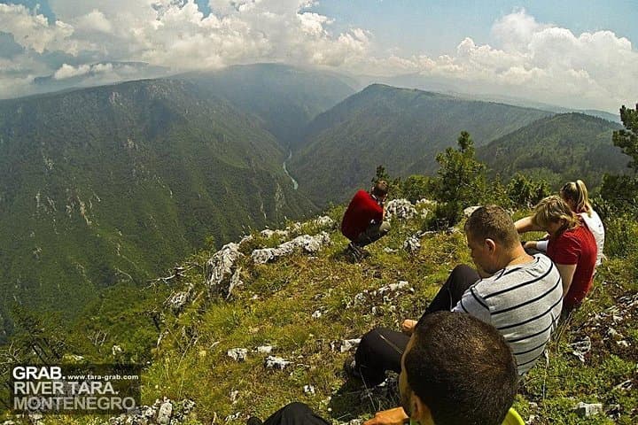
Morning light finds the trailhead at Camp Grab, where a last stretch of gravel gives way to a narrow path threading into mixed beech and fir forest. The air carries the scent of damp earth and resin; branches part to reveal a slow climb that pushes the view wider with every switchback. By the time you reach the open ridge of Sokolina, the valley below feels small and immediate—a living map of past grazing routes and stony fields.
Morning light finds the trailhead at Camp Grab, where a last stretch of gravel gives way to a narrow path threading into mixed beech and fir forest. The air carries the scent of damp earth and resin; branches part to reveal a slow climb that pushes the view wider with every switchback. By the time you reach the open ridge of Sokolina, the valley below feels small and immediate—a living map of past grazing routes and stony fields.
This route crosses landscapes shaped by tectonic lift and karst weathering: limestone ridges and plateaus that collect snow and feed stubborn springs. The area around Crkvicko polje has long been part of local mountain culture—seasonal shepherding, small ethno-villages like Grab, and trails used for trade and transhumance for centuries.
Expect two common line options: a quicker 4 km / ~90-minute approach from Crkvicko polje, or a longer 5 km / ~2-hour route via Maricina Greda (1100 m) that adds steeper sections and broader views. Total elevation is approximately 460 m at Camp Grab up to Sokolina’s 1,400 m—roughly 940 m of climb if you start at the camp.
Practical guidance: start early to avoid midday sun, carry at least 2 liters of water, and wear sturdy boots—trail surfaces shift between packed dirt, loose scree and exposed limestone slabs. Navigation is straightforward but not always signed; a local guide or GPX track reduces uncertainty. Weather can swing quickly at these elevations—pack layers and a windproof shell. Leave no trace: grazing and local farms depend on the same springs you’ll drink from, so treat water sources and trails with care.