THE ADVENTURE COLLECTIVE® · Independent discovery and booking for outdoor travel

A guided day hike over Siglufjarðarskarð on the Troll Peninsula takes you from fjordside town to ocean‑facing ridges, through glacial passes and rarely trod slopes. Expect mixed terrain, panoramic sea views and a route adjusted for ability and weather.
A guided day hike over Siglufjarðarskarð on the Troll Peninsula takes you from fjordside town to ocean‑facing ridges, through glacial passes and rarely trod slopes. Expect mixed terrain, panoramic sea views and a route adjusted for ability and weather.
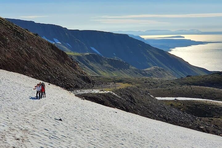
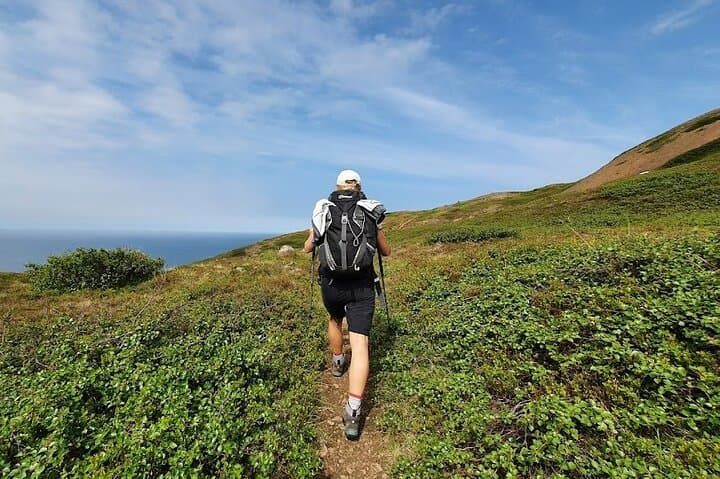
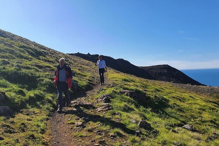
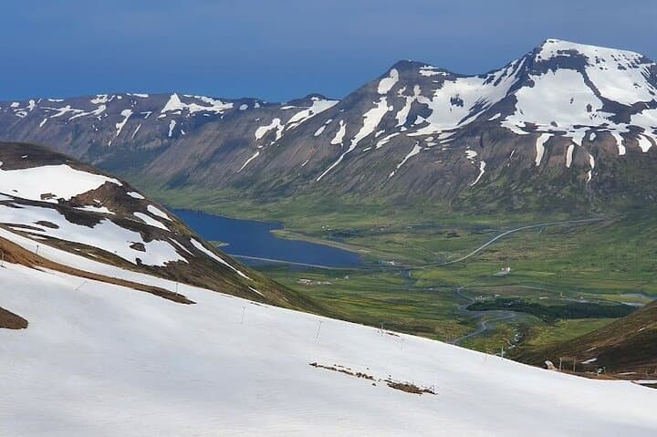
A raw North Iceland wind carries salt and kirka—sharp, mineral—across the shoulder of the Troll Peninsula as hikers step off the fjord road and climb. Peaks cut steep silhouettes above grassy ridges; below, the ocean glints where the valley of Fljótin opens into the sea. The trail can vanish into moss and bog, then reappear as a cleft between basalt slabs. Solitude is part of the route: this corner sees far fewer boots than the south, and the landscape often feels like a place reclaiming its own tracks.
Verified experiences and guided adventures in the surrounding area.
Operated by Sóti Summits · Siglufjörður, North Iceland
A raw North Iceland wind carries salt and kirka—sharp, mineral—across the shoulder of the Troll Peninsula as hikers step off the fjord road and climb. Peaks cut steep silhouettes above grassy ridges; below, the ocean glints where the valley of Fljótin opens into the sea. The trail can vanish into moss and bog, then reappear as a cleft between basalt slabs. Solitude is part of the route: this corner sees far fewer boots than the south, and the landscape often feels like a place reclaiming its own tracks.
Geology here is blunt and recent—glacially carved cols, volcanic bedrock and post‑glacial moraine shape the pass. Siglufjarðarskarð sits amid fjords that were once the heart of Iceland’s herring boom; small fishing towns like Siglufjörður carry that maritime history in wooden houses and local museums. Culturally, the area remains tied to the sea and seasonal runs: summers are long and luminous, winters short and strict.
Expect a rugged day‑hike: routes commonly range 8–12 km round‑trip with roughly 400–600 m of elevation gain depending on the approach, on mixed terrain—peat, scree and narrow ridgelines. Weather shifts fast; the guide adjusts the exact route to match group ability and conditions. Bring sturdy boots, layered waterproofs, extra water and a map or guide; allow five hours for the guided experience including stops for views and photos. Trails may be faint—route‑finding skills help but an experienced guide is included. Plan for strong winds, wet ground, and the kind of silence that only places with few visitors can offer.
moderate.
5 hours.
Comfortable being on your feet for up to 5 hours with steady climbs; good cardiovascular fitness and balance helpful
The guided route is suited to people with moderate fitness; steep sections and uneven terrain make it more challenging than a flat walk, but guides adjust pace and route to group ability.
Parts of the trail are faint and can be reclaimed by vegetation; a guide and basic map/compass skills are useful—this tour includes an experienced guide.
Tours can be canceled for severe weather; operators monitor conditions and may alter or postpone the itinerary for safety (you can cancel at least 24 hours beforehand for a refund).
Depends on age and fitness—children with prior hiking experience and stamina for multi‑hour walks can join, but confirm with the operator about suitability beforehand.
Siglufjörður and nearby fjords grew rapidly during Iceland’s early 20th‑century herring boom; the fishing heritage shaped local settlements and boatbuilding traditions.
Trails cross sensitive tundra and peat; traveling with a guide and staying on durable surfaces helps prevent erosion and preserves fragile plant communities.
Sóti Summits operates guided outdoor trips and adventures with an emphasis on safety, stewardship, and memorable experiences.
A raw North Iceland wind carries salt and kirka—sharp, mineral—across the shoulder of the Troll Peninsula as hikers step off the fjord road and climb. Peaks cut steep silhouettes above grassy ridges; below, the ocean glints where the valley of Fljótin opens into the sea. The trail can vanish into moss and bog, then reappear as a cleft between basalt slabs. Solitude is part of the route: this corner sees far fewer boots than the south, and the landscape often feels like a place reclaiming its own tracks.
A raw North Iceland wind carries salt and kirka—sharp, mineral—across the shoulder of the Troll Peninsula as hikers step off the fjord road and climb. Peaks cut steep silhouettes above grassy ridges; below, the ocean glints where the valley of Fljótin opens into the sea. The trail can vanish into moss and bog, then reappear as a cleft between basalt slabs. Solitude is part of the route: this corner sees far fewer boots than the south, and the landscape often feels like a place reclaiming its own tracks.
Geology here is blunt and recent—glacially carved cols, volcanic bedrock and post‑glacial moraine shape the pass. Siglufjarðarskarð sits amid fjords that were once the heart of Iceland’s herring boom; small fishing towns like Siglufjörður carry that maritime history in wooden houses and local museums. Culturally, the area remains tied to the sea and seasonal runs: summers are long and luminous, winters short and strict.
Expect a rugged day‑hike: routes commonly range 8–12 km round‑trip with roughly 400–600 m of elevation gain depending on the approach, on mixed terrain—peat, scree and narrow ridgelines. Weather shifts fast; the guide adjusts the exact route to match group ability and conditions. Bring sturdy boots, layered waterproofs, extra water and a map or guide; allow five hours for the guided experience including stops for views and photos. Trails may be faint—route‑finding skills help but an experienced guide is included. Plan for strong winds, wet ground, and the kind of silence that only places with few visitors can offer.