THE ADVENTURE COLLECTIVE® · Independent discovery and booking for outdoor travel

Short, steep and intensely high: Cerro Toco rises from the Atacama altiplano with 400 meters of ascent from a 5,200 m trailhead. Expect dramatic volcano views, thin air, and a full-day out-and-back from San Pedro de Atacama.
Short, steep and intensely high: Cerro Toco rises from the Atacama altiplano with 400 meters of ascent from a 5,200 m trailhead. Expect dramatic volcano views, thin air, and a full-day out-and-back from San Pedro de Atacama.
Dawn breaks on the puna and the wind pushes cold air across a parking lot at 5,200 meters. You step out of the van, boots crunching on volcanic scree, and the bulk of Cerro Toco rises like a blunt guardian against a pale sky. Licancabur and Juriques sit across the salt flats, their profiles sharp; small altiplano lagoons flash silver below.
Verified experiences and guided adventures in the surrounding area.
Operated by Sorbac · San Pedro de Atacama, Antofagasta Region
Dawn breaks on the puna and the wind pushes cold air across a parking lot at 5,200 meters. You step out of the van, boots crunching on volcanic scree, and the bulk of Cerro Toco rises like a blunt guardian against a pale sky. Licancabur and Juriques sit across the salt flats, their profiles sharp; small altiplano lagoons flash silver below.
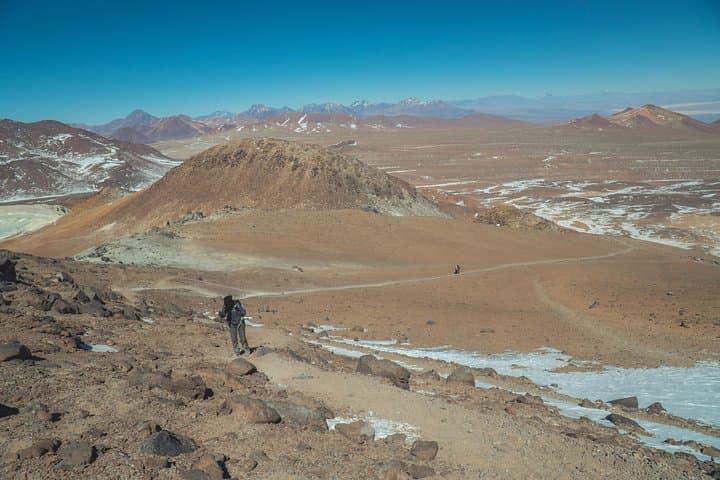
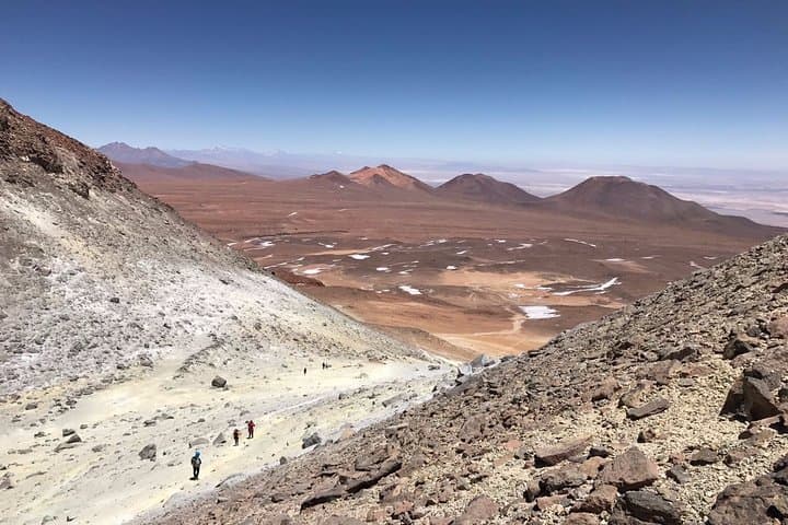
The Cerro Toco route threads the high Andean volcanic chain formed by tectonic uplift and repeated volcanism. Human history here is sparse but deep: pre-Columbian camelid routes crossed this salt-and-stone landscape and modern miners and astronomers have also left traces. Geologically the climb is short and steep—about 2 kilometers of trail with roughly 400 meters of elevation gain—but every meter counts at these elevations where the air thins and the sun intensifies.
Practically, expect 6–8 hours round trip including transport from San Pedro de Atacama, a breakfast stop with views of Licancabur, and careful pacing on uneven, rocky ground. Guides typically provide trekking poles and helmets; bring high-calorie snacks, layered clothing for strong temperature swings, and at least 2–3 liters of water. Acclimatize in town or with a prior low-level day; symptoms of altitude sickness can appear quickly.
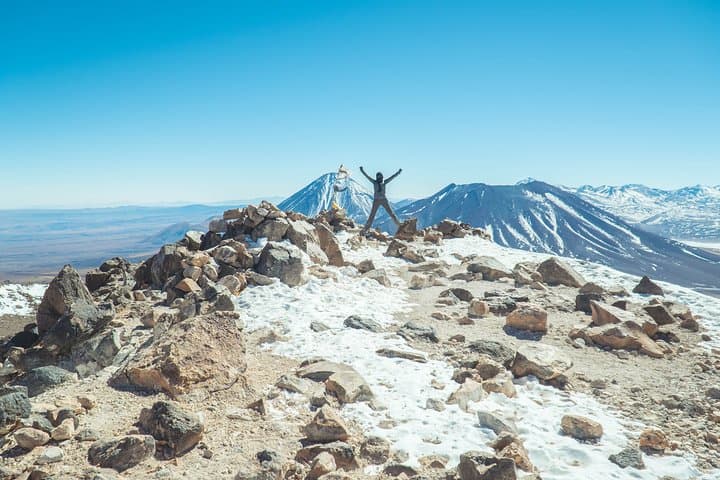
The summit rewards effort with sweeping views of other volcanoes, salt flats and high-altitude lagoons; wind and cold can move fast, so plan your timing around clear mornings. This is a short but serious high-altitude mountain day—technical skills are minimal, but cardiovascular fitness and respect for altitude are essential.
challenging.
6–8 hours.
Good cardiovascular fitness and prior high-altitude exposure recommended; comfortable with steady uphill walking for 2 km.
The route starts around 5,200 m and reaches ~5,600 m, so plan for about 400 meters of vertical gain over roughly 2 kilometers of trail.
No technical climbing skills are required; the trail is non-technical but uneven—poles, good boots and basic crampons only if icy conditions exist.
Leave very early to summit in mid-morning when winds are usually lighter and visibility is best; descent before afternoon winds and temperature drops.
Not recommended for those with cardiovascular problems, spinal injuries, or pregnancy; consult a physician about high-altitude risks.
Cerro Toco sits on the Andean volcanic chain that shaped the altiplano; the area was traversed historically by pre-Columbian herders and later by miners and astronomers.
The high-altitude puna is ecologically fragile—stay on trails, pack out all waste and avoid disturbing lagoon shorelines and wildlife.
Sorbac operates guided outdoor trips and adventures with an emphasis on safety, stewardship, and memorable experiences.
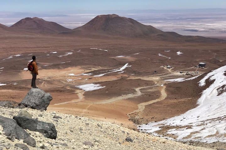
Dawn breaks on the puna and the wind pushes cold air across a parking lot at 5,200 meters. You step out of the van, boots crunching on volcanic scree, and the bulk of Cerro Toco rises like a blunt guardian against a pale sky. Licancabur and Juriques sit across the salt flats, their profiles sharp; small altiplano lagoons flash silver below.
Dawn breaks on the puna and the wind pushes cold air across a parking lot at 5,200 meters. You step out of the van, boots crunching on volcanic scree, and the bulk of Cerro Toco rises like a blunt guardian against a pale sky. Licancabur and Juriques sit across the salt flats, their profiles sharp; small altiplano lagoons flash silver below.
The Cerro Toco route threads the high Andean volcanic chain formed by tectonic uplift and repeated volcanism. Human history here is sparse but deep: pre-Columbian camelid routes crossed this salt-and-stone landscape and modern miners and astronomers have also left traces. Geologically the climb is short and steep—about 2 kilometers of trail with roughly 400 meters of elevation gain—but every meter counts at these elevations where the air thins and the sun intensifies.
Practically, expect 6–8 hours round trip including transport from San Pedro de Atacama, a breakfast stop with views of Licancabur, and careful pacing on uneven, rocky ground. Guides typically provide trekking poles and helmets; bring high-calorie snacks, layered clothing for strong temperature swings, and at least 2–3 liters of water. Acclimatize in town or with a prior low-level day; symptoms of altitude sickness can appear quickly.
The summit rewards effort with sweeping views of other volcanoes, salt flats and high-altitude lagoons; wind and cold can move fast, so plan your timing around clear mornings. This is a short but serious high-altitude mountain day—technical skills are minimal, but cardiovascular fitness and respect for altitude are essential.