THE ADVENTURE COLLECTIVE® · Independent discovery and booking for outdoor travel

A compact, glacier-edge guided hike to Rabothytta places you at the end of Okstindbreen—blue ice framing a rugged DNT cabin at 1,200 m. Expect steep tundra, fast-changing weather and unforgettable mountain views on this five-hour trek.
A compact, glacier-edge guided hike to Rabothytta places you at the end of Okstindbreen—blue ice framing a rugged DNT cabin at 1,200 m. Expect steep tundra, fast-changing weather and unforgettable mountain views on this five-hour trek.
A low cloud clings to the plateau as the group leaves the gravel at Leirbotnet and moves uphill. The path narrows, rocks click under boots, and the landscape opens into a high-arctic stage where Rabothytta sits—diagonal timber against ice—at about 1,200 meters above sea level. Fog rolls and lifts like a curtain; the blue ice of Okstindbreen dares you to come closer.
Verified experiences and guided adventures in the surrounding area.
Operated by ExploRana AS · Korgen, Nordland
A low cloud clings to the plateau as the group leaves the gravel at Leirbotnet and moves uphill. The path narrows, rocks click under boots, and the landscape opens into a high-arctic stage where Rabothytta sits—diagonal timber against ice—at about 1,200 meters above sea level. Fog rolls and lifts like a curtain; the blue ice of Okstindbreen dares you to come closer.
The cabin is a DNT (Norwegian Trekking Association) landmark named for French glaciologist Charles Rabot, built and maintained for mountain travelers and glacier observers. Geology here is raw: sculpted granite, moraine ridges and a glacier tongue that carves its own weather. Culturally the area belongs to northern Norway’s mountain farming communities—roads from Korgen climb out of agricultural valleys before spilling into the high tundra.
On this guided five-hour outing expect roughly a 5 km walk from parking with steady uphill sections and a final steep approach across glacially scoured ground. Weather changes fast—wind, fog and sun can trade places in minutes—so layers and waterproofs are essential. The itinerary typically includes a packed lunch and stops at scenic viewpoints; the guide handles route-finding and safety near ice edges.
Plan for good footwear with grip, 1–2 liters of water, and a 20–30% time buffer for slow visibility or snow patches in shoulder seasons. Mobile signal is intermittent; treat the cabin and surrounding ice with respect: stay on established paths, keep distance from crevasses and carry out waste. For hikers who want a compact, dramatic high-mountain experience, Rabothytta delivers both spectacle and a clear sense of the raw forces that shaped Norway's north.
moderate.
4–6 hours.
Participants should have a moderate level of fitness able to sustain uphill hiking for several kilometers and manage uneven terrain.
The guided excursion is about five hours round-trip with roughly 5 km from the parking area and steady uphill sections; it’s rated moderate—suitable for hikers with regular activity.
Guides route the group to safe viewpoints; stay with the guide and avoid walking onto the glacier without specialized equipment and training.
No formal facilities are available at the cabin area; plan accordingly and follow Leave No Trace practices.
The operator notes service animals allowed; children may join if fit for moderate uphill hiking—check with the tour provider about age restrictions.
Rabothytta is a DNT hut named after glaciologist Charles Rabot and has long served explorers and researchers studying Okstindbreen.
The alpine plateau is fragile—stick to established paths, pack out waste and avoid trampling lichen and moss which recover slowly in this climate.
ExploRana AS operates guided outdoor trips and adventures with an emphasis on safety, stewardship, and memorable experiences.
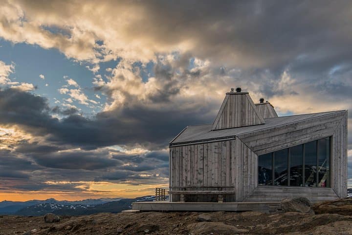
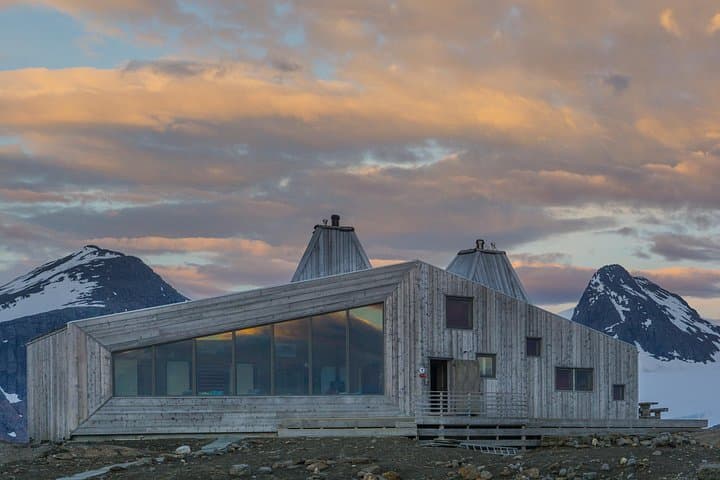
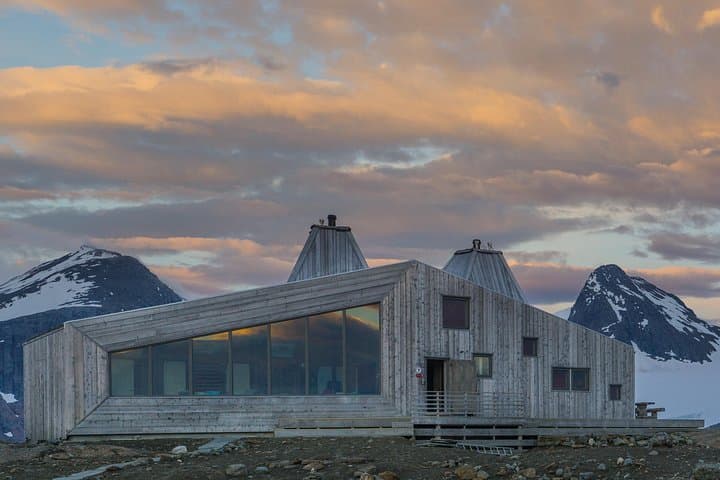
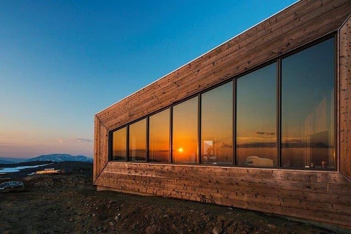
A low cloud clings to the plateau as the group leaves the gravel at Leirbotnet and moves uphill. The path narrows, rocks click under boots, and the landscape opens into a high-arctic stage where Rabothytta sits—diagonal timber against ice—at about 1,200 meters above sea level. Fog rolls and lifts like a curtain; the blue ice of Okstindbreen dares you to come closer.
A low cloud clings to the plateau as the group leaves the gravel at Leirbotnet and moves uphill. The path narrows, rocks click under boots, and the landscape opens into a high-arctic stage where Rabothytta sits—diagonal timber against ice—at about 1,200 meters above sea level. Fog rolls and lifts like a curtain; the blue ice of Okstindbreen dares you to come closer.
The cabin is a DNT (Norwegian Trekking Association) landmark named for French glaciologist Charles Rabot, built and maintained for mountain travelers and glacier observers. Geology here is raw: sculpted granite, moraine ridges and a glacier tongue that carves its own weather. Culturally the area belongs to northern Norway’s mountain farming communities—roads from Korgen climb out of agricultural valleys before spilling into the high tundra.
On this guided five-hour outing expect roughly a 5 km walk from parking with steady uphill sections and a final steep approach across glacially scoured ground. Weather changes fast—wind, fog and sun can trade places in minutes—so layers and waterproofs are essential. The itinerary typically includes a packed lunch and stops at scenic viewpoints; the guide handles route-finding and safety near ice edges.
Plan for good footwear with grip, 1–2 liters of water, and a 20–30% time buffer for slow visibility or snow patches in shoulder seasons. Mobile signal is intermittent; treat the cabin and surrounding ice with respect: stay on established paths, keep distance from crevasses and carry out waste. For hikers who want a compact, dramatic high-mountain experience, Rabothytta delivers both spectacle and a clear sense of the raw forces that shaped Norway's north.