THE ADVENTURE COLLECTIVE® · Independent discovery and booking for outdoor travel

A full-day hike from Bogotá delivers La Chorrera—Colombia’s highest staggered waterfall—through Andean forest, viewpoints, and a secondary fall you can walk behind. Expect steep sections, slippery rock, and rich birdlife on a 7 km route.
A full-day hike from Bogotá delivers La Chorrera—Colombia’s highest staggered waterfall—through Andean forest, viewpoints, and a secondary fall you can walk behind. Expect steep sections, slippery rock, and rich birdlife on a 7 km route.
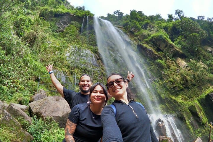
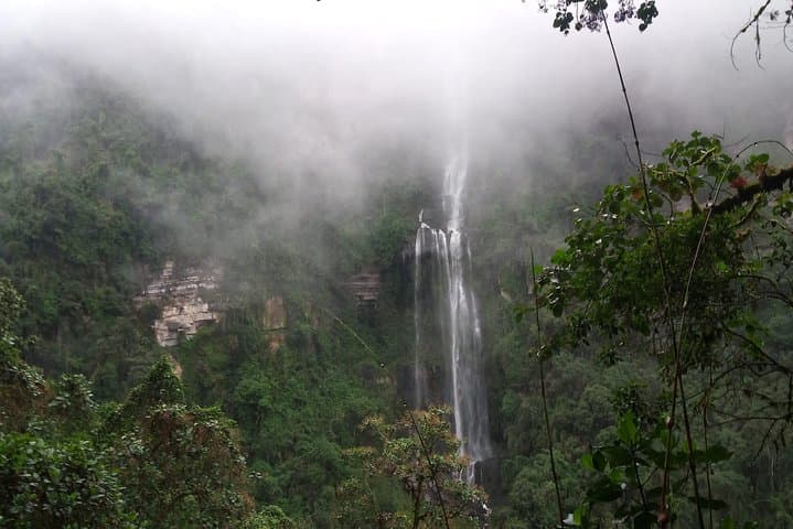
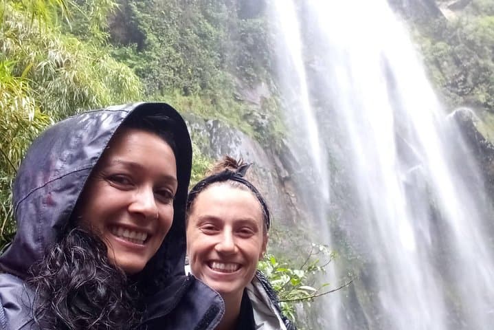
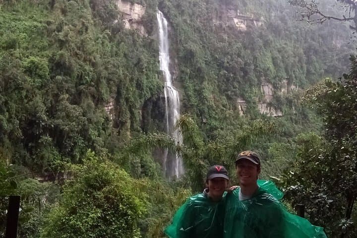
A thin mist greets you as the road trades Bogotá's concrete for steep, green ridgelines. Ninety minutes out of the city the car parks and the trail narrows—mossed roots and leaf litter give way to a steeper, stony path through Andean high forest. Voices of the forest rise: drip, birdcall, the distant, building roar of water. After several viewpoints and 7 km of mixed dirt track and steeper switchbacks, La Chorrera appears in stages—a staggered fall dropping roughly 590 meters, each cascade punctuating the valley like a drumbeat.
Verified experiences and guided adventures in the surrounding area.
Operated by Local Tours Colombia · Choachí, Cundinamarca
A thin mist greets you as the road trades Bogotá's concrete for steep, green ridgelines. Ninety minutes out of the city the car parks and the trail narrows—mossed roots and leaf litter give way to a steeper, stony path through Andean high forest. Voices of the forest rise: drip, birdcall, the distant, building roar of water. After several viewpoints and 7 km of mixed dirt track and steeper switchbacks, La Chorrera appears in stages—a staggered fall dropping roughly 590 meters, each cascade punctuating the valley like a drumbeat.
The route threads through land that was long used by Muisca communities and carved by uplift and erosion of the Eastern Cordillera; the falls sit where resistant volcanic and metamorphic rock forces water into dramatic drops. Along the way you pass El Chiflón—a 50–55 m curtain you can walk behind—and a small cave known locally as the Cave of the Monkeys. Flora and hummingbirds crowd the understory; the ridge lines give broad views back toward the Bogotá basin on clear days.
Practically: expect a 7–8 hour outing with about 7 km of walking and sustained uphill sections—moderate to challenging effort. Trail surfaces range from packed earth to rocky, uneven steps; slick when wet. Bring waterproof layers, a full liter of water, sturdy boots, and an early start to avoid afternoon showers. Between December and mid-April flows can be reduced, but the scenery and biodiversity remain compelling. Guided tours include transport and lunch, making this a doable, full-day escape into Colombia's high forest and its highest waterfall.
challenging.
7–8 hours.
Good cardiovascular fitness and leg strength; comfortable with sustained uphill hiking and uneven terrain.
The full experience is a 7–8 hour day with about 7 km of walking; expect sustained uphill sections and uneven terrain—rated moderate to challenging.
Yes; shared or private tours typically include round-trip transport from Bogotá (approximately 1.5 hours each way) and lunch, making it a full-day outing.
No; flows often decrease between December and mid-April (dry season). The falls are at their fullest during the rainy periods but trails can be muddier then.
Not recommended for those with serious mobility limitations or very young children—trail includes steep, uneven sections and some slippery rock.
The falls sit in territory historically used by Muisca communities and are shaped by uplift and erosion of the Eastern Cordillera.
Stick to trails and pack out waste; increased visitation requires responsible behavior to protect fragile Andean forest and water quality.
Local Tours Colombia operates guided outdoor trips and adventures with an emphasis on safety, stewardship, and memorable experiences.
A thin mist greets you as the road trades Bogotá's concrete for steep, green ridgelines. Ninety minutes out of the city the car parks and the trail narrows—mossed roots and leaf litter give way to a steeper, stony path through Andean high forest. Voices of the forest rise: drip, birdcall, the distant, building roar of water. After several viewpoints and 7 km of mixed dirt track and steeper switchbacks, La Chorrera appears in stages—a staggered fall dropping roughly 590 meters, each cascade punctuating the valley like a drumbeat.
A thin mist greets you as the road trades Bogotá's concrete for steep, green ridgelines. Ninety minutes out of the city the car parks and the trail narrows—mossed roots and leaf litter give way to a steeper, stony path through Andean high forest. Voices of the forest rise: drip, birdcall, the distant, building roar of water. After several viewpoints and 7 km of mixed dirt track and steeper switchbacks, La Chorrera appears in stages—a staggered fall dropping roughly 590 meters, each cascade punctuating the valley like a drumbeat.
The route threads through land that was long used by Muisca communities and carved by uplift and erosion of the Eastern Cordillera; the falls sit where resistant volcanic and metamorphic rock forces water into dramatic drops. Along the way you pass El Chiflón—a 50–55 m curtain you can walk behind—and a small cave known locally as the Cave of the Monkeys. Flora and hummingbirds crowd the understory; the ridge lines give broad views back toward the Bogotá basin on clear days.
Practically: expect a 7–8 hour outing with about 7 km of walking and sustained uphill sections—moderate to challenging effort. Trail surfaces range from packed earth to rocky, uneven steps; slick when wet. Bring waterproof layers, a full liter of water, sturdy boots, and an early start to avoid afternoon showers. Between December and mid-April flows can be reduced, but the scenery and biodiversity remain compelling. Guided tours include transport and lunch, making this a doable, full-day escape into Colombia's high forest and its highest waterfall.