THE ADVENTURE COLLECTIVE® · Independent discovery and booking for outdoor travel

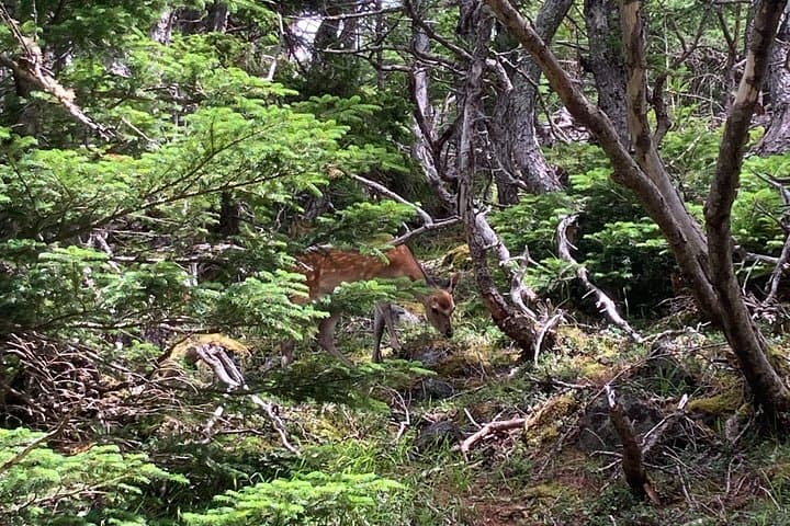
Stand on the rim of Mt. Fuji’s last great eruption: a full-day guided hike to Hoei Crater through forest, pumice and sweeping views. Ideal for hikers who want geology, wildlife and a serious day on Japan’s most famous volcano.
Stand on the rim of Mt. Fuji’s last great eruption: a full-day guided hike to Hoei Crater through forest, pumice and sweeping views. Ideal for hikers who want geology, wildlife and a serious day on Japan’s most famous volcano.
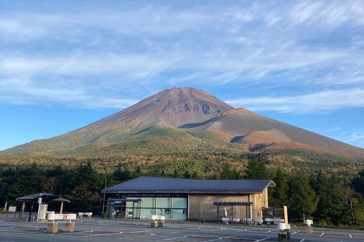
A cold wind pushes up the slope as you leave the tree line behind and the mountain opens into raw, black pumice — the Hoei Crater looms ahead, rough-edged and honest. On a clear day the crater’s rim frames the Pacific and the plain below; clouds move like slow rivers through the bowl, daring you closer.
Verified experiences and guided adventures in the surrounding area.
Operated by Fuji Diary · Fujinomiya, Shizuoka
A cold wind pushes up the slope as you leave the tree line behind and the mountain opens into raw, black pumice — the Hoei Crater looms ahead, rough-edged and honest. On a clear day the crater’s rim frames the Pacific and the plain below; clouds move like slow rivers through the bowl, daring you closer.
The Hoei Crater was born in 1707 during the last major eruption of Mt. Fuji; its layers of ash and lava read like geological pages. The southern approach from Mizugatsuka Park threads through sugi and mixed forest before giving way to loose volcanic scree, volcanic bombs and sparse alpine shrubs. Locals long used the lower slopes for pilgrimages and small-scale forestry, and modern guides point out plants that recolonize the ash — hardy species with intriguing adaptations.
Expect an 8-hour day on variable terrain: steep forest switchbacks, talus and soft ash underfoot, and exposed ridgelines near the rim. Typical round-trip distance is about 10–14 km with roughly 700–1,200 m of elevation gain depending on the start and chosen route. Weather shifts quickly; wind and sun both demand attention.
Practical guidance: start early to avoid afternoon clouds, bring layered insulation and sturdy boots, and carry 2–3 liters of water. Guides explain volcanic history and ecology while keeping pace appropriate for moderately fit hikers. An optional shorter route to Hoei No.3 Crater reduces exertion but still delivers dramatic views — a solid choice if you prefer rhythm over rush.
challenging.
8 hours.
Moderate to fit — you should be comfortable with steep climbs and uneven volcanic terrain for several hours.
The full-day route is challenging for casual walkers due to sustained elevation gain and loose volcanic terrain; a moderate fitness level is recommended. A shorter option to Hoei No.3 Crater reduces exertion.
No special permit is required for the Hoei Crater day hike, but guided tours may have their own booking policies; follow local rules and stay on designated trails.
Summer and early fall offer the most stable weather and melt-free trails; spring can be muddy and winter has deep snow and requires mountaineering experience.
The crater rim sits well below Mt. Fuji’s summit but altitude can still affect some hikers; pace yourself, stay hydrated and descend if you feel unwell.
Hoei Crater formed during the 1707 Hōei eruption; the event deposited ash over Edo (now Tokyo) and reshaped Fuji’s southeast flank, creating the broad crater hikers visit today.
Mt. Fuji’s slopes are protected; stay on marked trails to reduce erosion, carry out all trash, and avoid disturbing fragile alpine plants recolonizing volcanic soil.
Fuji Diary operates guided outdoor trips and adventures with an emphasis on safety, stewardship, and memorable experiences.

A cold wind pushes up the slope as you leave the tree line behind and the mountain opens into raw, black pumice — the Hoei Crater looms ahead, rough-edged and honest. On a clear day the crater’s rim frames the Pacific and the plain below; clouds move like slow rivers through the bowl, daring you closer.
A cold wind pushes up the slope as you leave the tree line behind and the mountain opens into raw, black pumice — the Hoei Crater looms ahead, rough-edged and honest. On a clear day the crater’s rim frames the Pacific and the plain below; clouds move like slow rivers through the bowl, daring you closer.
The Hoei Crater was born in 1707 during the last major eruption of Mt. Fuji; its layers of ash and lava read like geological pages. The southern approach from Mizugatsuka Park threads through sugi and mixed forest before giving way to loose volcanic scree, volcanic bombs and sparse alpine shrubs. Locals long used the lower slopes for pilgrimages and small-scale forestry, and modern guides point out plants that recolonize the ash — hardy species with intriguing adaptations.
Expect an 8-hour day on variable terrain: steep forest switchbacks, talus and soft ash underfoot, and exposed ridgelines near the rim. Typical round-trip distance is about 10–14 km with roughly 700–1,200 m of elevation gain depending on the start and chosen route. Weather shifts quickly; wind and sun both demand attention.
Practical guidance: start early to avoid afternoon clouds, bring layered insulation and sturdy boots, and carry 2–3 liters of water. Guides explain volcanic history and ecology while keeping pace appropriate for moderately fit hikers. An optional shorter route to Hoei No.3 Crater reduces exertion but still delivers dramatic views — a solid choice if you prefer rhythm over rush.