THE ADVENTURE COLLECTIVE® · Independent discovery and booking for outdoor travel

Drive the Transfăgărășan and step into Romania’s highest peaks for a full-day alpine hike through ridgelines, rock bands, and glacial basins. Expect steep climbs, sweeping views, and rapidly changing mountain weather.
Drive the Transfăgărășan and step into Romania’s highest peaks for a full-day alpine hike through ridgelines, rock bands, and glacial basins. Expect steep climbs, sweeping views, and rapidly changing mountain weather.
Morning light breaks over hairpin turns as the Transfăgărășan unfurls—the road climbs, the engine quiets, and the mountains take over.
Verified experiences and guided adventures in the surrounding area.
Operated by Active Weekends · Sibiu, Sibiu County
Morning light breaks over hairpin turns as the Transfăgărășan unfurls—the road climbs, the engine quiets, and the mountains take over.
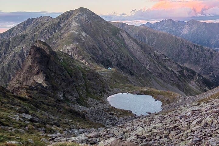
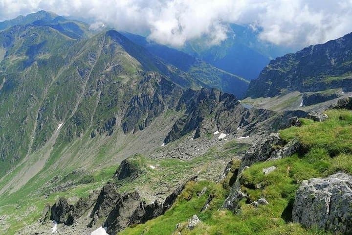
Walkers step from the roadside into a raw high-alpine world: craggy ridges, scree slopes, and meadows that open to distant glacial cirques. The route commonly accessed from the Balea Pass area rises toward peaks that top 2,500 m—Moldoveanu, Romania’s highest, sits within sight on clear days—offering steep ascents, exposed edges, and rock bands that demand steady footing.
Geology here is hard: crystalline schists and granite intrusions sculpted by ice and meltwater, producing narrow ridgelines and deep U-shaped valleys. Culturally the range marks the old divide between Transylvania and Wallachia; shepherding and seasonal pastures have shaped valley life for centuries, and wartime roads and mountain huts tell a quieter human story.
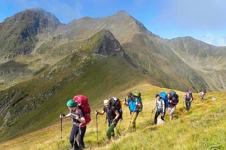
A typical full-day outing covers 10–14 km with 700–1,200 m of elevation gain depending on the summit goal, across mixed trail—well-trodden dirt, loose rock, and short scrambling sections. Expect sudden weather swings: sun one hour, wind-driven cloud the next.
Practical guidance: start early from Sibiu or Curtea de Argeș, carry 2–3 L of water, layered windproof clothing, and a map or GPS track. Time your hike outside the winter closure of the Transfăgărășan (often late autumn–spring). Respect grazing land rules, give wildlife space, and plan your return before dusk—the road down narrows quickly as light falls.
moderate.
8–10 hours.
Suitable for hikers with regular cardio fitness who can handle sustained uphill walking and short exposed sections.
Moderate—beginners with good fitness can complete popular routes, but expect steep sections and loose rock; consider hiring a guide if unfamiliar with alpine terrain.
The road is typically open late June to early October depending on snow; closures occur through winter and early spring—check local road updates before travel.
Most routes stay below extreme altitudes, but rapid ascent to 2,000+ m can cause mild symptoms in sensitive people—ascend steadily, hydrate, and descend if symptoms appear.
Many day trips offer private transport from Sibiu or nearby towns; self-driving is possible but the road is steep with tight hairpins and can be busy in summer—drive cautiously.
The Transfăgărășan was built during the 1970s as a strategic and economic link between regions; older shepherding routes and wartime shelters predate the modern road.
The Făgăraș area contains large wilderness tracts; stick to trails, pack out waste, and avoid disturbing nesting birds and grazing areas to minimize impact.
Active Weekends operates guided outdoor trips and adventures with an emphasis on safety, stewardship, and memorable experiences.
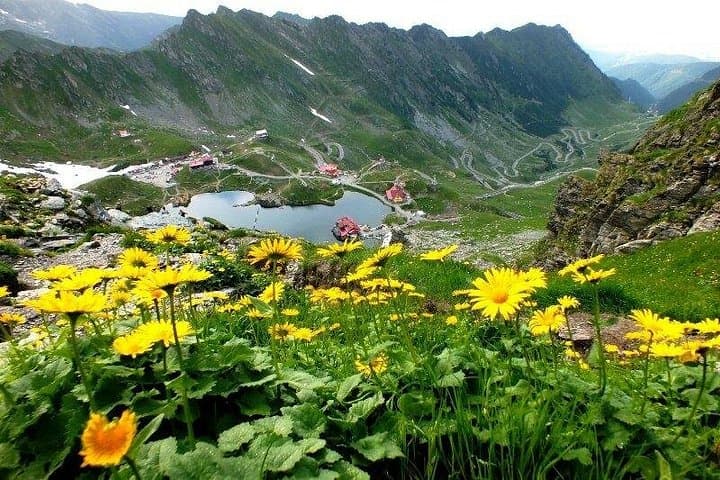
Morning light breaks over hairpin turns as the Transfăgărășan unfurls—the road climbs, the engine quiets, and the mountains take over.
Morning light breaks over hairpin turns as the Transfăgărășan unfurls—the road climbs, the engine quiets, and the mountains take over.
Walkers step from the roadside into a raw high-alpine world: craggy ridges, scree slopes, and meadows that open to distant glacial cirques. The route commonly accessed from the Balea Pass area rises toward peaks that top 2,500 m—Moldoveanu, Romania’s highest, sits within sight on clear days—offering steep ascents, exposed edges, and rock bands that demand steady footing.
Geology here is hard: crystalline schists and granite intrusions sculpted by ice and meltwater, producing narrow ridgelines and deep U-shaped valleys. Culturally the range marks the old divide between Transylvania and Wallachia; shepherding and seasonal pastures have shaped valley life for centuries, and wartime roads and mountain huts tell a quieter human story.
A typical full-day outing covers 10–14 km with 700–1,200 m of elevation gain depending on the summit goal, across mixed trail—well-trodden dirt, loose rock, and short scrambling sections. Expect sudden weather swings: sun one hour, wind-driven cloud the next.
Practical guidance: start early from Sibiu or Curtea de Argeș, carry 2–3 L of water, layered windproof clothing, and a map or GPS track. Time your hike outside the winter closure of the Transfăgărășan (often late autumn–spring). Respect grazing land rules, give wildlife space, and plan your return before dusk—the road down narrows quickly as light falls.