THE ADVENTURE COLLECTIVE® · Independent discovery and booking for outdoor travel

Seven days across Armenia’s volcanic highlands, from dragon-stone shorelines to the 4,090 m north summit of Aragats. Expect crater lakes, ancient petroglyphs and multi-day camping with guided support.
Seven days across Armenia’s volcanic highlands, from dragon-stone shorelines to the 4,090 m north summit of Aragats. Expect crater lakes, ancient petroglyphs and multi-day camping with guided support.
You stand above a crater lake as wind pushes across an empty basin and the copper-tinged slopes of an extinct volcano rise like a folded map. The Geghama range opens in every direction — red rock bluffs, scattered petroglyphs and stone menhirs that mark springs — while on clear days Mount Ararat watches from the south.
Verified experiences and guided adventures in the surrounding area.
Operated by Armland Adventure Club · Yerevan, Yerevan
You stand above a crater lake as wind pushes across an empty basin and the copper-tinged slopes of an extinct volcano rise like a folded map. The Geghama range opens in every direction — red rock bluffs, scattered petroglyphs and stone menhirs that mark springs — while on clear days Mount Ararat watches from the south.
This seven-day trek threads through volcanic highlands: Lake Vank and its dragon-stones, the 3,312 m summit of Mount Nazeli, the crater lakes on Azhdahak (3,597 m) and the long push from Lake Kari up to Aragats’s north summit (4,090 m). Geology here is recent volcanic action and pumice-rich slopes; soils are thin and vegetation switches from steppe to alpine cushion plants.
Culturally the route touches millennia — petroglyphs and standing stones point to Bronze Age water cults — and modern shepherding communities. Guides provide tents, mattresses and a mountain cook; camps cluster beside lakes or sheltered saddles.
Expect mixed terrain: scree slopes, volcanic ash trails, tussock meadows and occasional rocky ridgelines. Typical daily distance ranges 10–15 km with 300–800 m of ascent on summit days; the Aragats north peak day can run 10–12 km and take up to 10 hours.
Practical notes: pace for altitude, carry layers for strong sun and sudden wind, and use sturdy boots with good ankle support. Hydrate and filter water if asked to refill from springs. Start summit days early (pre-dawn) to avoid afternoon wind and maximize visibility. With experienced guides and basic alpine fitness, this route offers high country solitude, volcanic panoramas and a deep sense of place.
challenging.
7 days.
Good aerobic fitness and prior multi-day hiking experience; comfortable with consecutive long days at high elevation.
You should have regular aerobic fitness and prior day-hiking experience; summit days include 700–800 m of ascent and can last 8–10 hours.
Yes — guides provide tents, mattresses, a cook and three meals on camping days as described in the itinerary.
No special permits are required for the Geghama or Aragats routes, but local regulations and seasonal access can change; guides manage permits if needed.
Alpine conditions: strong sun, rapid temperature swings and gusty winds; afternoons are more unstable, so expect cold mornings and bright, windy days.
The Geghama stones and petroglyphs date back to the 2nd–3rd millennium BC and indicate early ritual associations with springs and lakes.
Alpine vegetation is fragile; stick to established campsites and trails, pack out waste, and avoid disturbing archaeological features.
Armland Adventure Club operates guided outdoor trips and adventures with an emphasis on safety, stewardship, and memorable experiences.
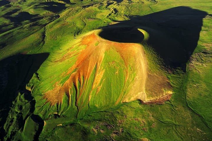
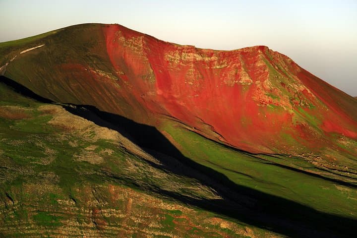
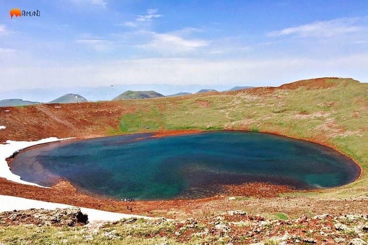
You stand above a crater lake as wind pushes across an empty basin and the copper-tinged slopes of an extinct volcano rise like a folded map. The Geghama range opens in every direction — red rock bluffs, scattered petroglyphs and stone menhirs that mark springs — while on clear days Mount Ararat watches from the south.
You stand above a crater lake as wind pushes across an empty basin and the copper-tinged slopes of an extinct volcano rise like a folded map. The Geghama range opens in every direction — red rock bluffs, scattered petroglyphs and stone menhirs that mark springs — while on clear days Mount Ararat watches from the south.
This seven-day trek threads through volcanic highlands: Lake Vank and its dragon-stones, the 3,312 m summit of Mount Nazeli, the crater lakes on Azhdahak (3,597 m) and the long push from Lake Kari up to Aragats’s north summit (4,090 m). Geology here is recent volcanic action and pumice-rich slopes; soils are thin and vegetation switches from steppe to alpine cushion plants.
Culturally the route touches millennia — petroglyphs and standing stones point to Bronze Age water cults — and modern shepherding communities. Guides provide tents, mattresses and a mountain cook; camps cluster beside lakes or sheltered saddles.
Expect mixed terrain: scree slopes, volcanic ash trails, tussock meadows and occasional rocky ridgelines. Typical daily distance ranges 10–15 km with 300–800 m of ascent on summit days; the Aragats north peak day can run 10–12 km and take up to 10 hours.
Practical notes: pace for altitude, carry layers for strong sun and sudden wind, and use sturdy boots with good ankle support. Hydrate and filter water if asked to refill from springs. Start summit days early (pre-dawn) to avoid afternoon wind and maximize visibility. With experienced guides and basic alpine fitness, this route offers high country solitude, volcanic panoramas and a deep sense of place.