THE ADVENTURE COLLECTIVE® · Independent discovery and booking for outdoor travel

Start from Prizren and climb into the Sharr Mountains on a 12 km day hike that gains roughly 1,000 m. Expect alpine meadows, glacial lakes, pastoral history and wide views across three countries.
Start from Prizren and climb into the Sharr Mountains on a 12 km day hike that gains roughly 1,000 m. Expect alpine meadows, glacial lakes, pastoral history and wide views across three countries.
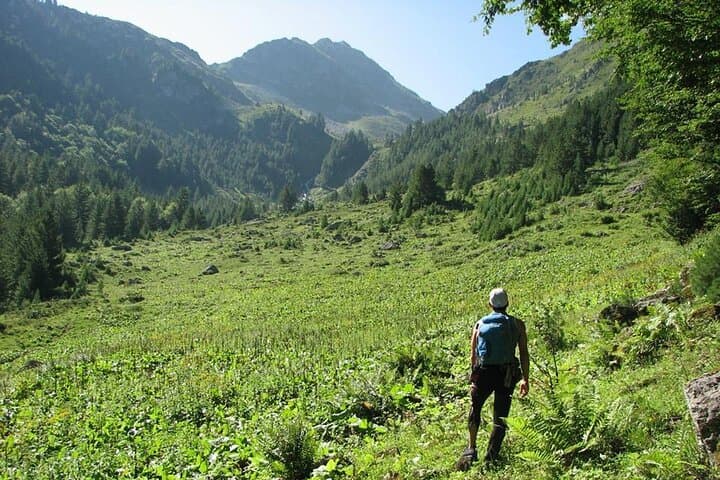
The trail begins with the town's stone bridge behind you and a ribbon of road leading up toward treeline. Within an hour the air thins; pines give way to scrub and open meadows, and the mountains take on a voice—wind that pushes you forward and ridgelines that dare you to climb.
Verified experiences and guided adventures in the surrounding area.
Operated by E-19 Mountain & Tourism · Prizren, Prizren
The trail begins with the town's stone bridge behind you and a ribbon of road leading up toward treeline. Within an hour the air thins; pines give way to scrub and open meadows, and the mountains take on a voice—wind that pushes you forward and ridgelines that dare you to climb.
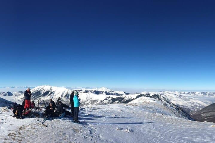
The Sharr (Šar) range is a crossroads of Balkan geology: ancient metamorphic cores sculpted into knife-edge ridges and broad bowls that hold cold glacial lakes. Human history here is pastoral—transhumant shepherding and the production of sharp Sharri cheese have shaped meadows and footpaths for centuries. Borders and cultures converge on these slopes; visible from high points are the mountain ranges of Kosovo, North Macedonia and Albania.
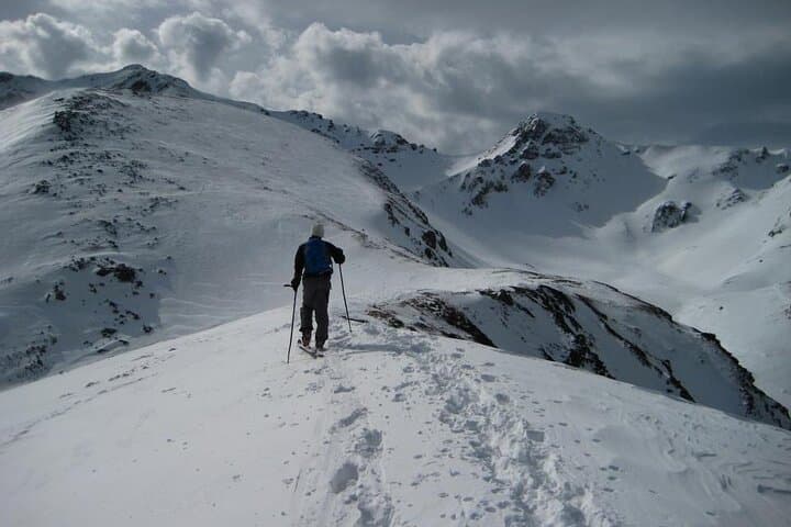
Expect terrain to alternate between packed dirt, scree fields and grassy alpine plateaus. Wildlife is present but shy—chamois pick their way on cliffs, birds of prey quarter the ridges, and foxes slip through the understory. In winter the same corridors collect deep, dry powder and turn into a quiet world of snow and trunks.
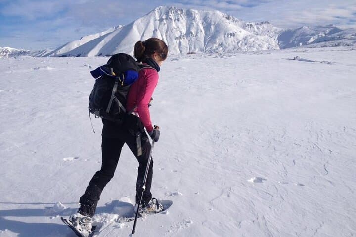
Practical guidance: this is a roughly 12 km out-and-back with about 1,000 m of elevation gain, typically done in ~6 hours. Start early to avoid afternoon weather and to reserve energy for steep sections; carry 2–3 liters of water, windproof layers, and solid ankle-support boots. Use trekking poles for balance on descent. If you plan winter travel, arrange snowshoes or touring skis and check avalanche forecasts. Leave no trace—these meadows and lakes recover slowly from erosion and litter.
challenging.
6 hours.
Suitable for regular hikers comfortable with sustained climbs and loose terrain; prepare for a steady ascent of ~1,000 m.
The typical route covers about 12 km round-trip with roughly 1,000 m of ascent, completed in around six hours depending on pace.
Physically fit beginners can join if prepared for steady climbs and rocky terrain; consider shorter options and communicate fitness levels when booking.
You may see chamois, foxes and raptors; bears and tortoises inhabit the region but sightings are rare—maintain distance and secure food.
The tour includes poles for summer hiking, picnic lunch and transport from Prizren; winter rentals for snowshoes or touring skis are offered at a discount.
The Sharr Mountains have long been summer pastures for local shepherds; centuries of transhumance shaped trails and the region's reputation for robust cheese production.
Sharr areas are sensitive to erosion and summer grazing pressure; stick to trails, pack out waste and support local guides who practice low-impact touring.
E-19 Mountain & Tourism operates guided outdoor trips and adventures with an emphasis on safety, stewardship, and memorable experiences.
The trail begins with the town's stone bridge behind you and a ribbon of road leading up toward treeline. Within an hour the air thins; pines give way to scrub and open meadows, and the mountains take on a voice—wind that pushes you forward and ridgelines that dare you to climb.
The trail begins with the town's stone bridge behind you and a ribbon of road leading up toward treeline. Within an hour the air thins; pines give way to scrub and open meadows, and the mountains take on a voice—wind that pushes you forward and ridgelines that dare you to climb.
The Sharr (Šar) range is a crossroads of Balkan geology: ancient metamorphic cores sculpted into knife-edge ridges and broad bowls that hold cold glacial lakes. Human history here is pastoral—transhumant shepherding and the production of sharp Sharri cheese have shaped meadows and footpaths for centuries. Borders and cultures converge on these slopes; visible from high points are the mountain ranges of Kosovo, North Macedonia and Albania.
Expect terrain to alternate between packed dirt, scree fields and grassy alpine plateaus. Wildlife is present but shy—chamois pick their way on cliffs, birds of prey quarter the ridges, and foxes slip through the understory. In winter the same corridors collect deep, dry powder and turn into a quiet world of snow and trunks.
Practical guidance: this is a roughly 12 km out-and-back with about 1,000 m of elevation gain, typically done in ~6 hours. Start early to avoid afternoon weather and to reserve energy for steep sections; carry 2–3 liters of water, windproof layers, and solid ankle-support boots. Use trekking poles for balance on descent. If you plan winter travel, arrange snowshoes or touring skis and check avalanche forecasts. Leave no trace—these meadows and lakes recover slowly from erosion and litter.