THE ADVENTURE COLLECTIVE® · Independent discovery and booking for outdoor travel

A 6.8-mile loop from Glacier Point to Sentinel Dome and Taft Point serves up expansive valley views, Ansel Adams’ photo angles, and dramatic granite fissures. This moderately paced day hike mixes a punchy opening mile with easy-to-moderate slab travel and big, exposed viewpoints.
A 6.8-mile loop from Glacier Point to Sentinel Dome and Taft Point serves up expansive valley views, Ansel Adams’ photo angles, and dramatic granite fissures. This moderately paced day hike mixes a punchy opening mile with easy-to-moderate slab travel and big, exposed viewpoints.
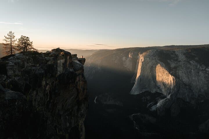
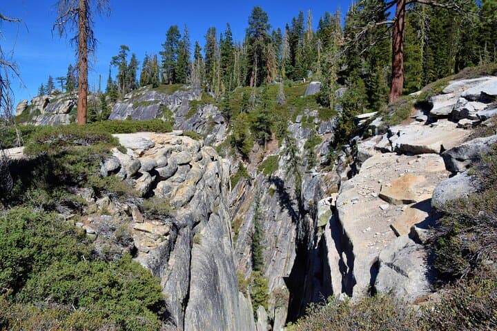
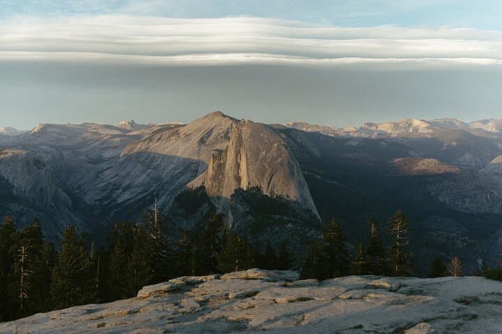
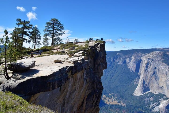
On a clear morning the granite opens like a map: Glacier Point lays out Yosemite Valley beneath you while the trail ahead drops and rises across sun-scoured slabs and white-pine pockets. The group meets at the east end near the Glacier Point lookout, studies the vast drop to Yosemite Valley, then drives a few minutes to the Sentinel Dome parking lot to begin a loop that threads the top of the range. Over 6.8 miles you'll hit Sentinel Dome's rounded summit (8,122') and continue to the fissures and cantilevered ledges of Taft Point, where wind and gravity choreograph some of Yosemite's most dramatic views.
Verified experiences and guided adventures in the surrounding area.
Operated by Lasting Adventures · Yosemite Village, California
On a clear morning the granite opens like a map: Glacier Point lays out Yosemite Valley beneath you while the trail ahead drops and rises across sun-scoured slabs and white-pine pockets. The group meets at the east end near the Glacier Point lookout, studies the vast drop to Yosemite Valley, then drives a few minutes to the Sentinel Dome parking lot to begin a loop that threads the top of the range. Over 6.8 miles you'll hit Sentinel Dome's rounded summit (8,122') and continue to the fissures and cantilevered ledges of Taft Point, where wind and gravity choreograph some of Yosemite's most dramatic views.
This route takes hikers across classic Sierra Nevada geology: uplifted granitic roof tops smoothed by millennia of glacial ice. Look for striated granite and the polished, bowl-like cirques that tell the story of Ice Age sculpting. The area also sits on Ansel Adams’ photographic ground—closer to Glacier Point you can stand where he framed the high country and imagine the camera’s patient counting of light and shadow.
Culturally the hike threads historic park corridors. Glacier Point Road was built in the early 20th century to give visitors high-angle views of the valley; Taft Point later became a preferred vantage for both climbers and sightseers. Local Ahwahnechee people lived in the valley for generations before the park era; as you scan the ridgelines, remind yourself that these stands of pine and granite were historically significant travel and gathering routes.
The walk itself opens with a more strenuous first mile—steeper pitches and short pitchy climbs—then eases into rolling granite and mixed forest. Expect exposed sections at Taft Point with sheer drops; the fissures are dramatic and unforgiving. The trail surface alternates between packed dirt and wide slabs; traction matters, especially if rain or snow has recently passed through.
Practical advice: start early to avoid midday crowds and heat, carry at least 2–3 liters of water per person, and bring sun protection—there’s long exposure between tree pockets. Wear sturdy hiking shoes with good grip for slab travel; trekking poles can help on the steeper first mile and on descents. If visiting in winter or shoulder seasons, check road and park reservations—Glacier Point Road can close seasonally or require a reservation. Guides provide poles on request and carry first aid; still, this is a route where basic navigation and good footwear keep the day enjoyable.
Ultimately this is a compact Yosemite day that rewards moderate effort with some of the park’s purest perspectives: a wide-angle view from Sentinel Dome, and the stomach-drop drama of Taft Point’s fissures. For families comfortable with exposed ledges and a healthy dose of uphill, it’s an unforgettable primer on what makes Yosemite distinct: an honest landscape shaped by stone, ice, and sky.
moderate.
6–8 hours.
Moderate endurance—able to handle a steep first mile and sustained walking on variable terrain.
Yes—park entry fees apply and the park may require timed reservations or a Glacier Point Road reservation in peak season; check the National Park Service website before travel.
The route can be suitable for older, steady children but Taft Point has exposed ledges—close supervision is required and families should assess comfort with heights.
The tour drives to the Sentinel Dome parking lot where the hike begins; public parking is limited during busy periods—carpooling or early arrival helps.
Only service animals are permitted; regular pets are not allowed on most alpine trails in Yosemite.
Glacier Point Road may be closed in winter and snow/ice make the slabs hazardous—check road status and bring traction devices if attempting in snowy conditions.
Cell coverage is spotty; guides provide emergency communication, but assume minimal service and share any critical contact info before heading out.
Glacier Point Road and the viewpoints along it were developed in the early 1900s to provide visitors with dramatic valley perspectives; photographers like Ansel Adams popularized these high-angle views.
Stick to established trails and avoid stepping on fragile alpine vegetation; Yosemite’s high-country soils recover slowly, so leave no trace and pack out all trash.
Lasting Adventures operates guided outdoor trips and adventures with an emphasis on safety, stewardship, and memorable experiences.
On a clear morning the granite opens like a map: Glacier Point lays out Yosemite Valley beneath you while the trail ahead drops and rises across sun-scoured slabs and white-pine pockets. The group meets at the east end near the Glacier Point lookout, studies the vast drop to Yosemite Valley, then drives a few minutes to the Sentinel Dome parking lot to begin a loop that threads the top of the range. Over 6.8 miles you'll hit Sentinel Dome's rounded summit (8,122') and continue to the fissures and cantilevered ledges of Taft Point, where wind and gravity choreograph some of Yosemite's most dramatic views.
On a clear morning the granite opens like a map: Glacier Point lays out Yosemite Valley beneath you while the trail ahead drops and rises across sun-scoured slabs and white-pine pockets. The group meets at the east end near the Glacier Point lookout, studies the vast drop to Yosemite Valley, then drives a few minutes to the Sentinel Dome parking lot to begin a loop that threads the top of the range. Over 6.8 miles you'll hit Sentinel Dome's rounded summit (8,122') and continue to the fissures and cantilevered ledges of Taft Point, where wind and gravity choreograph some of Yosemite's most dramatic views.
This route takes hikers across classic Sierra Nevada geology: uplifted granitic roof tops smoothed by millennia of glacial ice. Look for striated granite and the polished, bowl-like cirques that tell the story of Ice Age sculpting. The area also sits on Ansel Adams’ photographic ground—closer to Glacier Point you can stand where he framed the high country and imagine the camera’s patient counting of light and shadow.
Culturally the hike threads historic park corridors. Glacier Point Road was built in the early 20th century to give visitors high-angle views of the valley; Taft Point later became a preferred vantage for both climbers and sightseers. Local Ahwahnechee people lived in the valley for generations before the park era; as you scan the ridgelines, remind yourself that these stands of pine and granite were historically significant travel and gathering routes.
The walk itself opens with a more strenuous first mile—steeper pitches and short pitchy climbs—then eases into rolling granite and mixed forest. Expect exposed sections at Taft Point with sheer drops; the fissures are dramatic and unforgiving. The trail surface alternates between packed dirt and wide slabs; traction matters, especially if rain or snow has recently passed through.
Practical advice: start early to avoid midday crowds and heat, carry at least 2–3 liters of water per person, and bring sun protection—there’s long exposure between tree pockets. Wear sturdy hiking shoes with good grip for slab travel; trekking poles can help on the steeper first mile and on descents. If visiting in winter or shoulder seasons, check road and park reservations—Glacier Point Road can close seasonally or require a reservation. Guides provide poles on request and carry first aid; still, this is a route where basic navigation and good footwear keep the day enjoyable.
Ultimately this is a compact Yosemite day that rewards moderate effort with some of the park’s purest perspectives: a wide-angle view from Sentinel Dome, and the stomach-drop drama of Taft Point’s fissures. For families comfortable with exposed ledges and a healthy dose of uphill, it’s an unforgettable primer on what makes Yosemite distinct: an honest landscape shaped by stone, ice, and sky.