THE ADVENTURE COLLECTIVE® · Independent discovery and booking for outdoor travel

Climb Pacaya from Antigua for a compact, adventurous day on an active volcano. Expect lava fields, panoramic views of the Guatemalan volcanic chain, and a guided trek suited to moderate fitness.
Climb Pacaya from Antigua for a compact, adventurous day on an active volcano. Expect lava fields, panoramic views of the Guatemalan volcanic chain, and a guided trek suited to moderate fitness.
You step out of the shuttle as wind carrying volcanic dust brushes your face; the cone of Pacaya towers ahead, black lava ribs contrasting with bright Guatemalan sky. The track climbs through an endemic pine and cypress forest, then opens onto fields of jagged black rock that feel suddenly alien underfoot. Steam and distant rumble remind you this mountain is alive.
Verified experiences and guided adventures in the surrounding area.
Operated by Guate Tours by Nelson. · Antigua Guatemala, Sacatepéquez
You step out of the shuttle as wind carrying volcanic dust brushes your face; the cone of Pacaya towers ahead, black lava ribs contrasting with bright Guatemalan sky. The track climbs through an endemic pine and cypress forest, then opens onto fields of jagged black rock that feel suddenly alien underfoot. Steam and distant rumble remind you this mountain is alive.
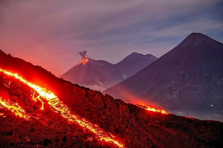
Pacaya sits on Guatemala’s volcanic chain, part of a belt of more than 30 volcanoes shaped by the subduction of the Cocos Plate; it has been intermittently active in modern times with frequent eruptions since the 1960s. Locals have long used the slopes for grazing and fuel; today the national park balances visitor access with protection of fragile volcanic terrain. Cultural life in nearby Antigua—colonial churches, coffee fincas, and a guide tradition of oral storytelling—frames the hike's start and finish.
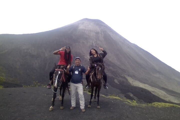
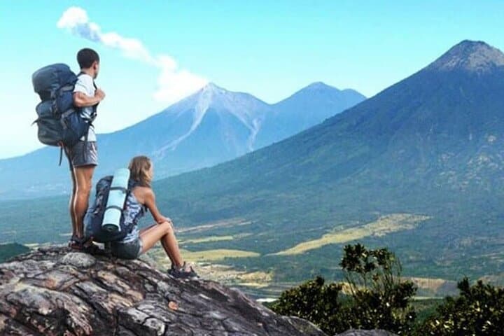
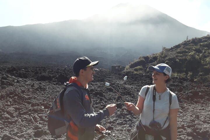
Expect 5–7 hours door-to-door: a paved drive from Antigua follows a panorama of Agua, Fuego, and Acatenango, then a steady climb of rough trail and loose volcanic scree. Surfaces shift from packed dirt to scoria and cooled lava flows where footing is uneven and sharp. Guides often offer optional horse support partway and pauses to toast marshmallows over still-warm fissures.
Practical advice: start early to avoid afternoon wind, bring layered insulation for summit chills, sturdy boots for molten-rock terrain, and at least 2 liters of water. Stay on marked routes, follow your guide’s pacing, and pack out all trash—volcanic landscapes regenerate slowly but are resilient when treated respectfully.
moderate.
6–7 hours.
Moderate fitness required: steady uphill walking, balance on loose rock, ability to hike for several hours at altitude
Typical door-to-door duration is around 6–7 hours including transport; the uphill hike portion is about 1.5–2 hours depending on pace.
Pacaya is an active volcano but guided visits proceed on monitored routes; eruptions can occur, so tours may be canceled in unsafe conditions.
Yes, many operators offer optional horseback assistance for part of the ascent for an additional fee or on request.
Entrance to Pacaya National Park is typically included in organized tour pricing; independent visitors should expect to pay a park fee at the gate.
Pacaya is part of Guatemala’s volcanic arc and has had frequent eruptive activity in the 20th century; its modern habitability changed after sustained activity post-1965.
Pacaya National Park protects fragile lava fields and endemic forest—stick to trails, avoid removing rock, and carry out all waste to minimize impact.
Guate Tours by Nelson. operates guided outdoor trips and adventures with an emphasis on safety, stewardship, and memorable experiences.
You step out of the shuttle as wind carrying volcanic dust brushes your face; the cone of Pacaya towers ahead, black lava ribs contrasting with bright Guatemalan sky. The track climbs through an endemic pine and cypress forest, then opens onto fields of jagged black rock that feel suddenly alien underfoot. Steam and distant rumble remind you this mountain is alive.
You step out of the shuttle as wind carrying volcanic dust brushes your face; the cone of Pacaya towers ahead, black lava ribs contrasting with bright Guatemalan sky. The track climbs through an endemic pine and cypress forest, then opens onto fields of jagged black rock that feel suddenly alien underfoot. Steam and distant rumble remind you this mountain is alive.
Pacaya sits on Guatemala’s volcanic chain, part of a belt of more than 30 volcanoes shaped by the subduction of the Cocos Plate; it has been intermittently active in modern times with frequent eruptions since the 1960s. Locals have long used the slopes for grazing and fuel; today the national park balances visitor access with protection of fragile volcanic terrain. Cultural life in nearby Antigua—colonial churches, coffee fincas, and a guide tradition of oral storytelling—frames the hike's start and finish.
Expect 5–7 hours door-to-door: a paved drive from Antigua follows a panorama of Agua, Fuego, and Acatenango, then a steady climb of rough trail and loose volcanic scree. Surfaces shift from packed dirt to scoria and cooled lava flows where footing is uneven and sharp. Guides often offer optional horse support partway and pauses to toast marshmallows over still-warm fissures.
Practical advice: start early to avoid afternoon wind, bring layered insulation for summit chills, sturdy boots for molten-rock terrain, and at least 2 liters of water. Stay on marked routes, follow your guide’s pacing, and pack out all trash—volcanic landscapes regenerate slowly but are resilient when treated respectfully.