THE ADVENTURE COLLECTIVE® · Independent discovery and booking for outdoor travel

Climb loose volcanic scree to a live crater rim on a half-day trip from Guatemala City. Expect dramatic lava fields, sulfur vents, clear highland views, and a steady 1.5-hour ascent to the observation zone.
Climb loose volcanic scree to a live crater rim on a half-day trip from Guatemala City. Expect dramatic lava fields, sulfur vents, clear highland views, and a steady 1.5-hour ascent to the observation zone.
A low cloud unravels above the slopes as the van pulls off the Pan-American Highway and the smell of wet earth gives way to sulfur at higher altitudes.
Verified experiences and guided adventures in the surrounding area.
Operated by JAGUAR TRAVELS · Guatemala City, Escuintla
A low cloud unravels above the slopes as the van pulls off the Pan-American Highway and the smell of wet earth gives way to sulfur at higher altitudes.
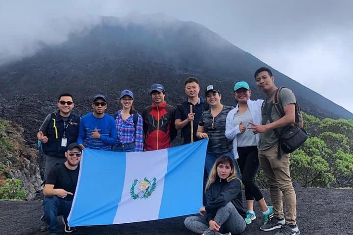
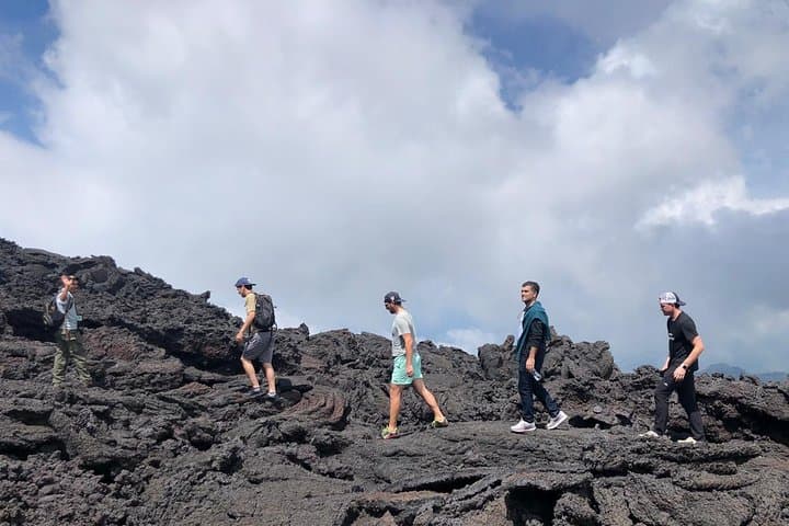
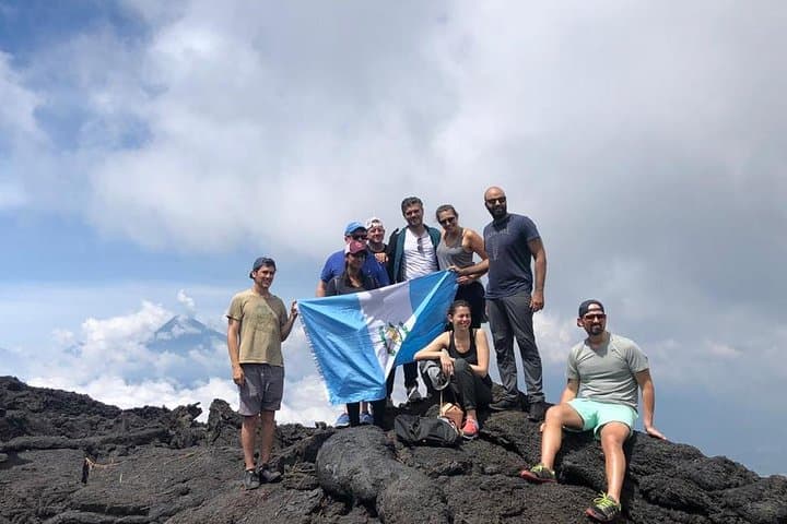
Walkers leave the city behind and climb through agricultural terraces into black, glassy fields — the petrified footprints of recent eruptions. After roughly 90 minutes of steady uphill on loose volcanic scree and hardened lava, the trail opens to the crater rim where steam and fresh venting peer into a raw, changing landscape. The view is direct: an active cone breathing steam and the highlands rolling toward Lake Amatitlán.
Pacaya is one of Guatemala’s most active volcanoes, part of the Central American Volcanic Arc. Its frequent eruptions have built dramatic lava flows and broad, low-angle slopes favored by trekkers. The area has long been used by local communities for grazing and small-scale agriculture; guides often share stories of how eruptions reshaped nearby villages and roads.
Practicalities matter here. Expect uneven volcanic rock, sudden gusts of sulfur-laced air, and temperatures that drop quickly as elevation climbs toward ~2,500 m. Tours typically include hotel pickup in Guatemala City, a local Pacaya guide, and a 6–7 hour round trip. Bring 2–3 liters of water, sturdy hiking boots, windproof layers, and a face scarf for ash. Follow your guide’s route, avoid fissures and warm lava surfaces, and allow extra time for photo stops — the raw geology rewards patience more than speed.
moderate.
6–7 hours.
Requires a moderate level of fitness: steady uphill hiking for ~1.5 hours on loose volcanic terrain; good balance helpful.
The main uphill is about 1–1.5 hours on loose volcanic scree to the lava field and crater viewpoints; the full tour runs roughly 6–7 hours including transport.
Pacaya is active; guides keep visitors to safe observation zones. Avoid fissures and fresh lava flows and follow all guide instructions — the main hazard is heat and unstable rock near vents.
Moderate fitness is required; the operator advises against participation for those with serious heart, back, or pregnancy concerns. Children may join but should be capable of the uphill walk.
Typical tours include hotel pickup in Guatemala City, an English/Spanish guide, local Pacaya guide, transport in an air-conditioned vehicle, and drop-off at the original pickup point.
Pacaya’s eruptive history has repeatedly reshaped local routes and settlements; its frequent activity made it a landmark and, more recently, a recreational climb for visitors based in Guatemala City and Antigua.
Stay on established trails to limit erosion and avoid trampling fragile vegetation colonizing new lava; local guides work with park authorities to manage foot traffic and visitor safety.
JAGUAR TRAVELS operates guided outdoor trips and adventures with an emphasis on safety, stewardship, and memorable experiences.
A low cloud unravels above the slopes as the van pulls off the Pan-American Highway and the smell of wet earth gives way to sulfur at higher altitudes.
A low cloud unravels above the slopes as the van pulls off the Pan-American Highway and the smell of wet earth gives way to sulfur at higher altitudes.
Walkers leave the city behind and climb through agricultural terraces into black, glassy fields — the petrified footprints of recent eruptions. After roughly 90 minutes of steady uphill on loose volcanic scree and hardened lava, the trail opens to the crater rim where steam and fresh venting peer into a raw, changing landscape. The view is direct: an active cone breathing steam and the highlands rolling toward Lake Amatitlán.
Pacaya is one of Guatemala’s most active volcanoes, part of the Central American Volcanic Arc. Its frequent eruptions have built dramatic lava flows and broad, low-angle slopes favored by trekkers. The area has long been used by local communities for grazing and small-scale agriculture; guides often share stories of how eruptions reshaped nearby villages and roads.
Practicalities matter here. Expect uneven volcanic rock, sudden gusts of sulfur-laced air, and temperatures that drop quickly as elevation climbs toward ~2,500 m. Tours typically include hotel pickup in Guatemala City, a local Pacaya guide, and a 6–7 hour round trip. Bring 2–3 liters of water, sturdy hiking boots, windproof layers, and a face scarf for ash. Follow your guide’s route, avoid fissures and warm lava surfaces, and allow extra time for photo stops — the raw geology rewards patience more than speed.