THE ADVENTURE COLLECTIVE® · Independent discovery and booking for outdoor travel

A compact afternoon trek up Nglanggeran delivers volcanic ridgelines, broad views of Gunungkidul karst, and a brief but rewarding climb suitable for most hikers. This guided option includes transfers from Yogyakarta and multilingual guides by request.
A compact afternoon trek up Nglanggeran delivers volcanic ridgelines, broad views of Gunungkidul karst, and a brief but rewarding climb suitable for most hikers. This guided option includes transfers from Yogyakarta and multilingual guides by request.
Late afternoon light slants across weathered volcanic rock as a narrow trail pushes through stunted trees and scrub — the climb to Nglanggeran’s summit is compact but emphatic. Guides meet visitors in Yogyakarta, drive roughly 1–1.5 hours to Nglanggeran Village, and lead an uphill trek that typically takes about an hour to the ridge. The path runs 1–2 km with roughly 120–200 m of elevation gain over uneven stone and packed dirt; loose scree appears near the final rock scrambles.
Verified experiences and guided adventures in the surrounding area.
Operated by Wandernesia · Nglanggeran Village, Special Region of Yogyakarta
Late afternoon light slants across weathered volcanic rock as a narrow trail pushes through stunted trees and scrub — the climb to Nglanggeran’s summit is compact but emphatic. Guides meet visitors in Yogyakarta, drive roughly 1–1.5 hours to Nglanggeran Village, and lead an uphill trek that typically takes about an hour to the ridge. The path runs 1–2 km with roughly 120–200 m of elevation gain over uneven stone and packed dirt; loose scree appears near the final rock scrambles.
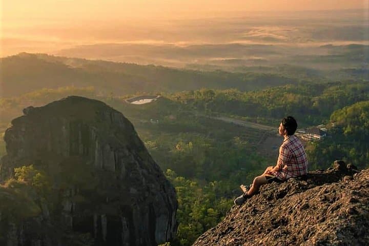
Geology here tells the region’s deep story: Nglanggeran is an ancient volcanic plug and remnant of Palaeo-volcanic activity, its hardened core resisting erosion while the surrounding landscape lowered. Culturally, the hill sits within Gunungkidul regency, where small farming communities and simple warungs serve local coffee and tofu — guides often share village lore about the peak and the embung (small reservoir) below.
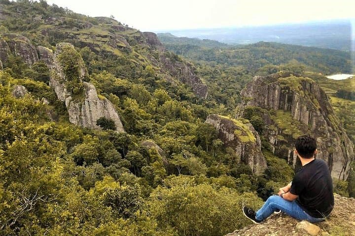
Expect sweeping views of limestone karst to the south and agricultural patchwork toward Yogyakarta; wind can push across the ridge, daring you to step closer to the outcrops. Wildlife is subtle — birds and occasional long-tailed macaques appear near the trail.
Practically: wear sturdy shoes, carry 1–1.5 liters of water, and bring sun protection; the route is exposed on the final approach. The tour is usually scheduled in the afternoon to catch softer light and cooler temperatures, and the whole excursion—including transfers and stops—runs about 4–5 hours. Local guides handle permits and fees; travel light, follow the guide, and pack out trash to protect the geopark’s fragile slopes.
moderate.
4–5 hours.
Light-to-moderate fitness: able to sustain a brisk hour-long uphill on uneven footing.
The ascent from the parking area to the summit typically takes about 45–75 minutes over 1–2 km with roughly 120–200 m elevation gain.
Yes—English guides are regularly available; Dutch, French, and Italian guides are limited seasonally and require advance request.
Yes; the route is recommended for most fitness levels, though those with spinal or serious heart conditions should avoid it per operator guidance.
Yes, local retribution and embung fees are included in the tour price and handled by the guide.
Nglanggeran is a remnant volcanic plug that stands above the surrounding landscape, shaped by millions of years of erosion and long used by local communities for grazing and small-scale agriculture.
The site is managed through community-based tourism and geopark initiatives—stay on trails, pack out waste, and follow guide instructions to reduce erosion and disturbance.
Wandernesia operates guided outdoor trips and adventures with an emphasis on safety, stewardship, and memorable experiences.
Late afternoon light slants across weathered volcanic rock as a narrow trail pushes through stunted trees and scrub — the climb to Nglanggeran’s summit is compact but emphatic. Guides meet visitors in Yogyakarta, drive roughly 1–1.5 hours to Nglanggeran Village, and lead an uphill trek that typically takes about an hour to the ridge. The path runs 1–2 km with roughly 120–200 m of elevation gain over uneven stone and packed dirt; loose scree appears near the final rock scrambles.
Late afternoon light slants across weathered volcanic rock as a narrow trail pushes through stunted trees and scrub — the climb to Nglanggeran’s summit is compact but emphatic. Guides meet visitors in Yogyakarta, drive roughly 1–1.5 hours to Nglanggeran Village, and lead an uphill trek that typically takes about an hour to the ridge. The path runs 1–2 km with roughly 120–200 m of elevation gain over uneven stone and packed dirt; loose scree appears near the final rock scrambles.
Geology here tells the region’s deep story: Nglanggeran is an ancient volcanic plug and remnant of Palaeo-volcanic activity, its hardened core resisting erosion while the surrounding landscape lowered. Culturally, the hill sits within Gunungkidul regency, where small farming communities and simple warungs serve local coffee and tofu — guides often share village lore about the peak and the embung (small reservoir) below.
Expect sweeping views of limestone karst to the south and agricultural patchwork toward Yogyakarta; wind can push across the ridge, daring you to step closer to the outcrops. Wildlife is subtle — birds and occasional long-tailed macaques appear near the trail.
Practically: wear sturdy shoes, carry 1–1.5 liters of water, and bring sun protection; the route is exposed on the final approach. The tour is usually scheduled in the afternoon to catch softer light and cooler temperatures, and the whole excursion—including transfers and stops—runs about 4–5 hours. Local guides handle permits and fees; travel light, follow the guide, and pack out trash to protect the geopark’s fragile slopes.